Tracking some rain, much warmer air, and windy conditions this weekend
INDIANAPOLIS (WISH) — Temperatures failed to get into the 60s in some locations today despite there being a lot of sunshine. This does not change our route towards much warmer air and windy conditions that will build in for the final weekend of April.
We will also be tracking daily rain and storm chances, which in all fairness we do not need more rain around here.
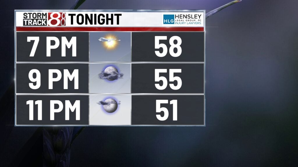
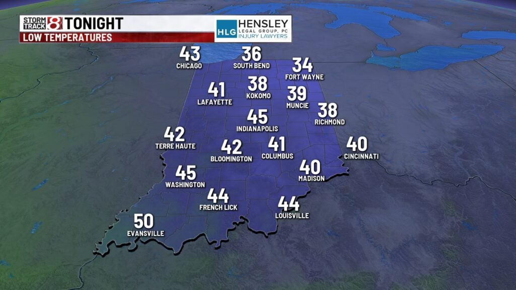
Thursday night: A partly cloudy and slightly warmer night will be on deck for us. Lows will drop into the mid 40s.
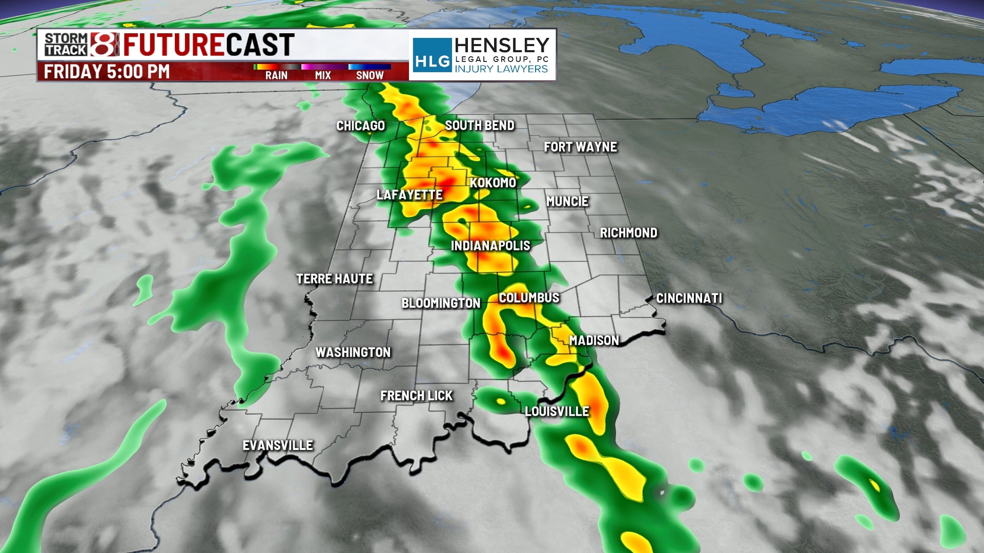
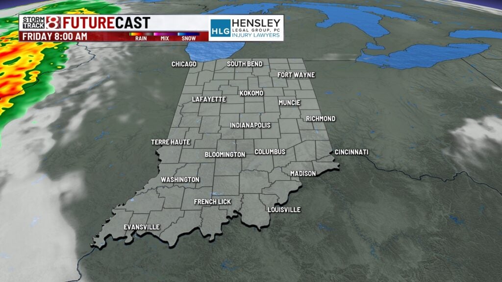
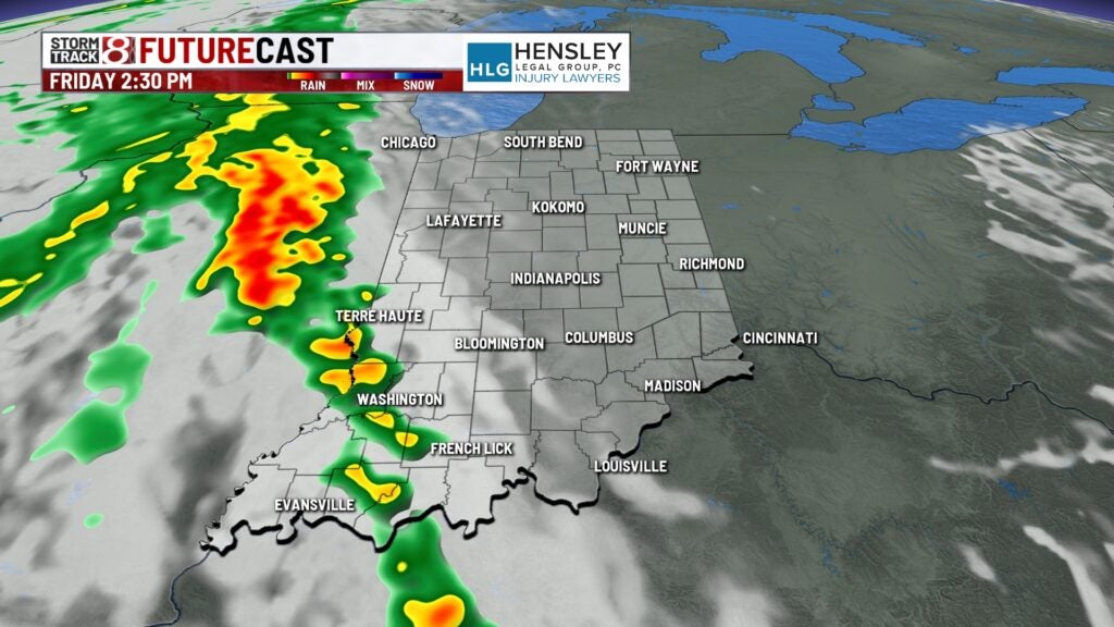
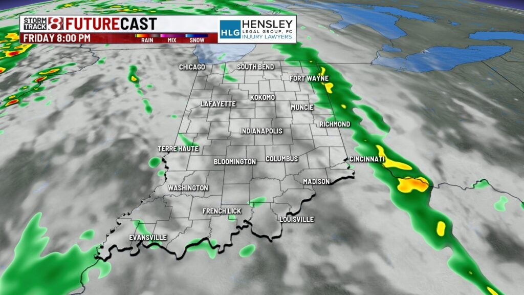
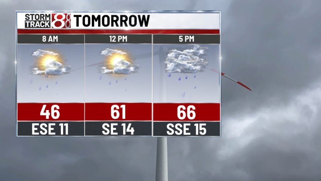
Friday: Expect temperatures to be a bit warmer to end the workweek, but we will also bring rain chances back into the picture. A warm front is set to gradually move into our state, which is the reason why rain, warmer air, and breezy winds will all slide in. Scattered showers and isolated storms will develop Friday afternoon with additional isolated to scattered coverage of activity into and through Friday night.

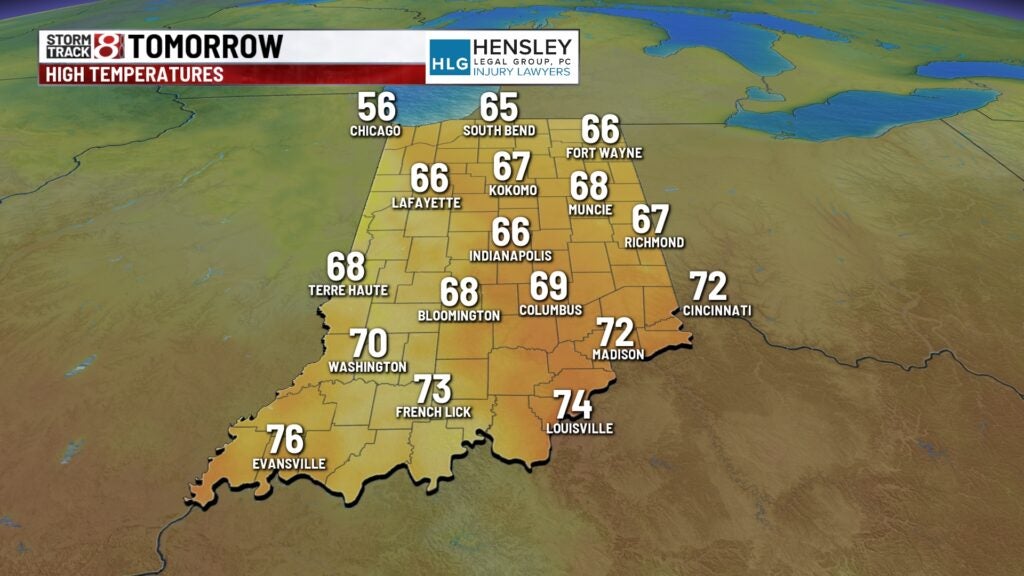
Highs are set to rise into the upper 60s, which is right around normal for this time of the year. We’re also going to have winds gust up to 20-30 MPH at times.
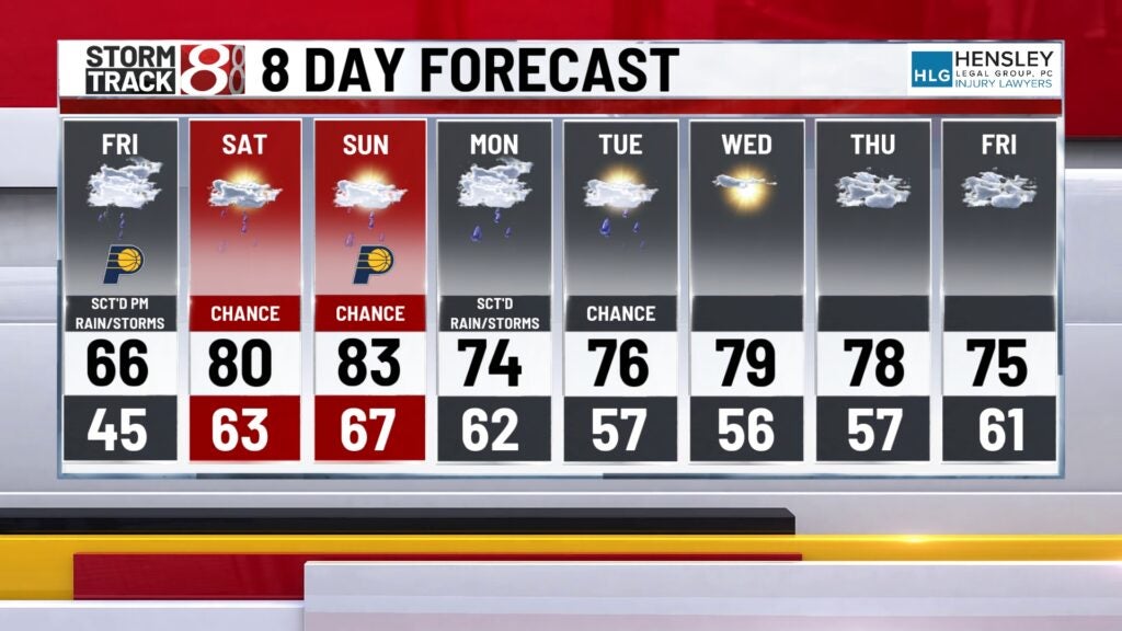
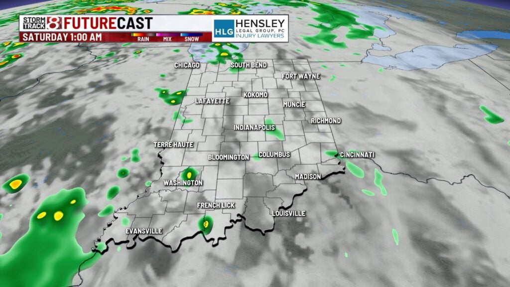
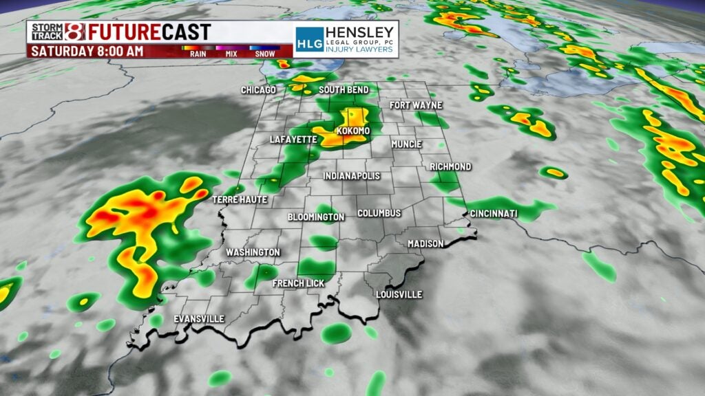
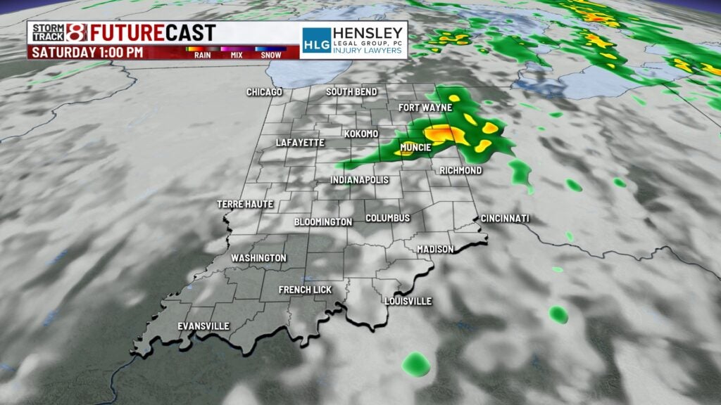
Saturday: Scattered showers and a few rumbles of thunder will be ongoing through daybreak Saturday. We look to mostly dry out by the early afternoon hours, but we can’t rule out spotty pop-ups (aka hit-and-miss) for the remainder of the day. Now, this current line of thinking could change depending on if a boundary from the west flies into our state as areas out there will have very active weather. In essence, this would increase our rain and storm chance if a boundary arrives this weekend overall.
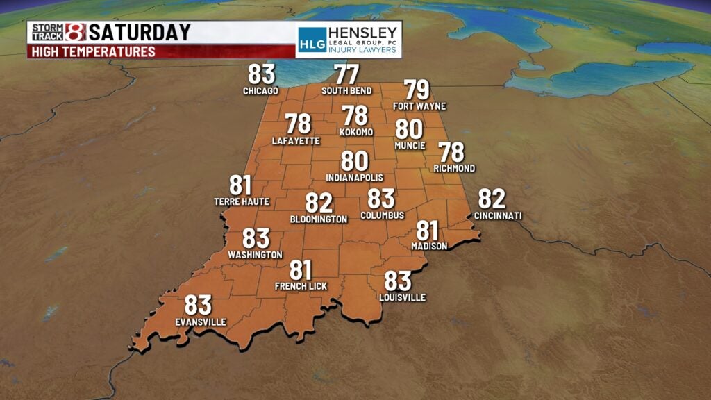
Aside from the rain chance, we’re also talking a very warm and windy day. Highs will soar into the upper 70s to low 80s due to strong southerly winds that will gust up to 30-40 MPH. Indianapolis will also be on record high watch Saturday as the record is 84 from 1990.
8-Day Forecast: Sunday could end up being our warmest day of this year with highs in the mid 80s. We’ll also have to watch Sunday for record high potential in Indy as it is 86 from 1894. More rain and storm potential will arrive very late Sunday night into Monday. We currently do not have a severe risk outline for Monday, but this could change. Highs will slightly fall back into the 70s for the first half of next week.