Severe weather chances return this week
INDIANAPOLIS (WISH) — A weak front was diving through Indiana as Hoosiers woke up Sunday morning.
A more potent system later this week will increase severe weather chances.
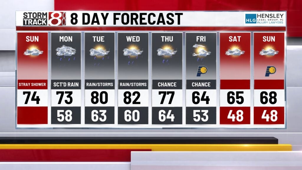
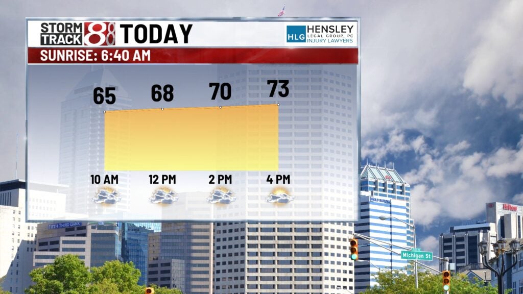
SUNDAY: Mostly cloudy skies to start with more breaks in the clouds this afternoon. A stray shower can’t be ruled out, but the vast majority remain dry. High temperatures in the mid-70s.
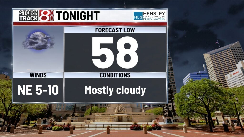
SUNDAY NIGHT: Mostly cloudy skies as the next system starts to move closer. Low temperatures in the mid to upper 50s.
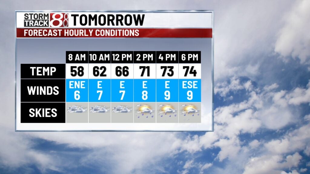
MONDAY: Scattered showers will work in from the south as a warm front lifts into the area. The best chance of showers will be midday into the afternoon hours. High temperatures in the low to mid-70s.
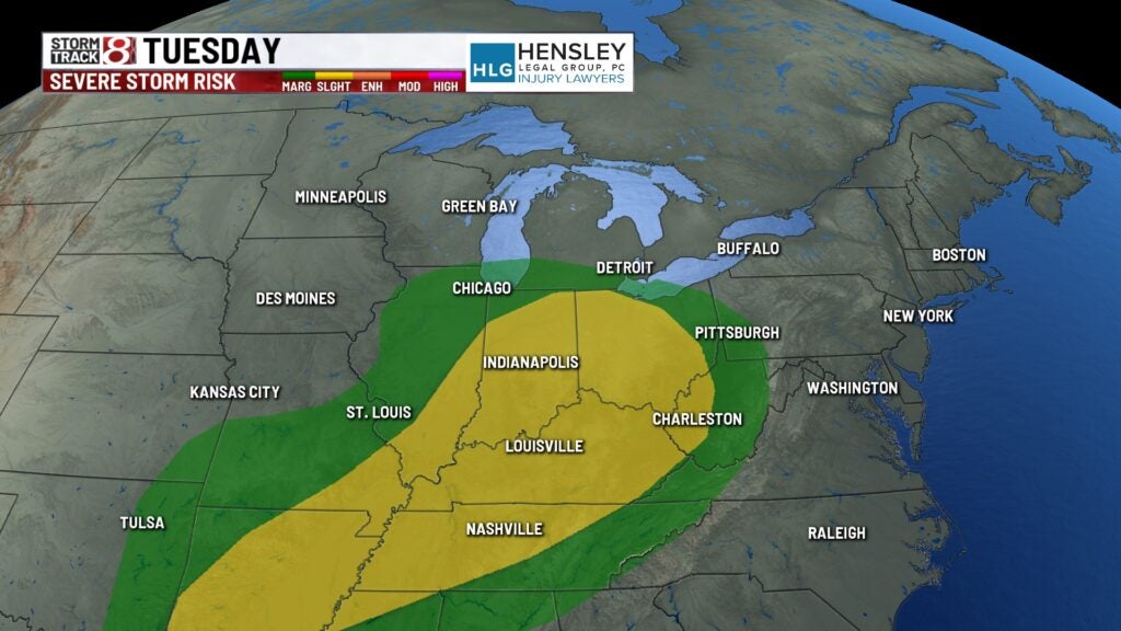
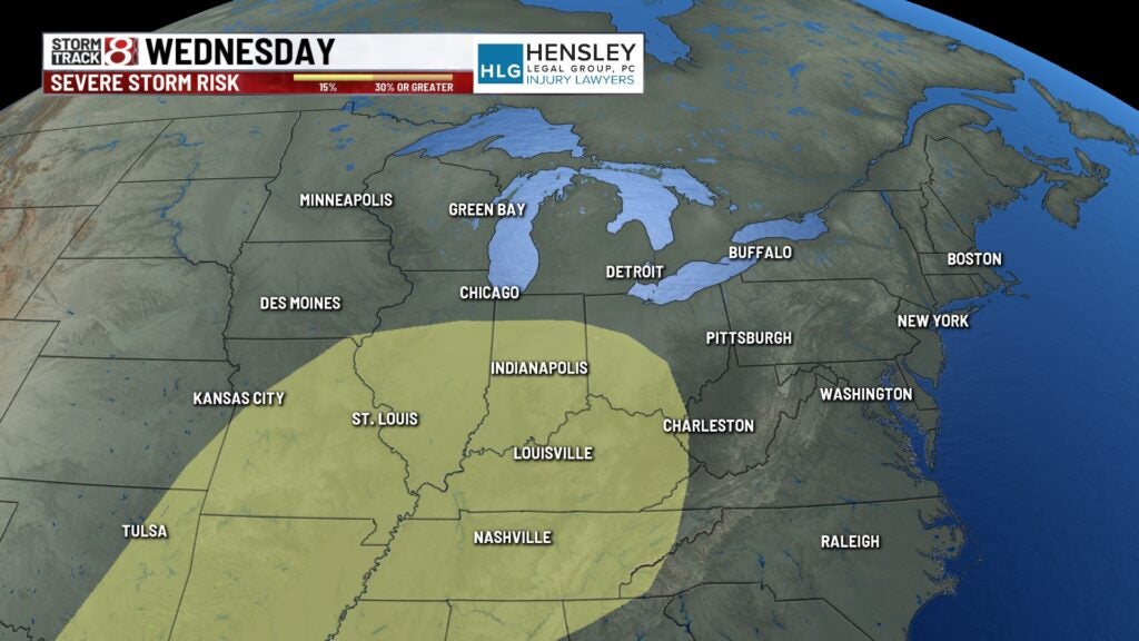
8-DAY FORECAST: Severe weather chances return to the forecast Tuesday and Wednesday. Indiana is in a slight risk of strong storms for both days. A complex of storms is possible Tuesday morning before some redevelopment along a cold front in the afternoon. Refiring of strong storms along the front will also be possible for Wednesday. Stay with Storm Track 8 on this storm system since there is still a lot to determine this far out.
The cold front doesn’t fully cross the state until late Wednesday, which will allow temperatures to run above average for these days. By next weekend, highs will only be in the 60s.