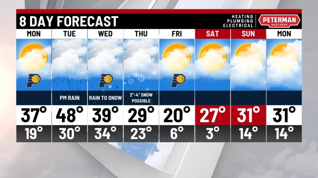
Fairly nice Monday, rain Tuesday, winter mix Wednesday, snow Thursday
INDIANAPOLIS (WISH) — Looks like all types of winter weather is coming our way with a midweek weather system.
The preliminary forecast is for precipitation to start as rain late Tuesday. Then, rain changes to a mix of rain, ice and snow Wednesday. Then snow continues through the day Thursday. Early indications are from 2-4 inches of snow in central Indiana with several inches more possible in northern Indiana.
Considering it is late January, it was another pleasant day to enjoy some fun outside, like ice skating at the rink in Carmel.

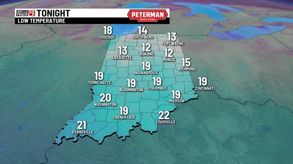
Expect about-average temperatures for us early Monday morning.
For the last day of January, Monday is shaping up fairly nice: sunshine, not too windy, and typical midwinter temperatures
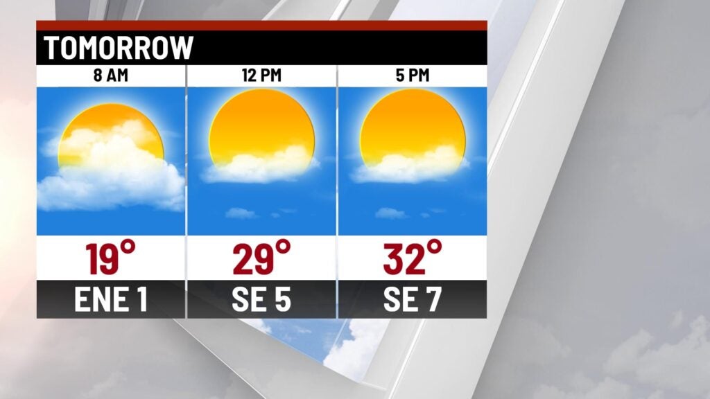
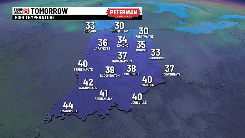
Decent weather is expected again Monday afternoon as temperatures will be above freezing by noon or so.
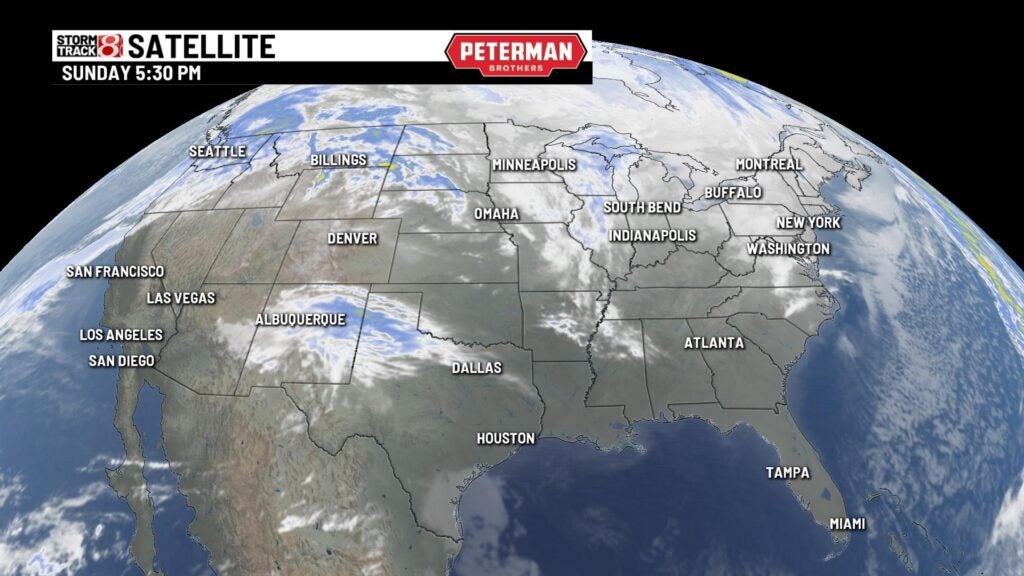
The satellite view shows not much going on in our area, but, way out to the southwest in New Mexico, a low-pressure area is getting organized. This is the system that will bring snow and ice to the Ohio Valley by midweek. Exact track of the storm “to be determined.”
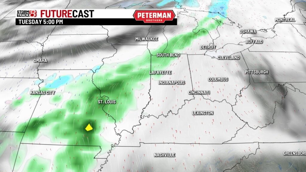
For now, it appears the precipitation will start as rain late Tuesday.
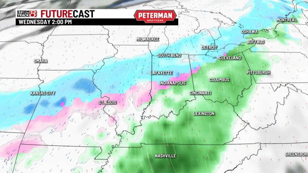
By 2 p.m. Wednesday, an area of snow (blue) could form to the north of the rain (green). The whole area of precipitation will be shifting to the south. That means rain changing to snow for central Indiana. Some freezing rain and ice is also possible in the pink area.
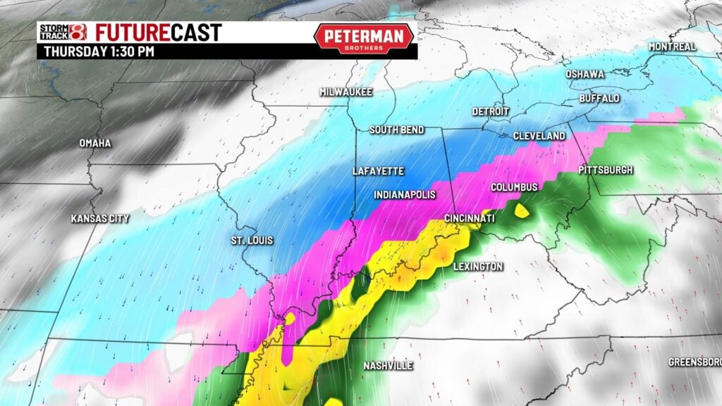
By Thursday afternoon, the darker blue indicates the snow will be increasing and accumulating.
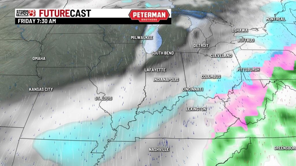
Finally, by Friday morning the winter weather system will be moving south and east out of Indiana.
A summary of forecast events: Precipitation starts as rain late Tuesday, changes to snow late Wednesday. the snow continued through Thursday evening. From 2-4 inches is the preliminary snowfall estimate. Several more inches are possible in northern Indiana. This all depends on the track of the low pressure area moving right along the Ohio River to our south. Any change in that track will significantly impact rain and snow areas.
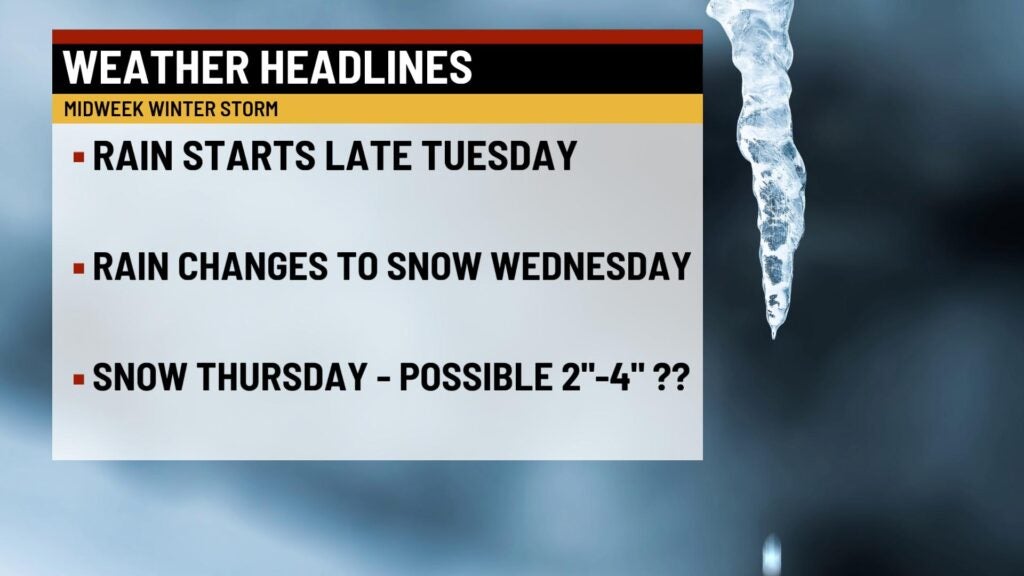
8 Day Outlook: The Tuesday rain changes to a mix of rain and snow by Wednesday afternoon. There also is the possibility of freezing rain and ice. By Thursday morning, the wintry mix will change to all snow. Snow will continue through the evening Thursday. First estimates are form 2-4 inches of snow in central Indiana with several more inches possible in northern Indiana. The week will end with very cold air returning. Lows in the single digits and highs in the 20s.