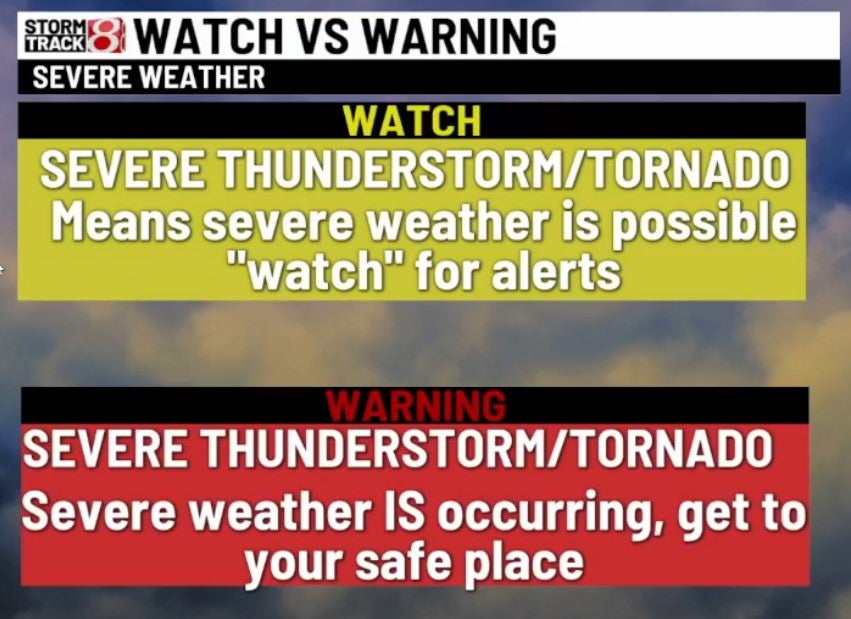
Severe weather comes to Central Indiana
INDIANAPOLIS (WISH) — Severe weather has arrived in Indiana, and we’re here to provide you with minute-by-minute updates.
6:00 a.m. update
All warnings and watches for thunderstorms and tornadoes in the state have expired.
12:52 a.m. update
Severe storms continue across the northern half of the state. Wind gusts of 60+ MPH are possible.
12:41 a.m. update
A severe thunderstorm warning has been issued for Howard, Clinton, Boone, Tipton, Carroll, Hamilton and Montgomery counties until 1 a.m. EST.
12:33 a.m. update
Duke Energy is reporting that more than 2,000 of their customers across western and Central Indiana are without power.
12:22 a.m. update
Eastern Indiana is now under a tornado watch until 6 a.m.
12:17 a.m. update
A severe thunderstorm warning has been issued for areas including Lafayette, West Lafayette and Crawfordsville until 12:45 a.m. EST.
12:11 a.m. update
A tornado warning has been issued for Daviess, Knox, Greene and Sullivan counties until 12:45 a.m. EST.
11:56 p.m. update
A severe thunderstorm warning has been issued for Greene County until 12:30 a.m. EST.
11:49 p.m. update
A tornado warning has been issued for parts of Fountain, Parke and Vermillion counties until 12:15 a.m. EST.
11:43 p.m. update
A severe thunderstorm warning has been issued for Daviess, Greene, Knox, Martin and Owen counties until 12:15 a.m. EST.
11:34 p.m. update
A severe thunderstorm warning has been issued for Fountain, Vermillion, and Warren counties until midnight EST.
11:19 p.m. update
A fast-moving strong storm is currently racing into Morgan and Johnson counties and will move towards Indianapolis. Wind gusts up to 50 MPH are possible. This is moving northeast at 75 MPH.
11:18 p.m. update
Storms across Central Indiana stay below severe limits for now.
11:16 p.m. update
Indianapolis, Greenwood and Plainfield issue special weather statements until 11:45 p.m. EST.
11:02 p.m. update
A tornado warning in eastern Illinois is tracking toward the Indiana state line near the areas of Rockville and Crawfordsville.
10:58 p.m. update
A severe thunderstorm warning has been issued for White and Pulaski counties until 11:30 p.m. EST.
8:47 p.m. update
A severe thunderstorm warning has been issued for Bartholomew, Brown, Johnson and Shelby counties until 10:15 p.m. EST.
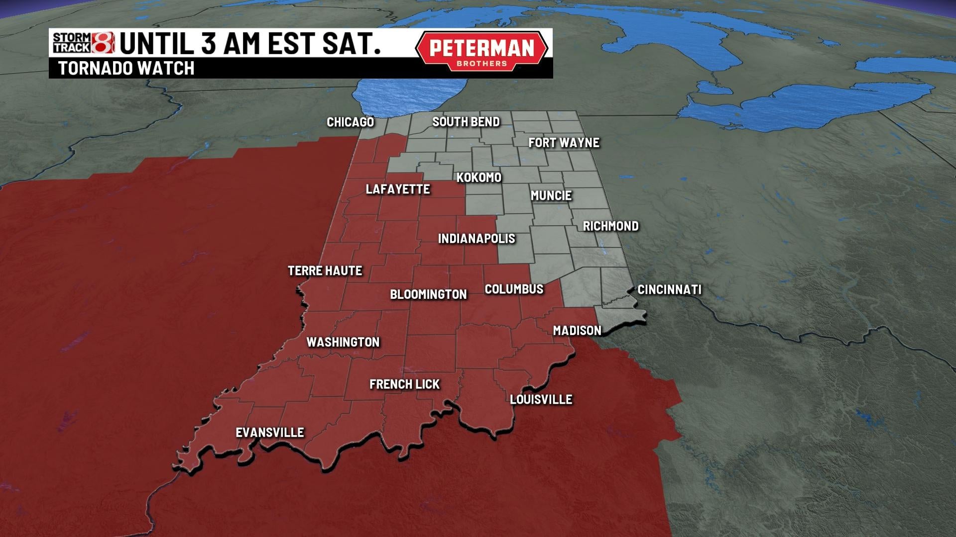
9:40 p.m. update
A tornado watch has been declared for parts of Indiana. The watch is active until 3 a.m. EST and covers the following counties:
- BARTHOLOMEW
- BENTON
- BOONE
- BROWN
- CLAY
- CLINTON
- DAVIESS
- FOUNTAIN
- GREENE
- HENDRICKS
- JACKSON
- JASPER
- JENNINGS
- JOHNSON
- KNOX
- LAWRENCE
- MARION
- MARTIN
- MONROE
- MONTGOMERY
- MORGAN
- NEWTON
- OWEN
- PARKE
- PUTNAM
- SULLIVAN
- TIPPECANOE
- VERMILLION
- VIGO
- WARREN