Mild and soggy start to the week
INDIANAPOLIS (WISH) — Unseasonably warm temperatures continue for the last week of the year, with several rain chances on tap.
Monday:
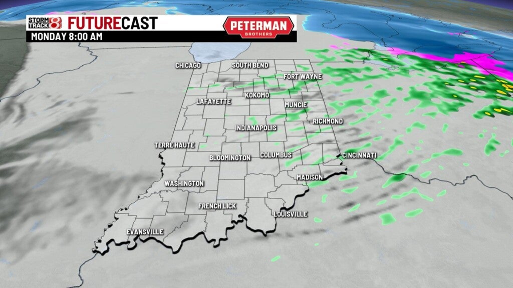
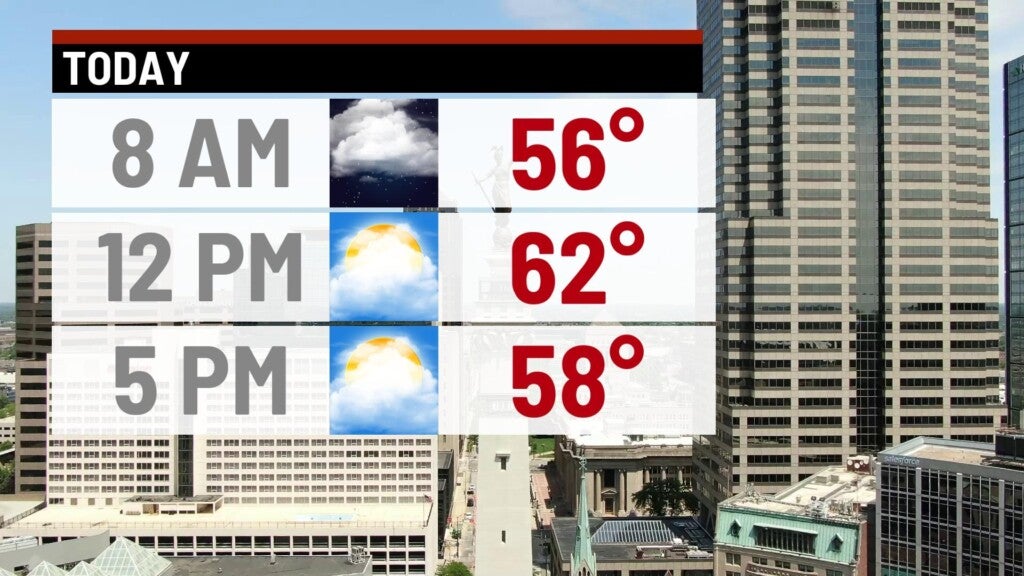
An upper-level wave moving across the state has sparked showers and even a few thunderstorms across much of the region. Look for rain to gradually diminish through the morning, with a quiet and mild afternoon on tap. Highs should reach the lower to middle 60s this afternoon. The record high for today is 68 degrees (2008).

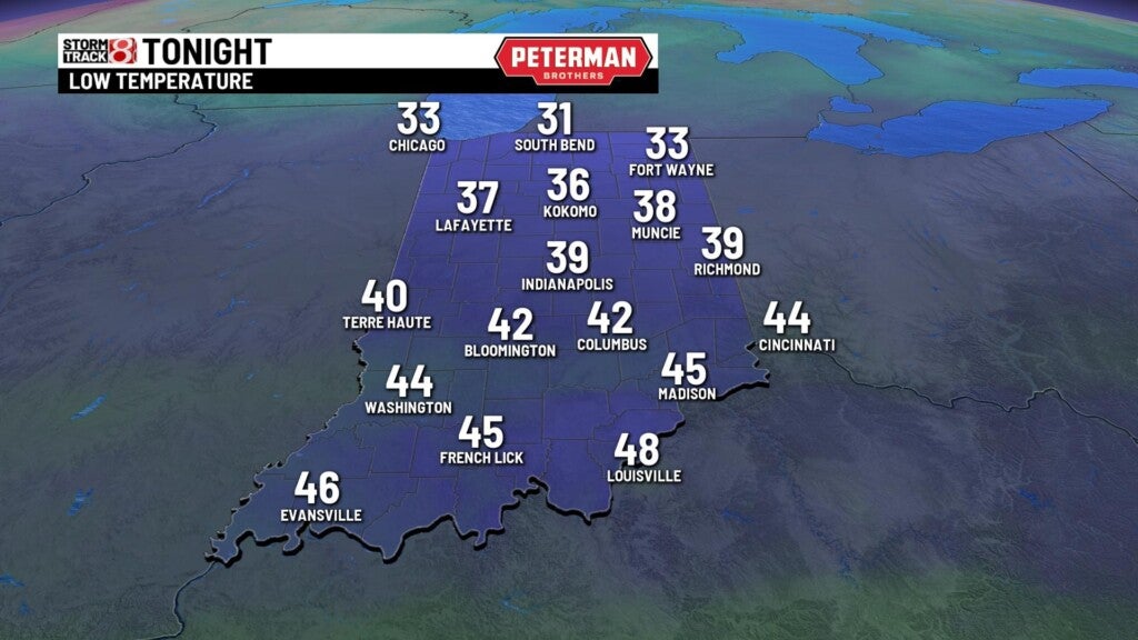
Monday night:
It will be a mostly cloudy and quiet night, with lows falling to the lower 40s.
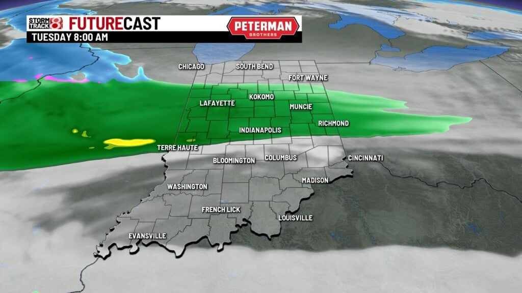
Tuesday:
A system moving through the Midwest will spark several waves of showers, starting as early as Tuesday morning. Some heavy downpours will be possible on and off throughout the day. Rainfall amounts to exceed an inch in spots.

Highs top out in the lower to middle 50s.


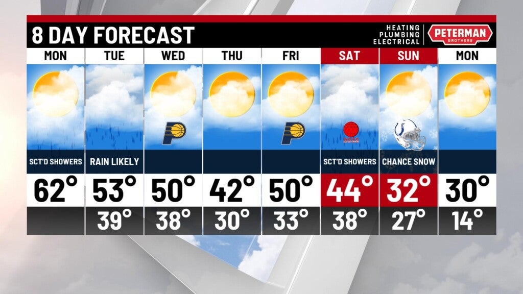
8 day forecast:
Temperatures will remain well above average for the rest of the week with relatively quiet conditions. Look for our next system of interest to kick off the new year on Saturday with scattered showers likely. There is a big shot of colder air moving in for Sunday, with could bring down a few light snow showers as well.