Quiet and chilly Wednesday
INDIANAPOLIS (WISH) – Temperatures will remain well below average for the start of November.
This morning:
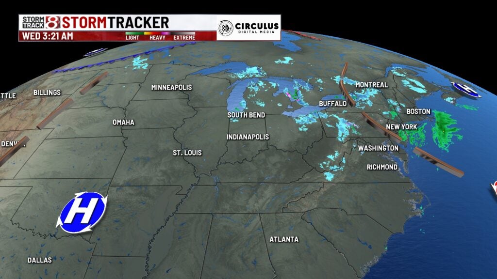
System that brought blustery winds and scattered snow showers has broken down, allowing for a quiet and dry early morning. A few snow showers remain coming off Lake Michigan for northwestern counties in the state.
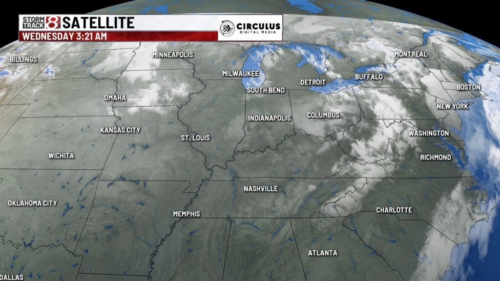
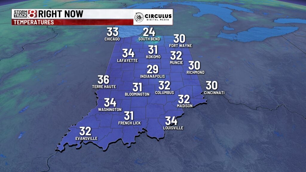
Temperatures are again cold, but not as chilly as previous mornings thanks for cloud cover overhead.
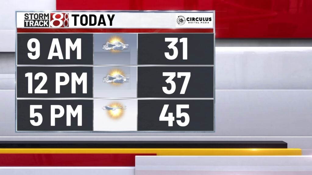
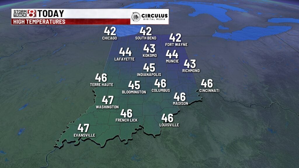
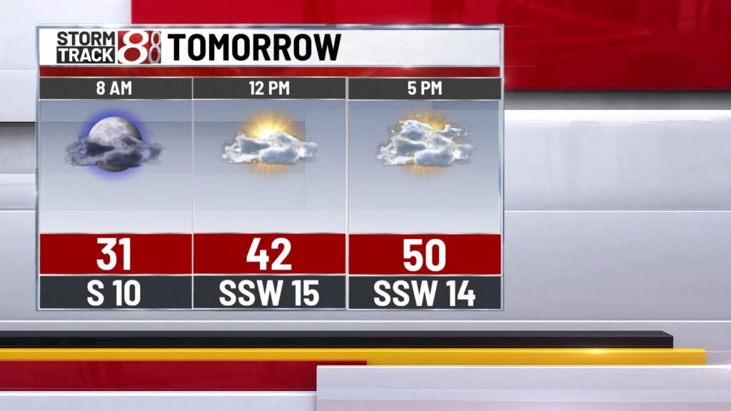
Wednesday:
Lake effect snow showers will continue through mid-morning for far northwestern counties across the state. The rest of the state should see clouds breaking throughout the day.

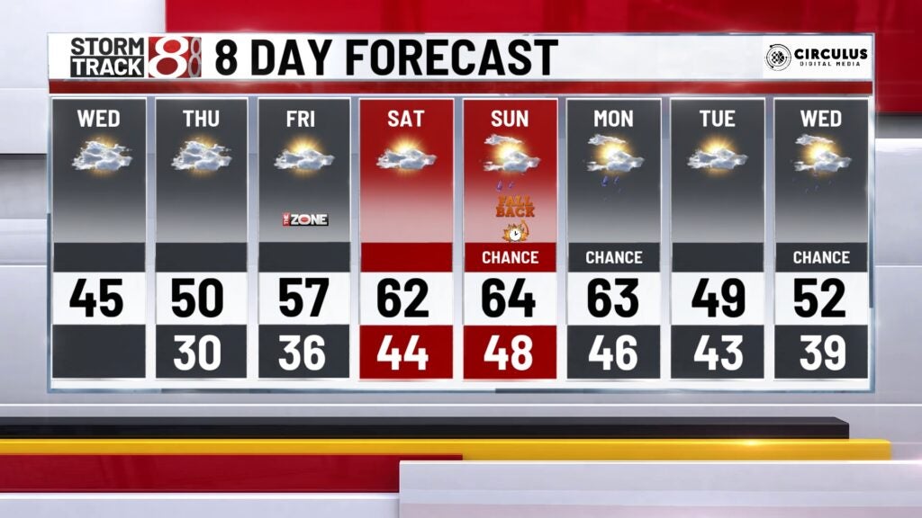
Winds should be a bit calmer, but temperatures will remain chilly. Highs top out in the middle 40s this afternoon.
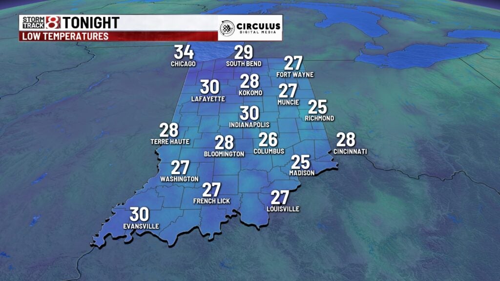
Wednesday night:
Partly cloudy conditions and quiet weather, with chilly temperatures across the state. Lows fall to the upper 20s/lower 30s.
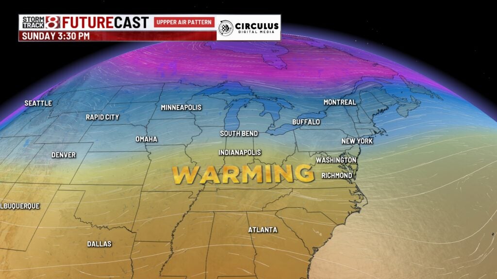
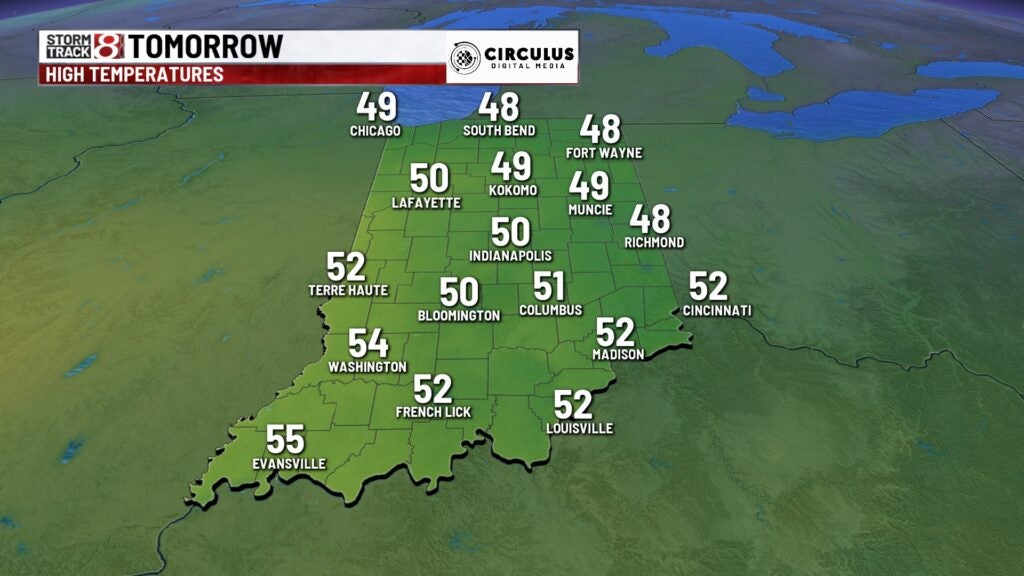
Thursday:
Warming trend begins, as the early season polar plunge retreats back into Canada. Temperature will remain below average, but improved compared to earlier in the week. Highs top out in the upper 40s/lower 50s.
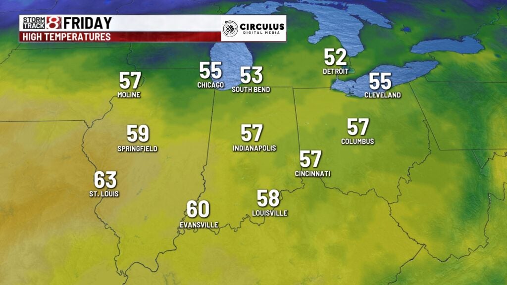
Friday:
Temperatures much closer to average to end the week, as the upper level pattern “flattens out” Highs should reach the middle/upper 50s.
Weekend:
Beautiful weekend on tap, with temperatures returning to the 60s. Just a slight chance for showers on Sunday.

8 day forecast:
Mild temps continue on Monday as a cold front moves through sparking rain chances. Another shot of colder temps moves in for Tuesday and Wednesday of next week.