Tracking wet, windy weather through end of workweek
INDIANAPOLIS (WISH) — We got to enjoy lots of sunshine, warmer temperatures, and calm conditions for our Wednesday.
However, we will not stay calm for long as we bring in rain and stronger winds, with much colder air to follow.
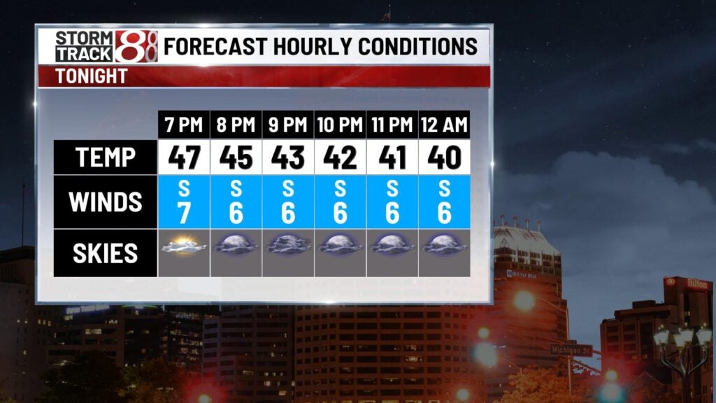
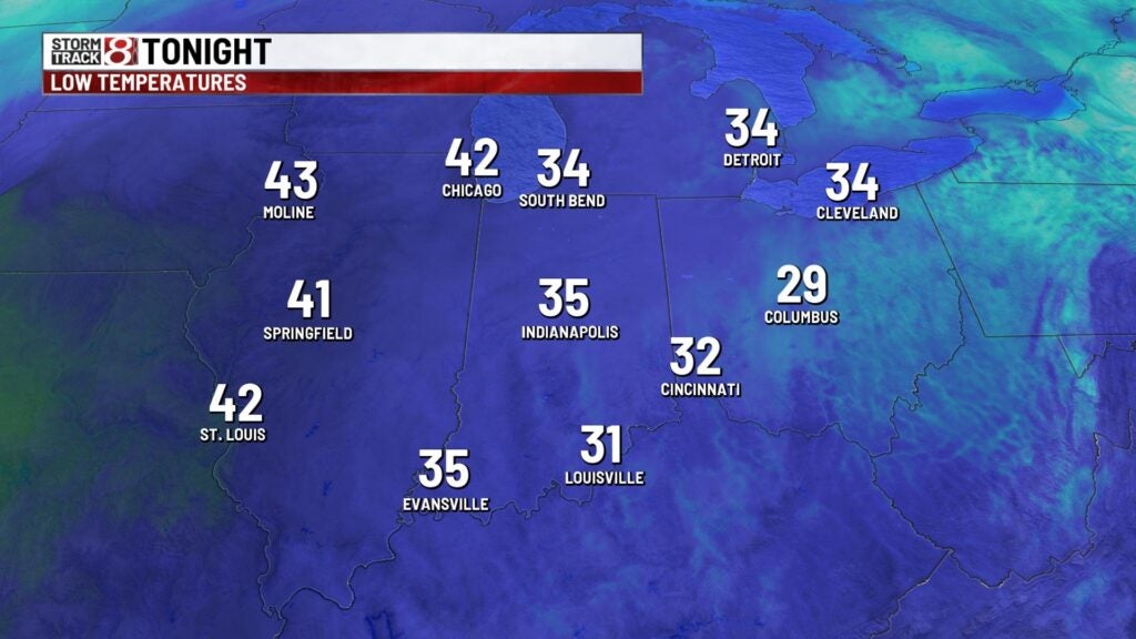
Wednesday night: Skies will become mostly cloudy after sunset, which will lead way to a much warmer night. Lows will only fall into the mid 30s.
Thursday: We’ll start dry under mostly cloudy skies. However, we’ll see showers return to the state after the lunch hour. Showers will become widespread in coverage by the latter half of the day.

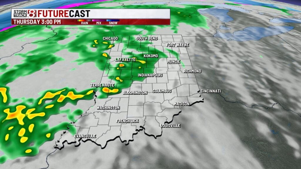
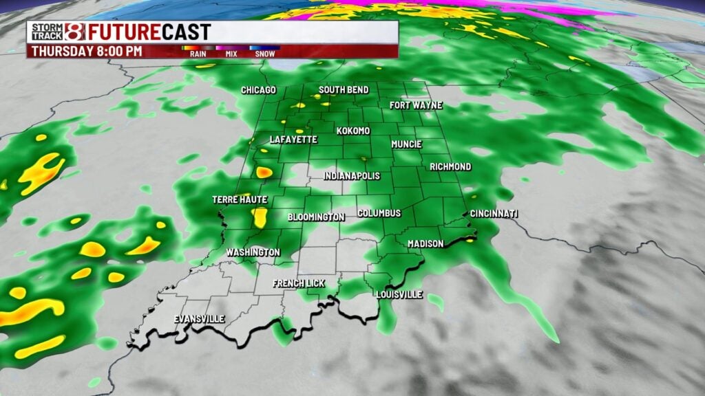
Highs look to get into the mid 50s. Winds will also pick back up with gusts approaching from 30-40 mph by Thursday night.
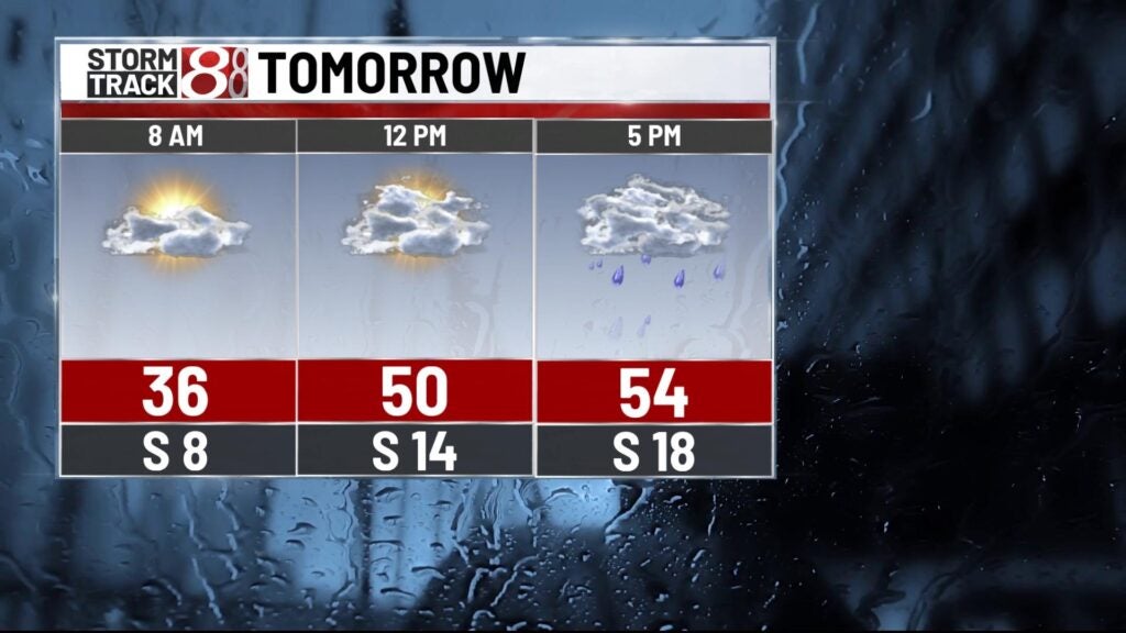

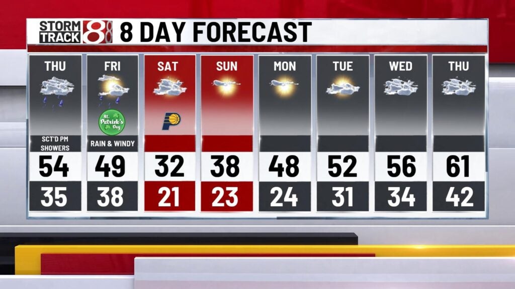
St. Patrick’s Day: A few showers will hang around into the start of our Friday before rain moves out going into Friday afternoon as the cold front quickly progresses eastward.

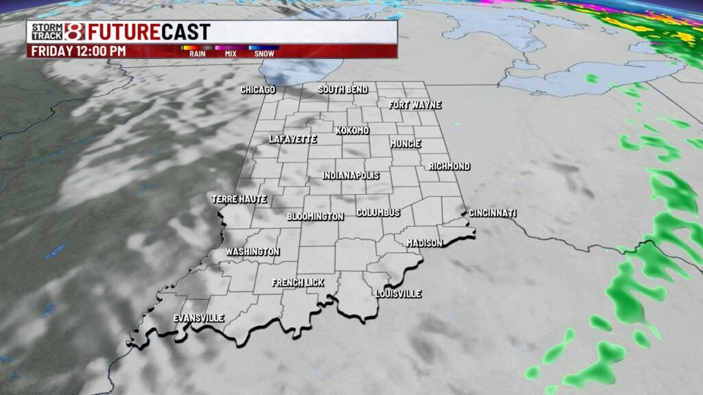
Since the cold front is set to pass through in the first half of the day, our high temperatures will happen Friday morning with numbers in the upper 40s to low 50s. Temperatures will then decline for the remainder of the day. Winds will also stay a bit breezy with gusts from 30-40 mph at times.

8-Day Forecast: A cold air mass will lock into our area this weekend as Saturday will feature highs struggling to get into the low 30s with breezy winds. A few snow showers are even possible during the first half of Saturday. Sunday will mark the start of another warmup as highs top out in the upper 30s. The warming trend will continue into next week with temperatures returning to the 50s by next Tuesday.