A warm and windy final weekend of April expected
INDIANAPOLIS (WISH) — Central Indiana got back into the 60s on Friday after struggling a bit the past couple of days.
A bit of sun in spots happened before some showers moved in during the afternoon hours.
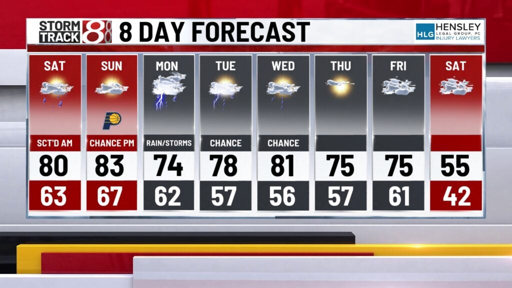
Expect near-record warmth this weekend with more chances for rain and storms going into next week.
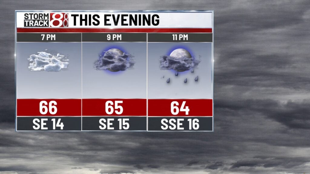
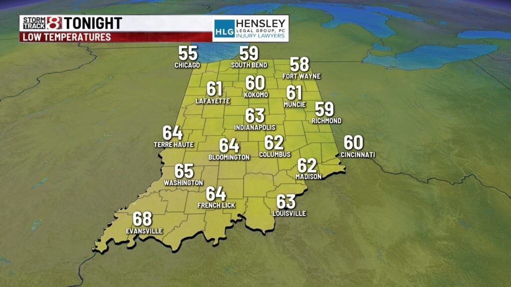
Friday night: Isolated to scattered showers and storms were expected.
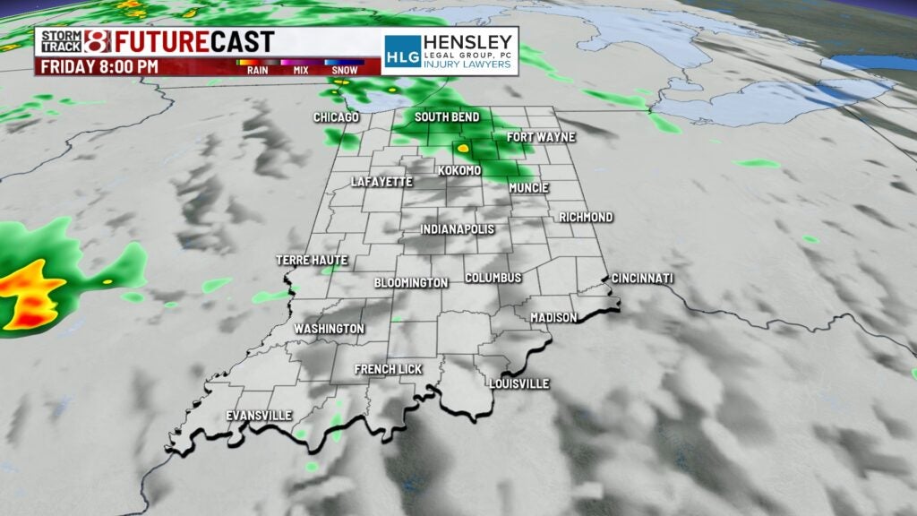
It will be a mild and breezy night with lows in the low to mid 60s. Winds will also gust up to 20-30 mph.
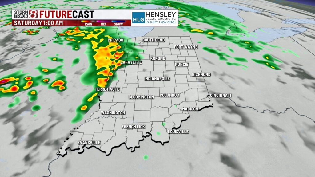
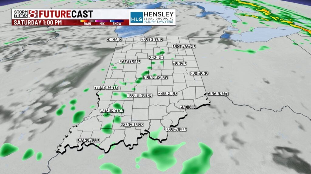
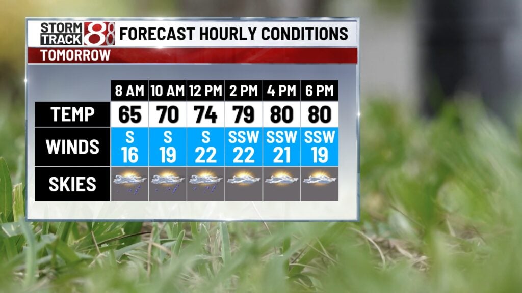
Saturday: Scattered showers and storms will persist into the morning and may continue into part of the afternoon hours.
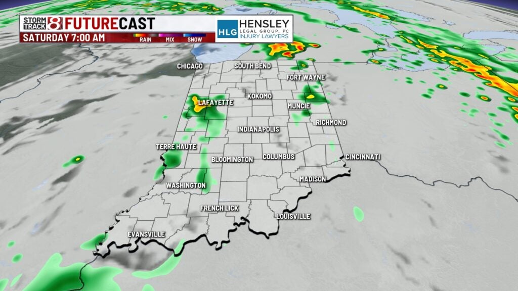
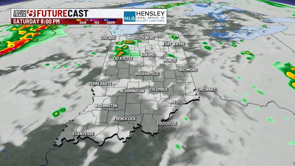
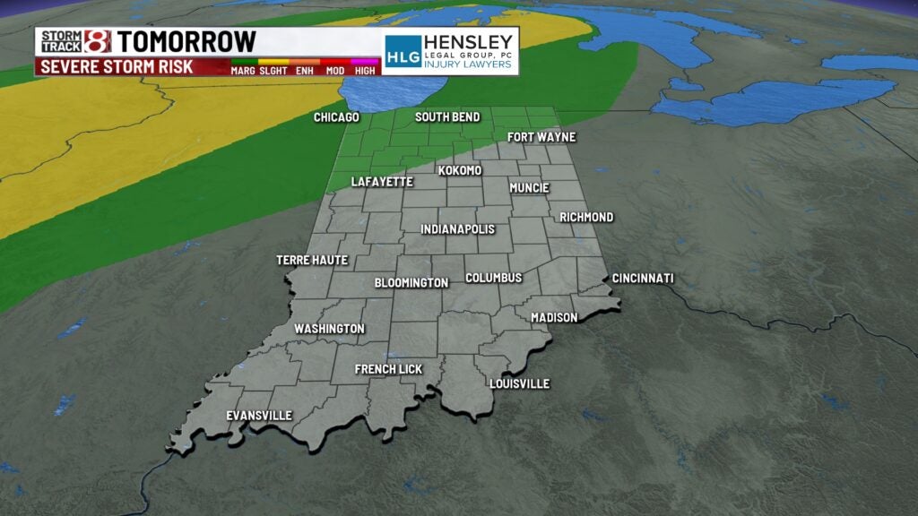
There is a low possibility of strong to severe storms in northern Indiana in the afternoon and night.
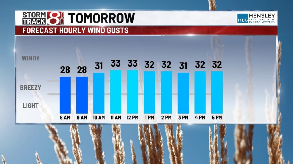
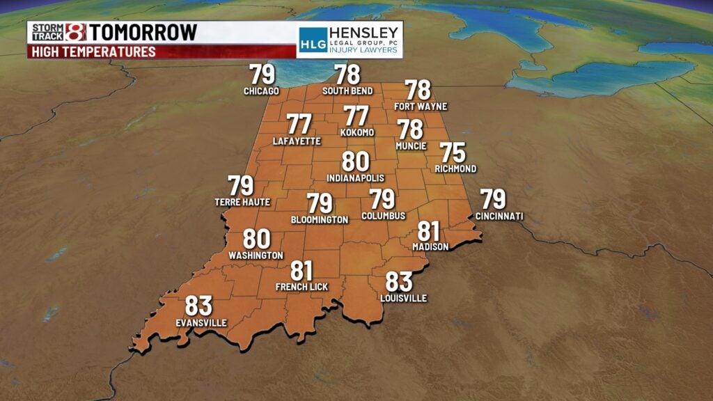
Highs will soar into the upper 70s to low 80s due to a strong southerly breeze. Wind gusts are set to be up to 25-35 mph at times. The potential for a record high exists in Indianapolis; the record is 84 from 1990.
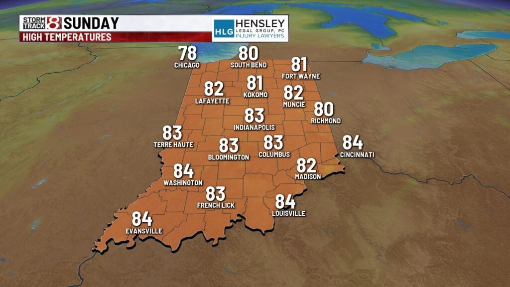
Sunday: Another near-record high and windy day was expected. Some sunshine will be in the mix. Highs look to get into the low to mid 80s with winds gusting to 25-35 mph. The record high in Indy on Sunday is 86 from 1894.
Rain chances will increase again late Sunday night into Monday.
8-Day Forecast: Rain and storms will remain possible Monday and for much of next week. Now, no day next week will be a complete washout, but daily rain chances will be in place nonetheless. Despite the rain chances, highs will stay in the 70s for much of next week.