Active Wednesday night, windy with additional activity Thursday
INDIANAPOLIS (WISH) — We’re gearing up for a soggy and breezy Wednesday night.
Then, it’ll be even more windy Thursday with more showers and storms before much colder air arrives.
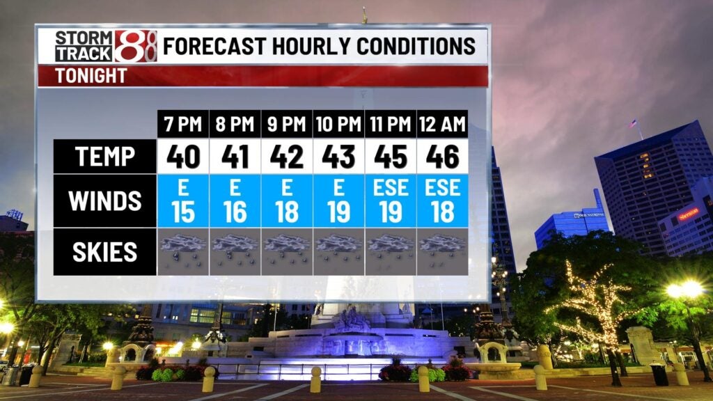
Wednesday night: Have the rain gear on hand as widespread rain and a few storms roll in. Heavy rain will occur at times, but severe weather was not anticipated.

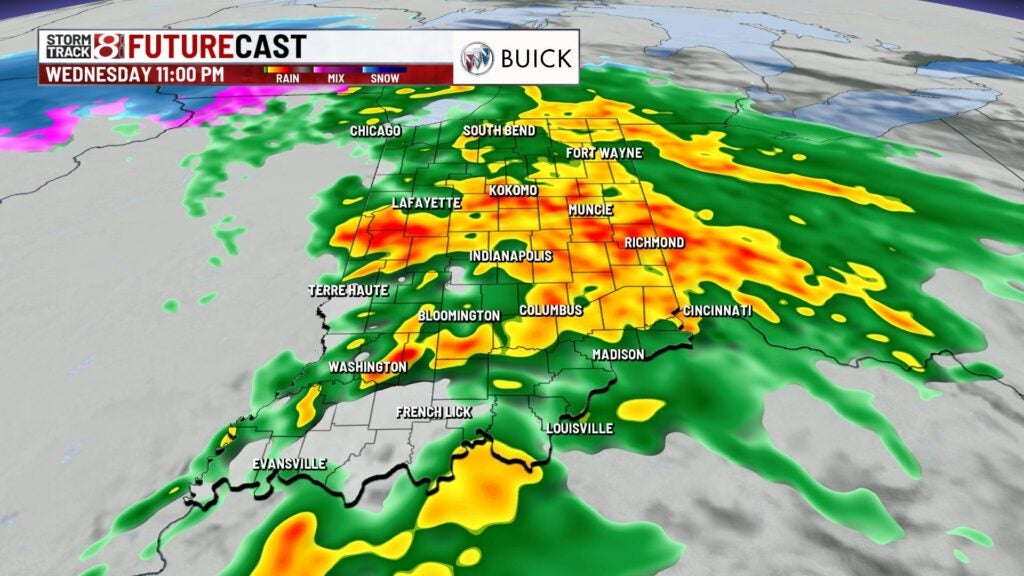
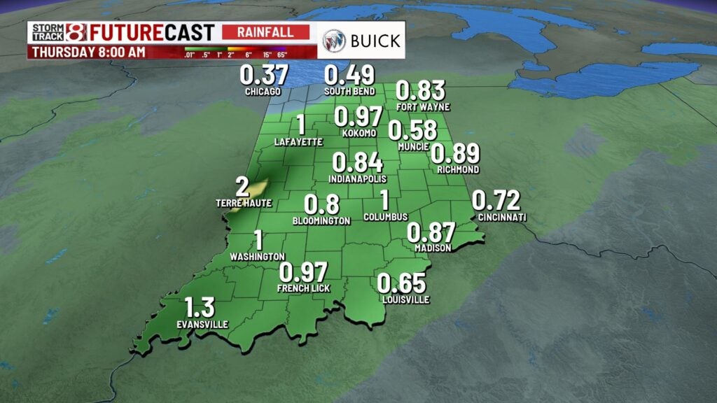
By sunrise Thursday, central Indiana is expected to have from a half-inch an an inch of rain with locally higher amounts possible. Minor flooding issues may also occur.
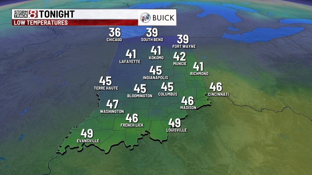
Temperatures are going to be on the rise, which is contrary to numbers typically decreasing at night. Numbers look to ride into the upper 40s to low 50s by the overnight hours. Breezy winds will also be in place with gusts from 30-40 mph at times.
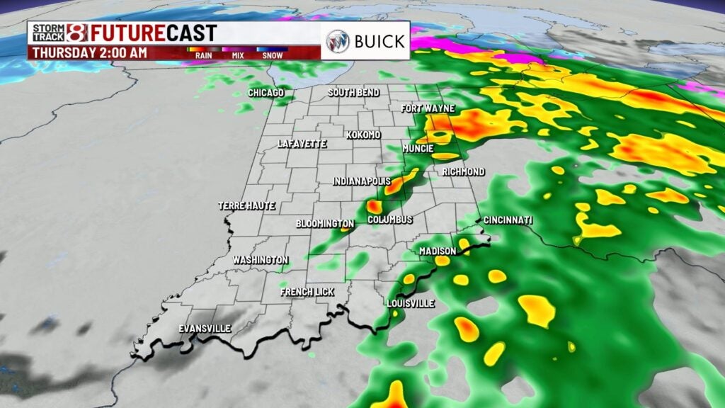
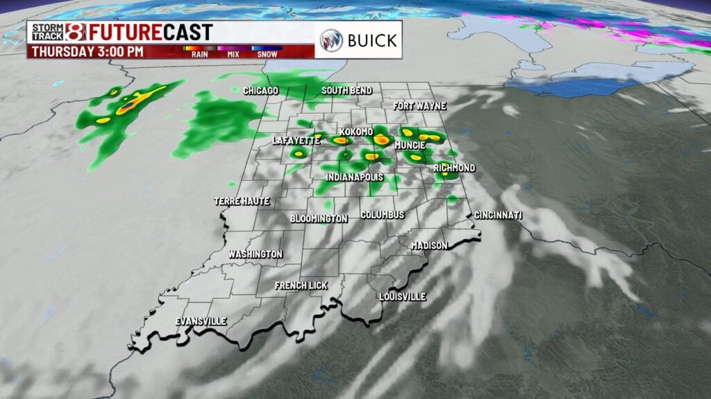
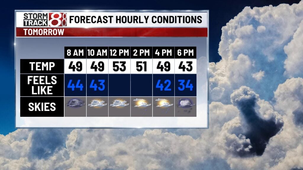
Thursday: As we get to daybreak Thursday, there will be a lull in activity. There will even be some sunshine that enters the picture for some of the state, but this will spark a new round of showers and isolated storms Thursday afternoon. Then, much colder air sinks in with a transition to some flurries Thursday night.


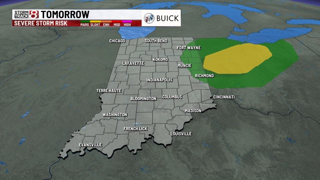
We can’t rule out isolated strong to severe storms Thursday afternoon for some of eastern Indiana. Damaging winds and hail are the main concerns, but we could also have isolated instances of rotating storms.
Highs will push into the low to mid 50s, but temperatures drop quickly going into the nighttime hours. Gusty winds not associated with storms are going to continue with gusts from 40-45 mph at times.

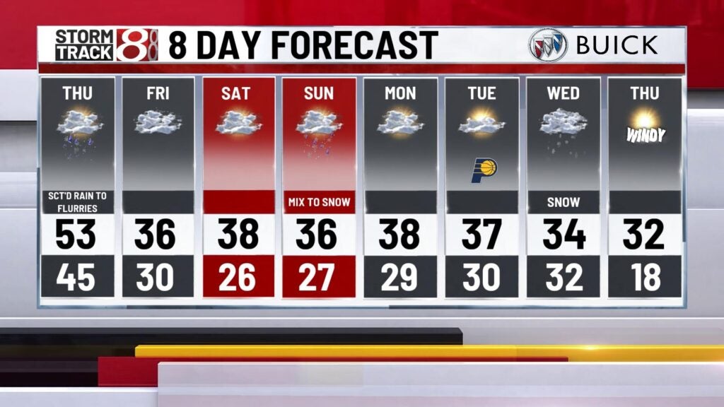
Friday: Be sure to grab the winter coat for a cold, breezy and gloomy day to end the workweek. Highs will struggle to get into the mid 30s.

8-Day Forecast: Dry, chilly conditions are expected for Saturday with highs in the upper 30s. Then, we’ll track another system for Sunday with the chance for rain and snow. It is still too soon to determine if and how much snow accumulation we will see. Highs will stay near to slightly above-normal going into next week with numbers in the upper 30s. Additional active weather is possible by midweek next week.