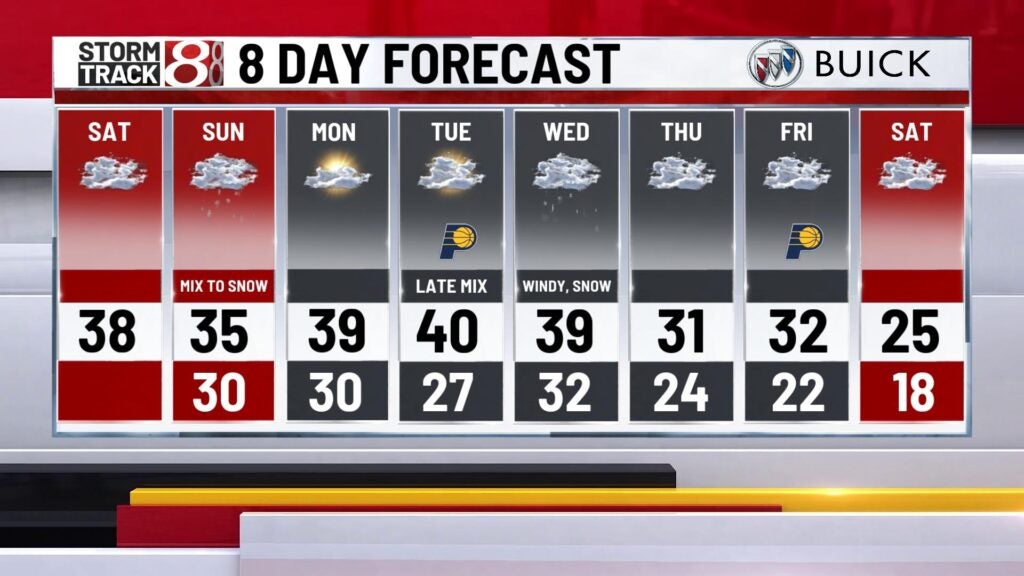
Cloudy Saturday with snow for Sunday
INDIANAPOLIS (WISH) — We’re in store for a quiet start to the weekend before snow develops and moves into the state late tonight and tomorrow.
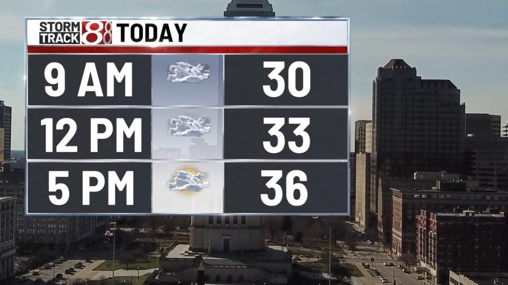
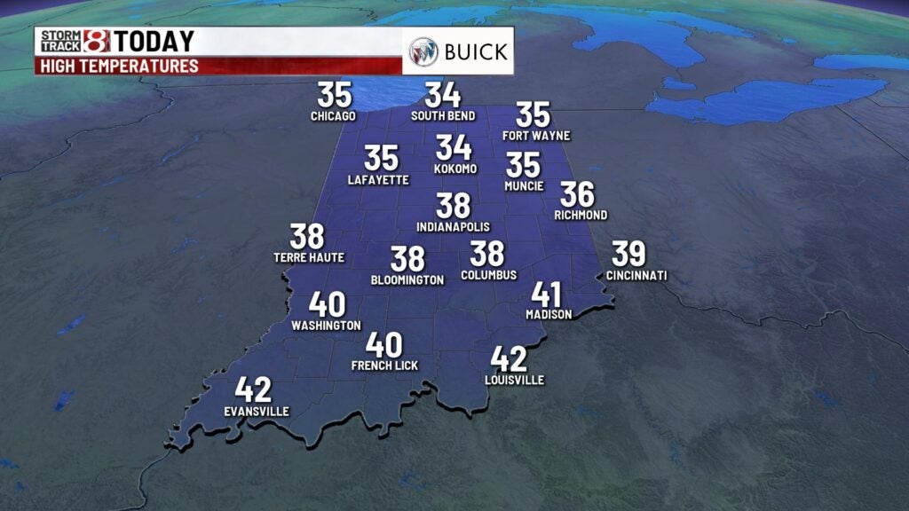
TODAY: Look for mostly cloudy skies throughout much of the day today. Temperatures will be seasonable with highs right around normal in the middle 30s. Winds stay light out of the south and southwest.
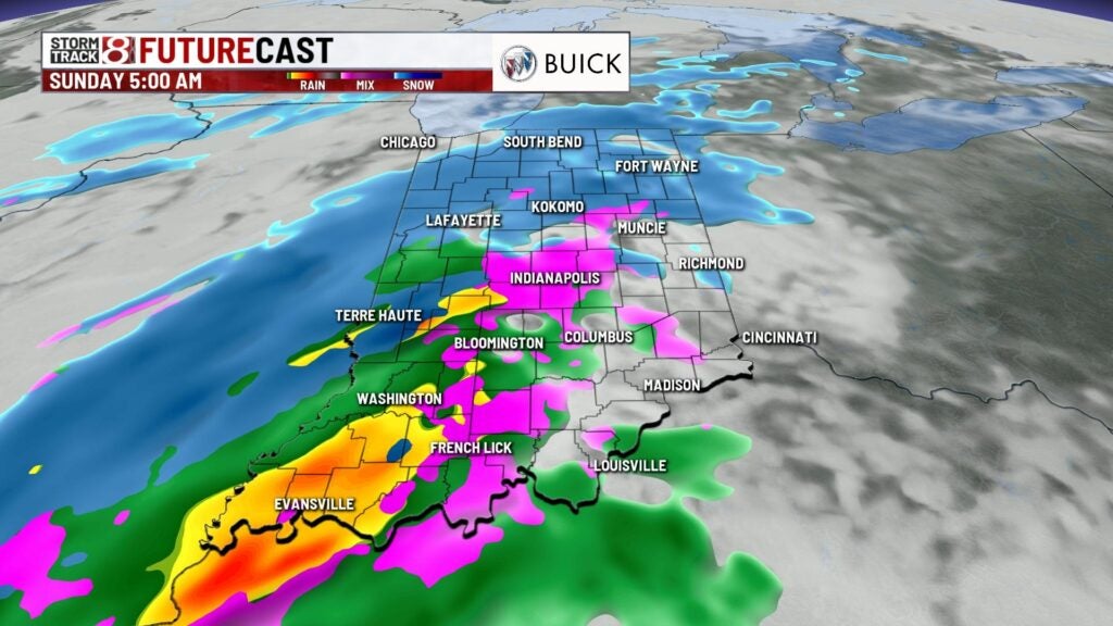
TONIGHT: Clouds stick around overnight and by daybreak we’ll see a chance for some light snow to develop across much of the state. Lows fall near 30.


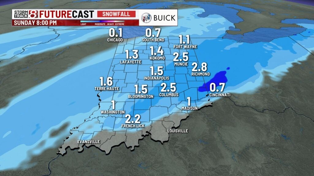
SUNDAY: Light snow will continue for the first half of the day. It may mix at times with rain especially during the afternoon. Accumulations look to be on the light side. Most spots will pick up an inch or an inch and a half. Some areas east of Indy like Muncie and Richmond may see a little more snowfall. Highs climb into the middle 30s.


MONDAY: Snow ends and we’ll see a break in the cloud cover for the start of the new week. Temperatures climb into the upper 30s near 40 for Monday with a partly cloudy sky.
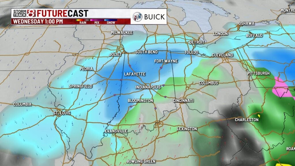
8DAY FORECAST: All eyes turn to a potential winter storm for the middle part of the workweek. Tuesday clouds increase ahead of this system. Highs climb into the upper 30s near 40. The bulk of the precipitation will fall on Wednesday. Snowfall accumulation is likely and it may be significant. The exact track and if there will be any mixed precipitation is still uncertain. Winds pick up with the system and may gust near 30 mph at times. This will create blowing and drifting snow. The snow comes to an end for the end of the week and temperatures begin to drop. Next weekend we may only see highs in the 20s.