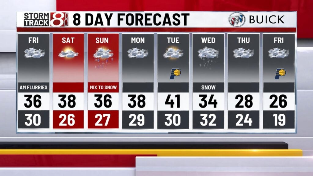
Cold air to take over going into the weekend
INDIANAPOLIS (WISH) — We had a mild and breezy first half of Thursday with showers and isolated storms before colder temperatures sprinted in.
This colder airmass will hang with us going into this weekend with chances for a wintry mix in the extended forecast.
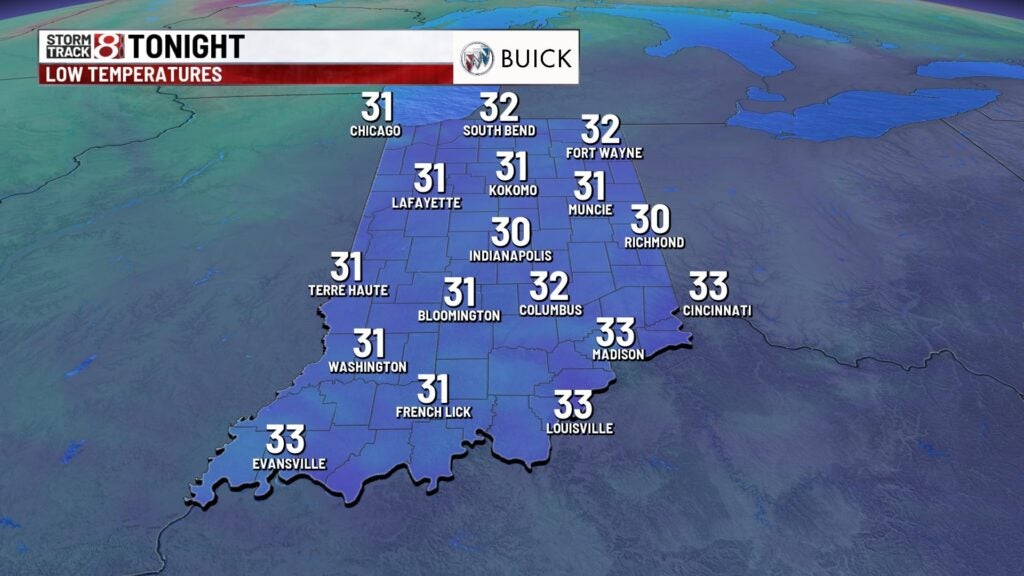
Thursday night: We’re in for a cold and windy night with bouts of scattered flurries and light snow showers possible. Lows will tumble into the low 30s.


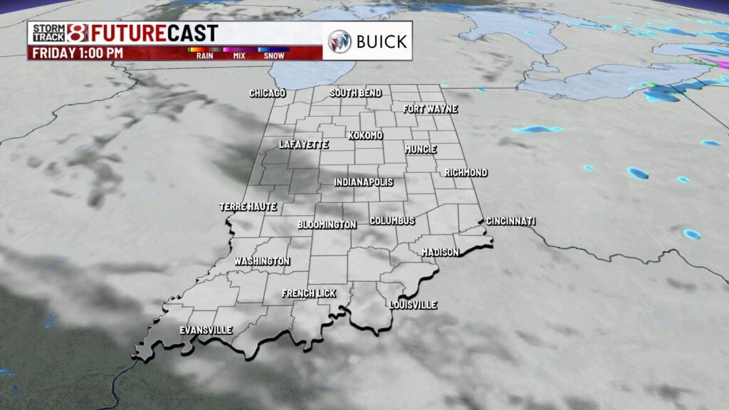
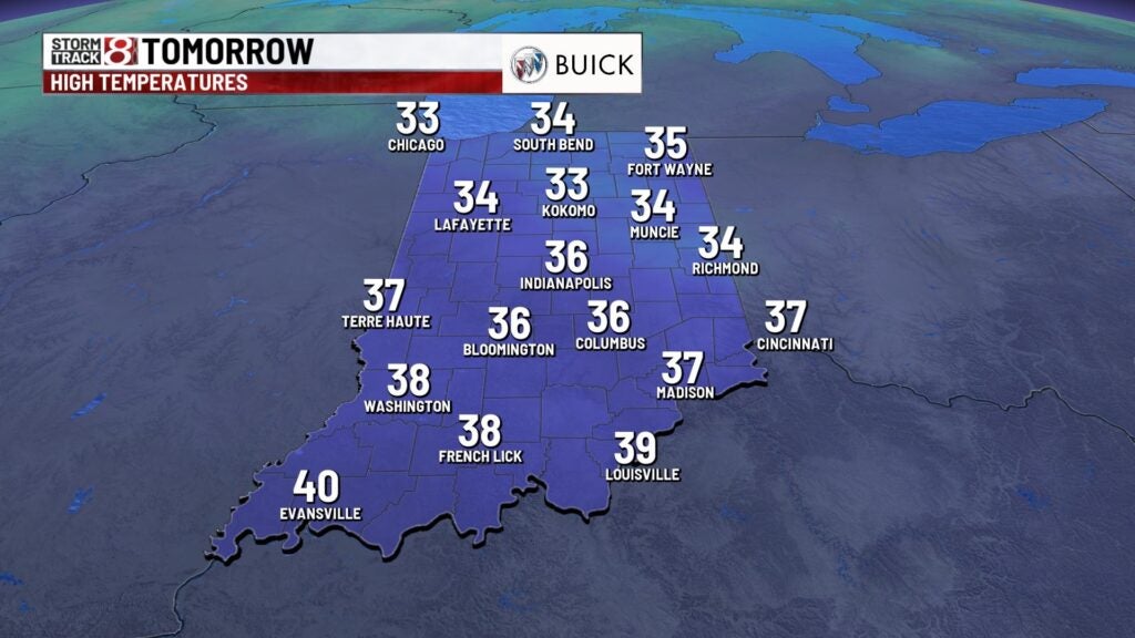
Friday: The winter coat will need to be a necessity as it will feel brisk throughout the day. Isolated to scattered flurries will be possible until early afternoon. Highs are going to struggle to get into the mid 30s with breezy winds sticking around.


Weekend: Chilly yet near-normal temperatures will continue to be the story. Sunshine will enter back into our area on Saturday, but highs will only manage to top out in the upper 30s. We’ll track another system that slides in by Saturday night. This will bring a chance for rain and snow that will persist through Sunday, and precipitation intensity overall will stay on the light side. Highs will rise into the mid 30s for Sunday.


8-Day Forecast: We look to briefly dry out to start next week with highs in the upper 30s. Then, a potentially stronger system is set to arrive by midweek next week with additional rain and snow chances. By the latter half of next week, temperatures slip into the 20s.