Heat turning up the next couple of days
INDIANAPOLIS (WISH) — August got off to a rocky start for central Indiana with severe storms producing scattered areas of damage during the morning hours. We are set to turn up the heat with additional storm chances this week.
A ***Severe Thunderstorm Watch*** remains in effect until 11 PM EDT for the southern third of Indiana.

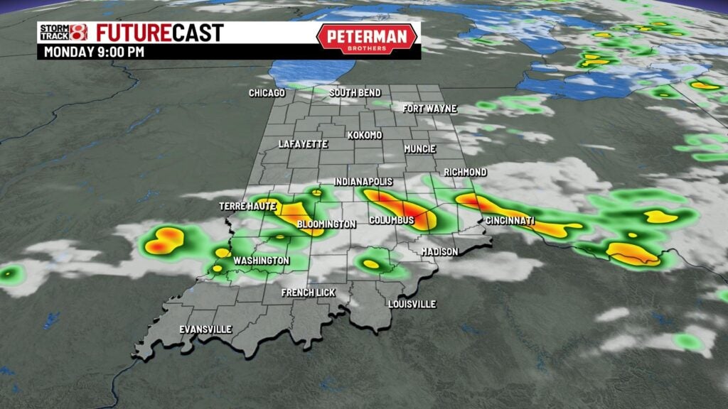
Monday night: Scattered showers and storms remain possible for areas south of interstate 70. There is also the possibility for isolated strong to severe storms over the next few hours with the greater threat south of a Vincennes-Columbus line. Damaging winds and hail are the main threats, but an isolated tornado is also possible.

A warm and muggy night is expected with lows in the upper 60s.


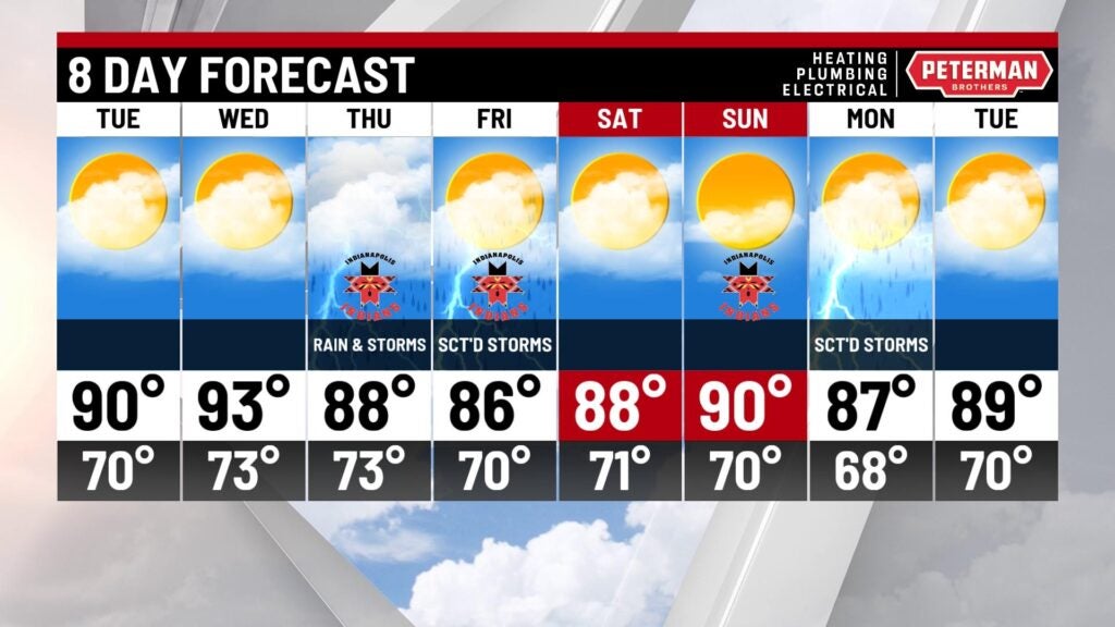
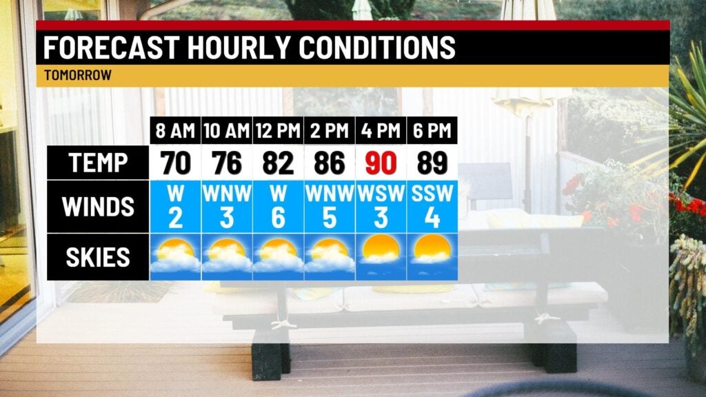
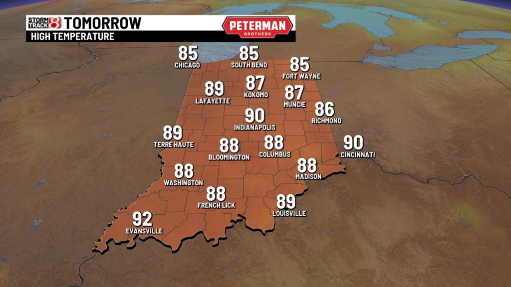
Tuesday: Prepare for a hot day as we look to march back towards the 90s. Heat index values will be in the mid-90s at times due to the high humidity values.
Wednesday: The hottest day of the week comes into play for Wednesday as it will feel quite miserable outside. Highs in the mid 90s in conjunction with muggy air will cause some locations to feel like the upper 90s to potentially low 100s. Along with a sweltering afternoon, scattered showers and storms are possible in the latter half of the day.


8-Day Forecast: More active weather looks to enter the bigger picture for Thursday and Friday. Then, above average temperatures with dry conditions slide in for the upcoming weekend.