
Mild and dry Wednesday, active second half of week to follow
INDIANAPOLIS (WISH) — Despite a cloudy day, we were able to warm up into the 50s in portions of central Indiana. The warmup continues into Wednesday before we track rain chances for the remainder of the workweek.
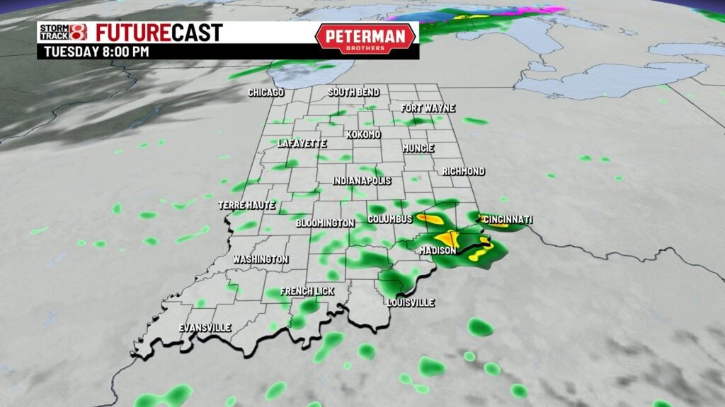
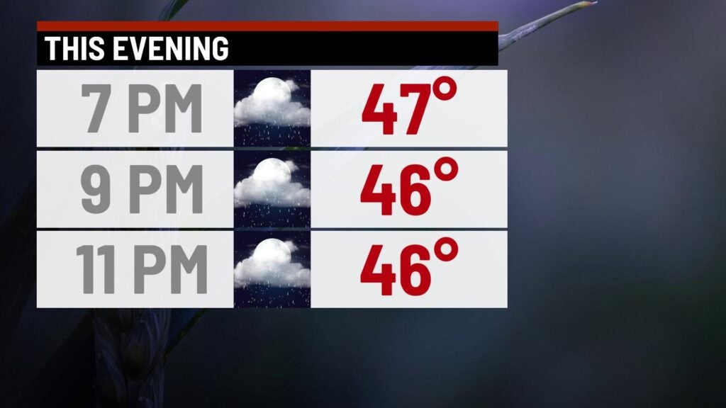
Tuesday night: A few light showers are possible tonight with areas of fog developing closer to daybreak. Lows are set to once again be on the mild side for this time of the year with numbers in the upper 30s to low 40s.


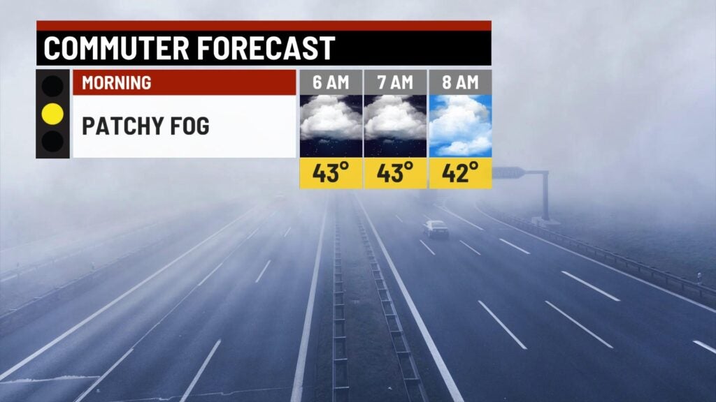
Wednesday: Patchy fog is expected to start our Wednesday, so be extra cautious during the morning commute. Warmer air will continue to infiltrate our state as we try to work in a little bit of sunshine. Highs look to rise into the low to mid 50s.


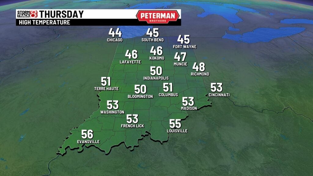
Thursday: Have the rain gear on hand for Thursday as active weather moves back into the state. Rain coverage will gradually increase throughout the day with showers becoming more numerous by the latter part of Thursday.
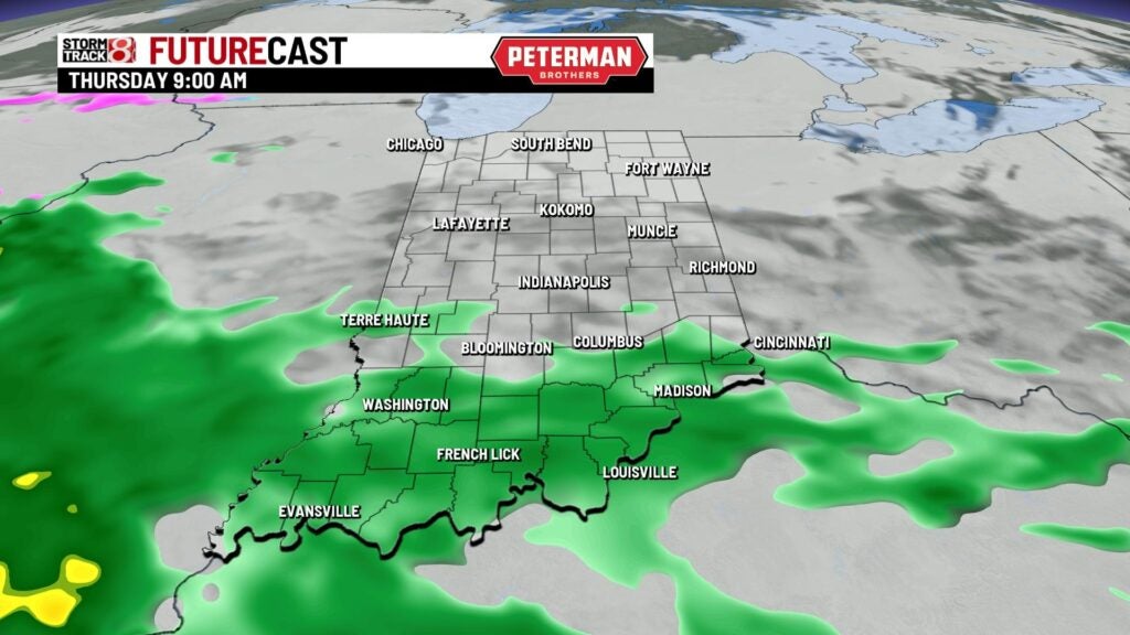
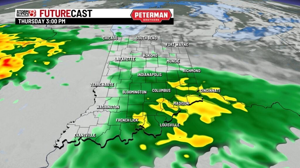


Although it will be a damp and cloudy day, highs will still manage to sneak into the upper 40s to low 50s.
8-Day Forecast: Scattered showers persist into Friday with highs cooling down into the mid 40s. We’ll dry out just in time for the upcoming weekend with near normal temperatures in the low to mid 40s. Rain chances won’t stay away for long as they return by late Sunday and into the first half of next week.
