


Mild with increasing rain chances through midweek
INDIANAPOLIS (WISH) — After a dry start to the workweek, we are monitoring several chances for rain with mild air in place.
Monday night: Skies will become mostly cloudy going into tonight as temperatures hang around in the 40s overnight. Breezy winds out of the south will be the reason why tonight will stay mild.


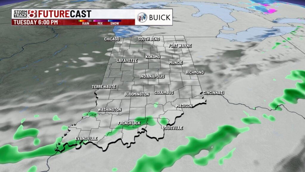
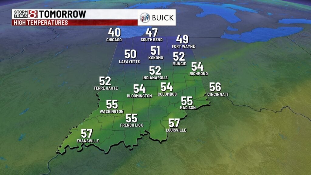
Tuesday: Rain returns to the forecast for our Tuesday as isolated to scattered showers will develop in the morning hours. Shower development will continue into the early afternoon hours before activity slides out.
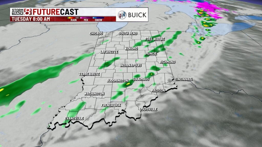
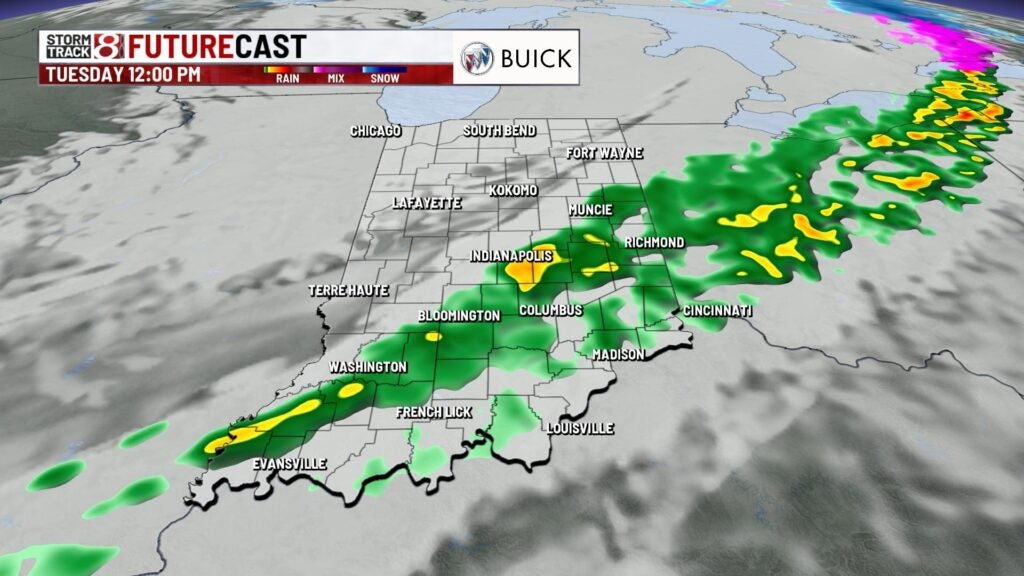
Despite the rain and extra cloud cover, breezy southerly winds will aid in a warmer afternoon with temperatures rising into the low 50s. Wind gusts will be up to 25-30 MPH at times.
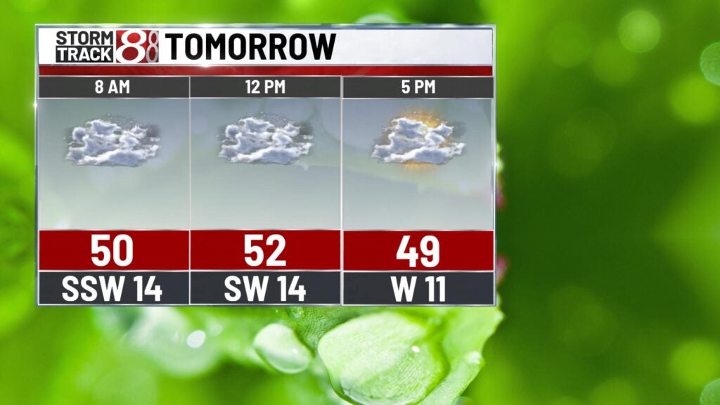
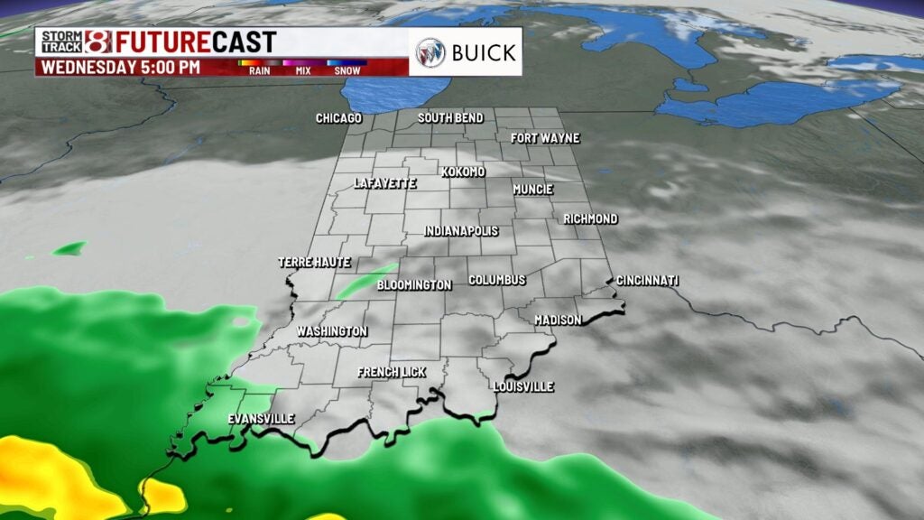
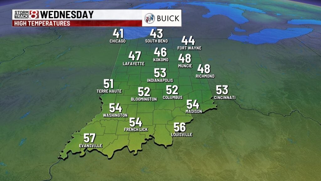
Wednesday: We will see a dry start to Wednesday, but a better shot for rain will move in after sunset. By Wednesday night, widespread showers are expected with pockets of heavier rain. Along with the rain, it will become windy after sunset Wednesday as well.

Highs will get back into the low 50s.
8-Day Forecast: Showers will continue into the Thursday morning commute before rain moves out near the lunch hour. Highs on Thursday will be in the low 50s with gusty winds up to 35-40 MPH at times. Colder air begins to arrive for Friday with scattered rain chances in the afternoon hours, and there could be some snow showers that mix in. Highs briefly dip into the 30s for Saturday before we quickly rebound going into next week.
