


Monday rain, warmer midweek
INDIANAPOLIS (WISH) — Rain chances return for the first part of the workweek. Warmer temperatures heading this way for the middle part of the week.
A batch of showers are moving across the metro area this morning. No severe weather expected. But you may see some downpours. Rain will be possible on/off during the day today.
TODAY: A few showers and thunderstorms are possible today. No severe weather expected but some of the afternoon sport practices or games may see some showers or a few claps of thunder. Best chance of rain will arrives later this morning and into the afternoon.


Highs today will climb into the 70s. It will also be breezy with winds out of the southwest 10 to 20 miles per hour. Some of these winds may gust 20 to 25 miles per hour.


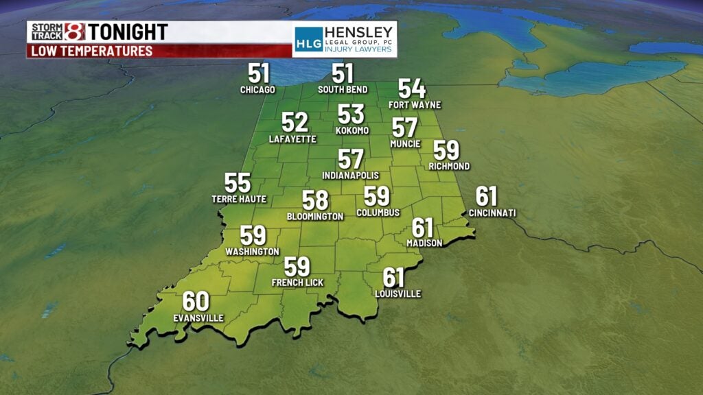
TONIGHT: Rain chances continue into the overnight hours. We may pick up a half inch up to an inch of rainfall in some spots. Winds begin to drop and temperatures fall into the middle and upper 50s. Areas in northern Indiana may see temperatures fall into the lower 50s.
TUESDAY: We will start out with some cloud cover early in the morning with sunshine returning for the afternoon. Winds will not be as breezy for the afternoon. Temperatures climb into the middle and upper 70s.


WEDNESDAY: Dry weather continues for the middle part of the week. We begin to warm into the 80s for the middle part of the workweek. Highs climb into the lower 80s Wednesday and evening the middle 80s on Thursday.

8DAY FORECAST: Spotty showers and thunderstorms will be possible late Thursday. Rain chances ramp up on Friday with highs dropping back into the middle 70s. This weekend looks like it will be half and half. Right now it looks like the Indy Mini Marathon will be dry. Temperatures stay into the 70s for the rest of the 8day forecast.
