Monitoring wintry mix chances for this weekend
INDIANAPOLIS (WISH) — After dealing with a cold and breezy Friday with precip sprinkled in the mix throughout the day, we’ll track another system that will bring more rain/snow chances.
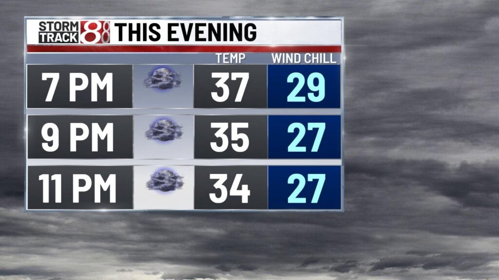
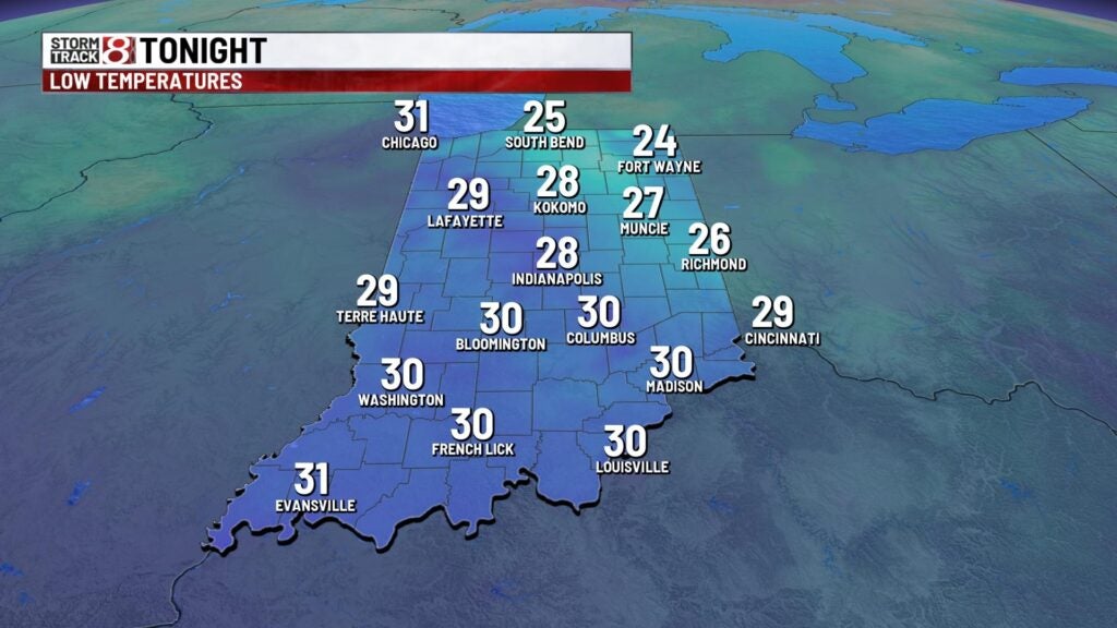
Friday night: We’ll keep the chance for some isolated to scattered sprinkles/flurries through central and north Indiana tonight.
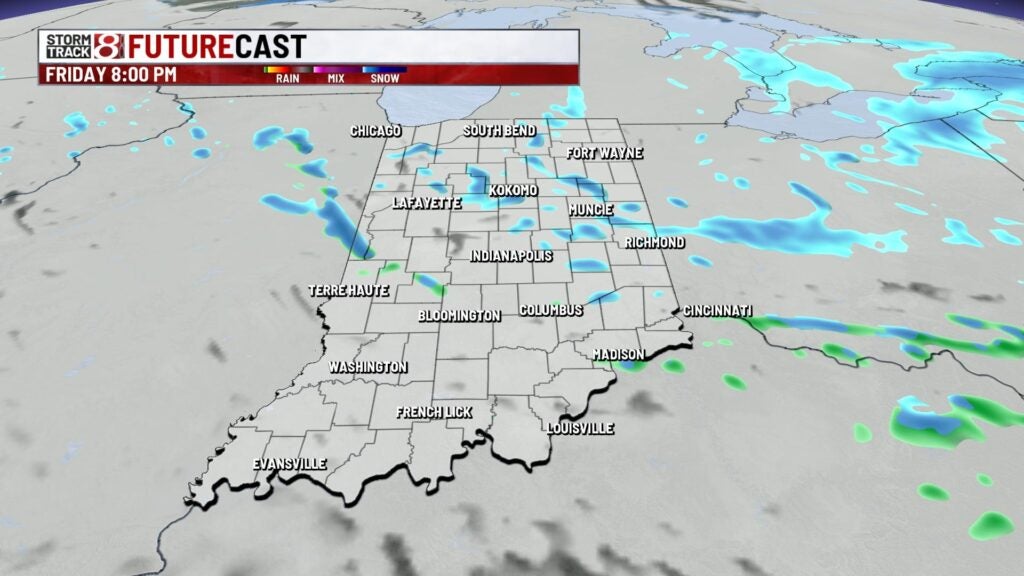
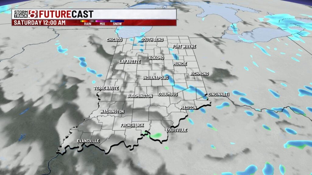
Lows are set to fall into the upper 20s. Winds will also die down a bit for tonight as well.
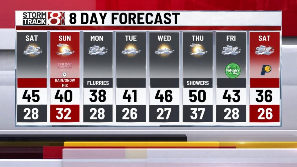
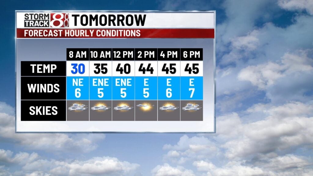
Saturday: A cold start to our Saturday is expected under partly to mostly cloudy skies. Then, we’ll see some clearing by early Saturday afternoon before cloud cover quickly builds back ahead of our next system. Showers will move back into the state Saturday afternoon with snow mixing into the picture late Saturday night.

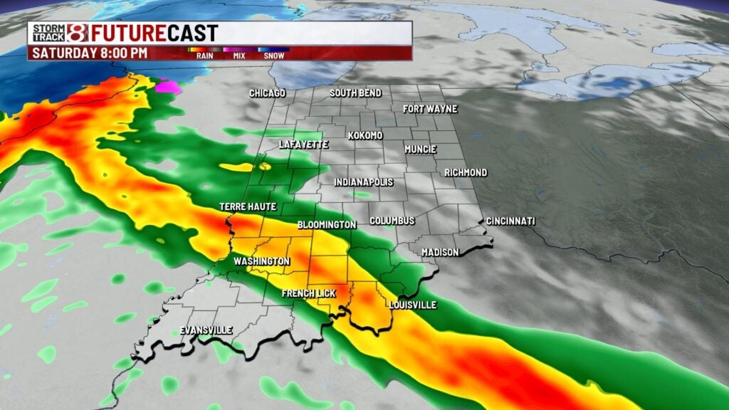

Highs look to get back into the low to mid 40s.

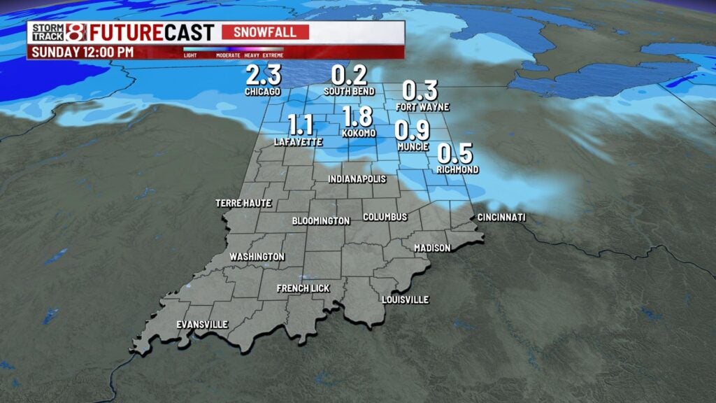
Sunday: A wintry mix will be ongoing to begin our Sunday. Precip will become more scattered for the day with lingering rain/snow showers persisting into Sunday night.
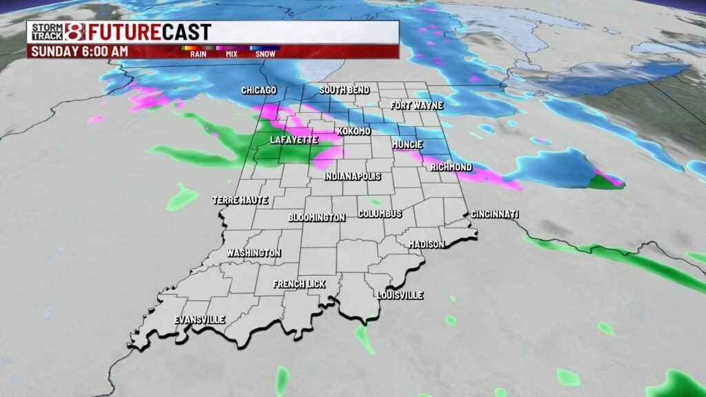

There is potential for light snow accumulation for areas along and northeast of interstate 74 with up to one inch of snow possible. This accumulation will be mainly on grassy and elevated surfaces, but some roads could have slushy accumulation that are not treated.
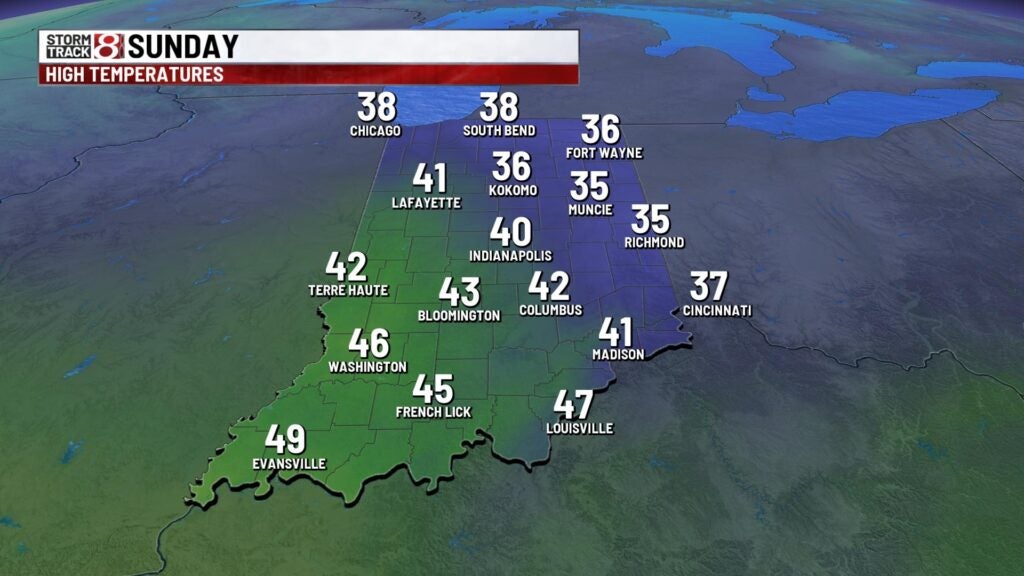
Highs will only get into the upper 30s to low 40s.
8-Day Forecast: The start to the new workweek will feel winterlike with chilly high temperatures in the upper 30s and breezy winds with gusts up to 30 MPH at times. A few flurries could even linger into Monday morning before we work in some dry time and a warmup through midweek. Temperatures look to push near 50 degrees by Thursday before another system rolls in to close out the workweek.