


Patchy frost overnight; rain chances return Friday evening

INDIANAPOLIS (WISH) — Some areas could see their first frost Friday morning.
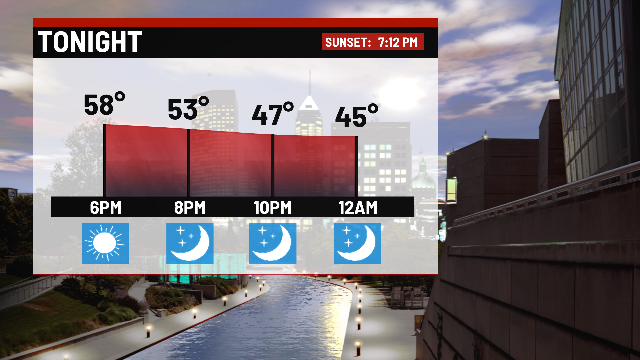
Tonight:
Mainly clear conditions through the evening and overnight. We turn much colder compared to Thursday morning, as temperatures reach the middle 30s.

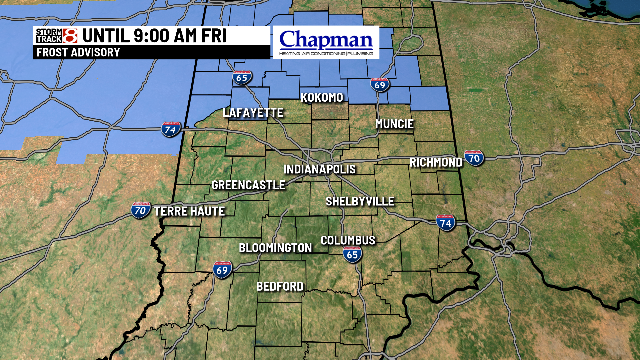
A Frost Advisory is in effect for far northern counties until 9am. Frost will likely NOT be widespread, thanks to a breeze still kicking up for much of central Indiana. Northwestern counties may have lighter winds, which could lead to a better chance for frost overnight.
Friday:
Starting the day off dry and sunny. Clouds will gradually build throughout the day. Afternoon highs only hit the lower 50s.
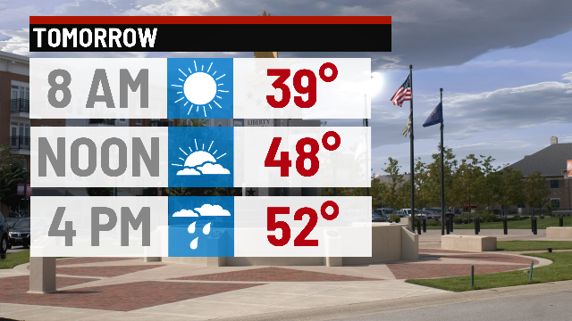
Upper level disturbance moving through during the second half of the day should help to spark scattered light showers around the area. Rain chances hang around through Midnight, before moving east.

Weekend forecast:
Not bad for the weekend, but still cool – especially Saturday. Decent chance for some frost in scattered areas Saturday morning, followed by highs in the lower 50s Saturday afternoon.
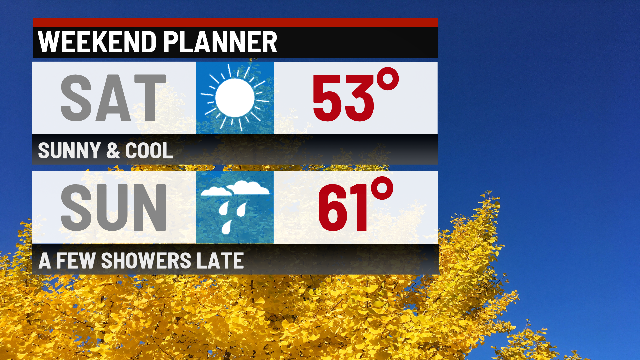
We’ll see highs return to the lower 60s Sunday, with late evening rain chances.
Frost chances:
As previously mentioned, some patches of frost will be possible both Friday morning and Saturday morning. Possibly our next best chance for widespread frost could come Monday night into Tuesday morning.

8 day forecast:
Rain chances Friday night, Sunday night and Monday. The first half of the work week remains cool, with a slight warm up on tap for the end of the work week.
