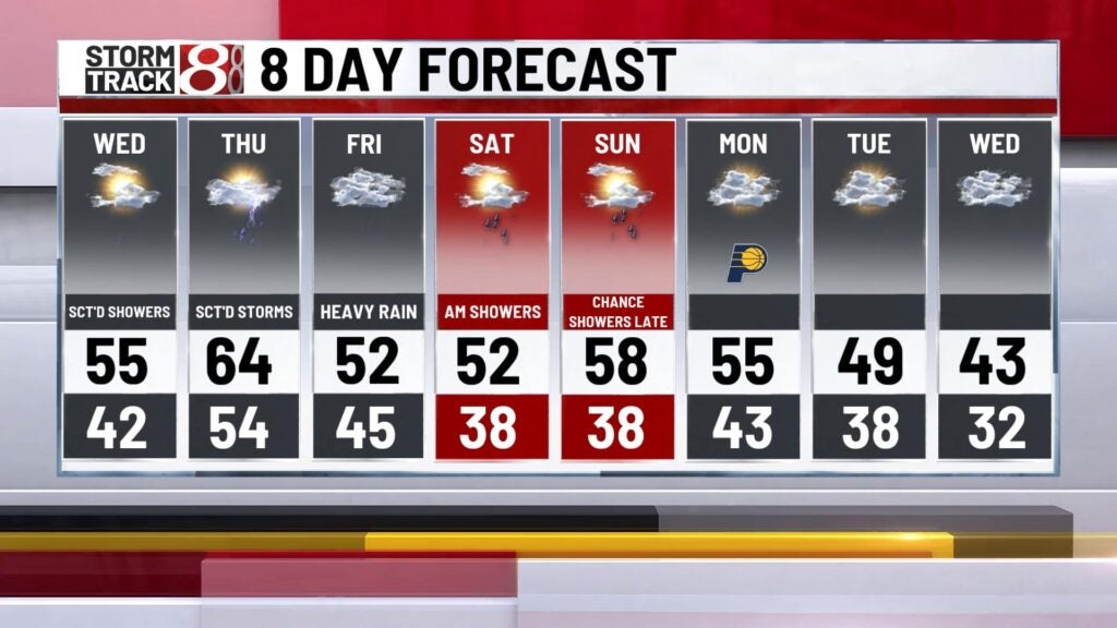
Rain chances picking up with heavy rain threat late week
INDIANAPOLIS (WISH) — We are continuing to track an active pattern that will set up beginning Tuesday night and culminate with the potential for extended heavy rain late this week. Temperatures are also going to continue warming up through midweek.
Tuesday night: Expect a batch of lighter rain tonight with winds remaining slightly breezy.


A more mild night will be on deck too with lows in the low 40s.


Wednesday: Rain chances lessen for Wednesday with coverage being spotty at best during the day.

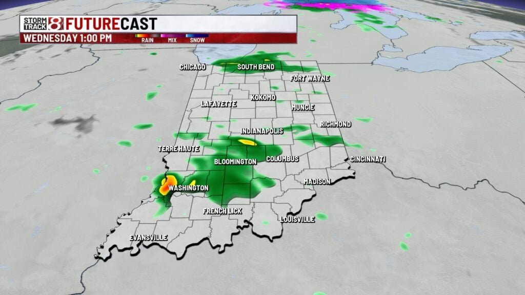
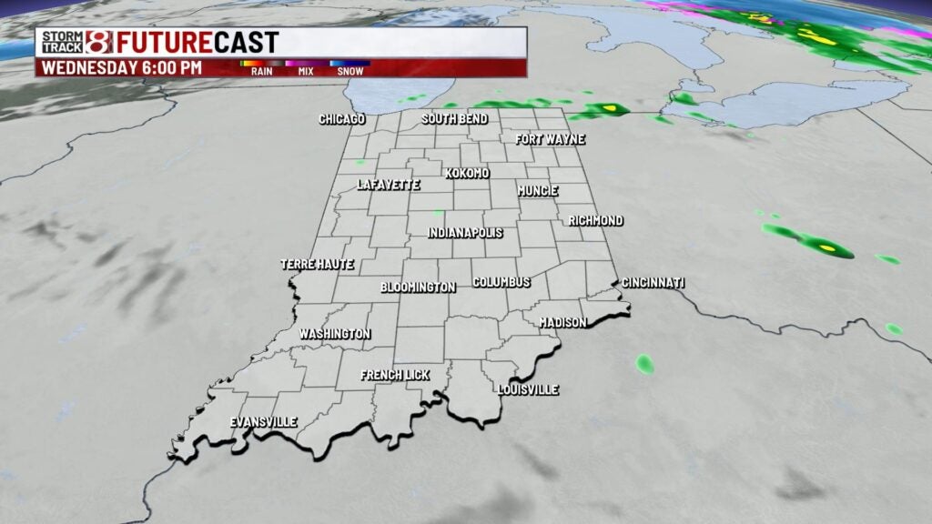
Areas in the northern third of the state will have a much better shot for redevelopment of showers and even isolated storms late Wednesday into early Thursday. Central Indiana will stay mostly quiet Wednesday night as a whole with the exception of spotty showers after sunset Wednesday.
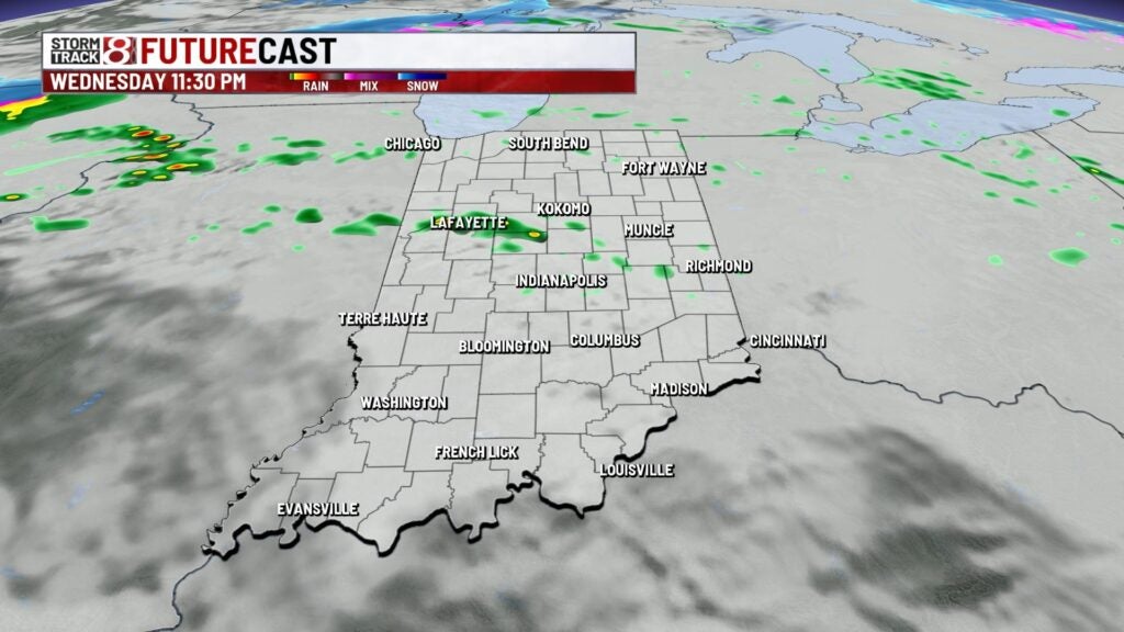
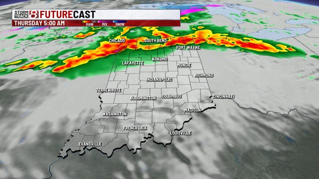
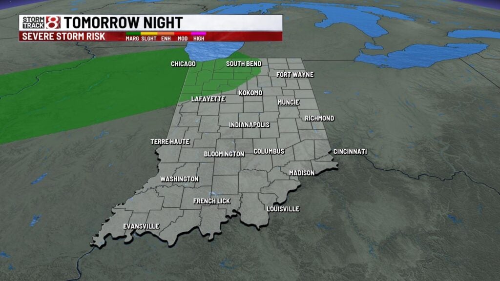
There is an outside chance for a rogue strong to severe storm or two late Wednesday night into early Thursday for areas north of a Lafayette-Logansport line. The main concern will be large hail.

Highs will rise into the mid to upper 50s with breezy winds in place. Winds will become a little bit stronger going into Wednesday night with gusts up to 25-30 MPH at times.


Thursday: A mild and breezy day is expected with on and off scattered showers starting after daybreak Thursday. As we get towards the second half of Thursday, a front will begin to gradually move south. This is when more potent rain moves in late Thursday as a band of heavier, persistent, rain slides in with embedded thunder possible.


Highs are set to climb into the mid 60s.
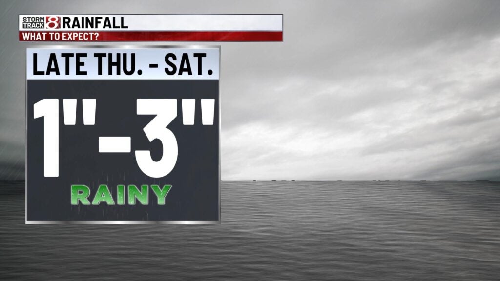
8-Day Forecast: The band of heavy rain will continue into Friday with concerns for flooding beginning to rise. At this time, greatest confidence for extended heavier rainfall lies from near and south of interstate 70 with the late Thursday/early Friday round of activity. There could be a bit of a break from the rain for some of central Indiana before a potential second round of heavier precip arrives Friday night. Rain becomes more light going into Saturday morning.
At this time, central Indiana has the potential to see one to three inches of rain from late Thursday to Saturday with locally higher amounts possible. Ensemble data currently showcases a high probability for two or more inches of rain near and south of I-70. There could be flash flooding in low lying and flood prone areas.

Another shot for rain slides in late Sunday into Monday. High temperatures after Thursday will mainly hover in the low to mid 50s.