Rainy end to the week with flooding concerns
INDIANAPOLIS (WISH) — We are tracking two main rounds of heavy rain ahead for the remainder of the workweek which will raise concerns for flooding.
A Flood Watch will be in effect from 8 PM EST Thursday to 8 AM EST Saturday morning.

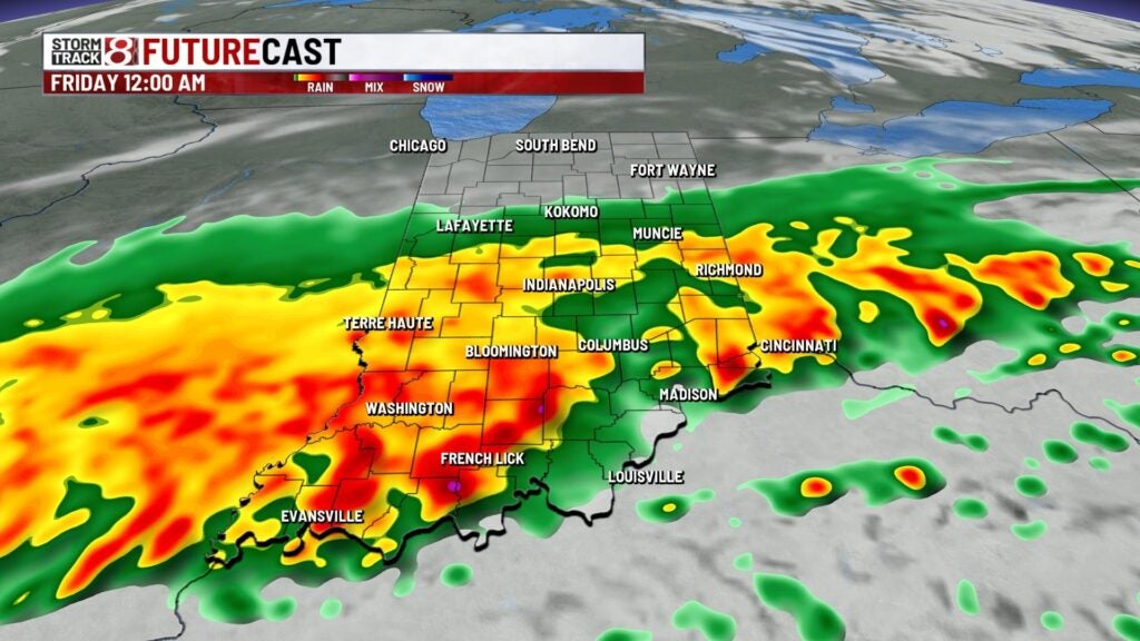
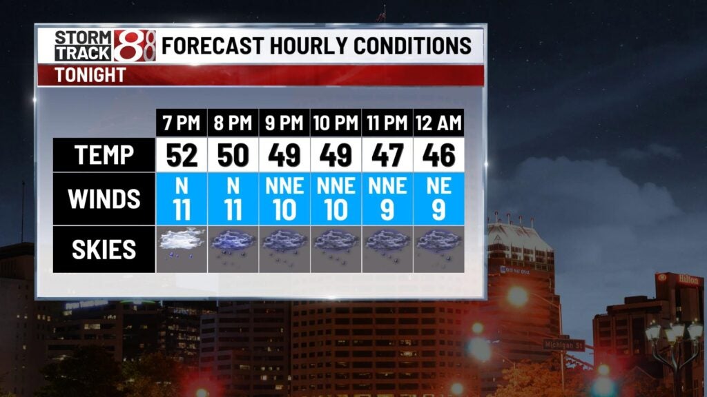
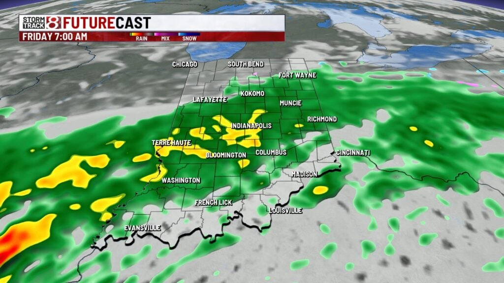
Thursday night: A wet night is expected with the first of two rounds of heavy rain developing along and south of interstate 70. This activity will continue into Friday.


There remains a low threat for strong/severe storms until Thursday night for areas southwest of Indy with hail the main threat.

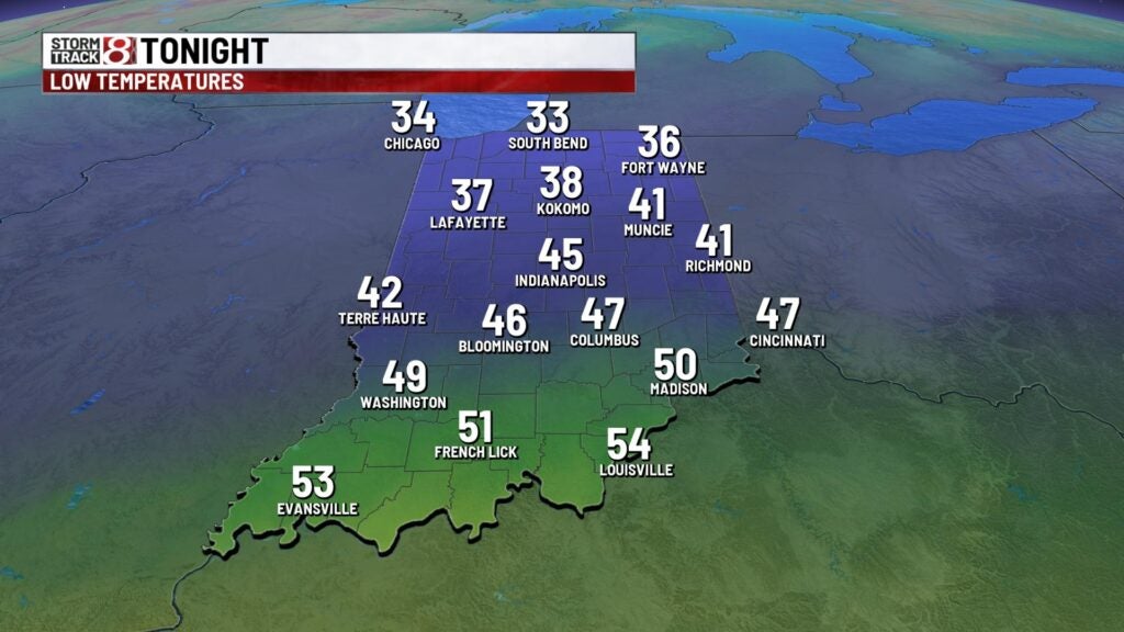
Temperatures will fall into the mid 40s.
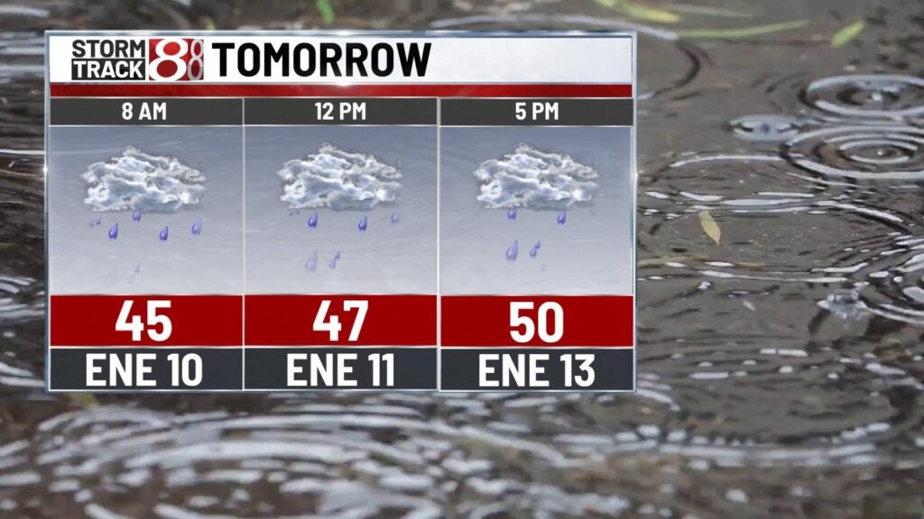
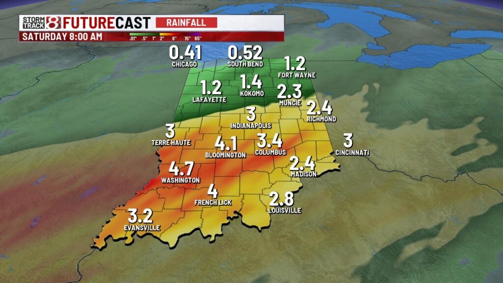
Friday: The Friday morning commute will be active with ongoing rain. Areas in south central Indiana will see heavy rain for longer durations of time. The initial heavy rain band from late Thursday into Friday morning will bring up to one to two inches of rain with areas south possibly seeing locally higher amounts.

Flooding will be likely even the possibility flash flooding and moderate river flooding. There could be periods in which rain becomes more scattered instead of widespread Friday afternoon.

Highs will only get into the low 50s.

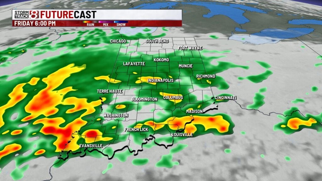
Friday night: A second round of heavy precip with instances of embedded thunder is set to arrive by Friday night. There is a low threat for strong/severe storms Friday night south of a Terre Haute-Greenwood line with damaging winds the primary concern. By Saturday morning, an additional one to two inches of rain is possible from this second main wave of activity. Winds will also become breezy again by Friday night with gusts up to 25-30 MPH.
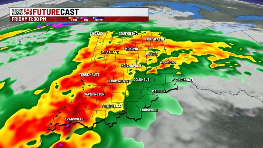

Forecast rainfall totals overall: As a whole, areas along and south of interstate 70 could have up to two to four inches of rain with isolated higher amounts from late Thursday to early Saturday.
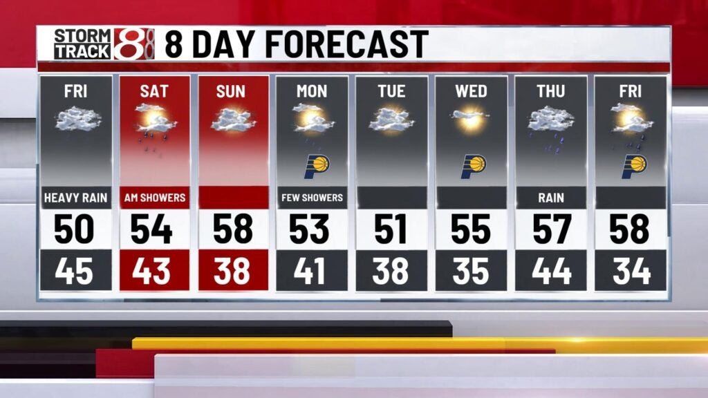
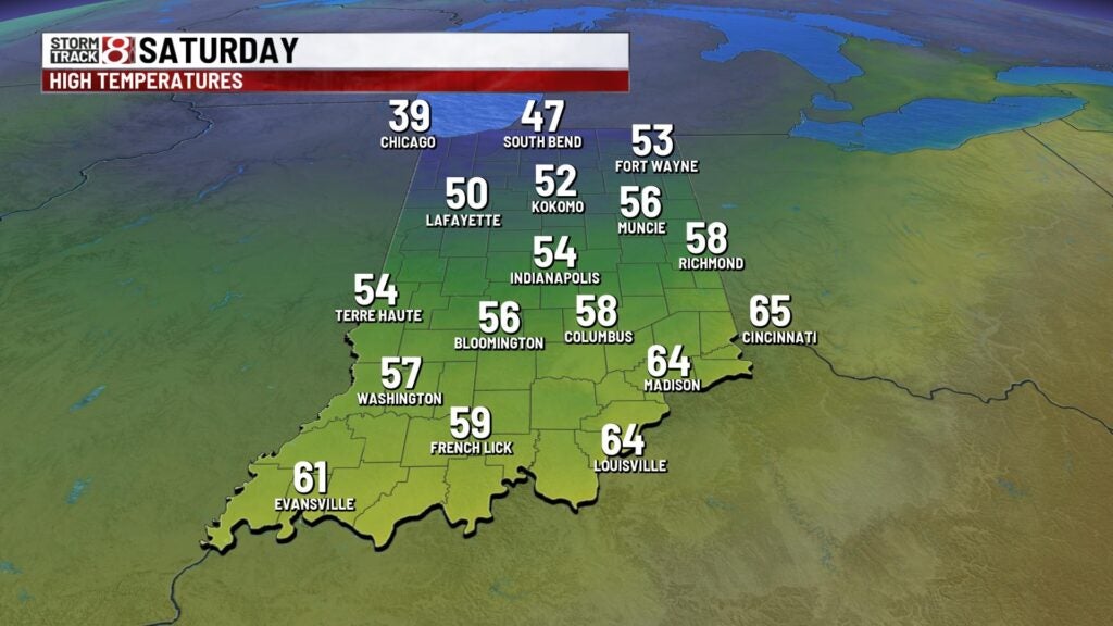
Saturday: A few showers may hang around early Saturday before all activity leaves the state just after daybreak Saturday. However, we’re set to work in windy conditions as the low passes away from Indiana. Wind gusts look to be up to 35-45 MPH from late Saturday morning through Saturday evening. Highs will take place Saturday morning as well with numbers in the mid 50s.
8-Day Forecast: Sunday is shaping up to be a much more calm day with highs in the upper 50s. However, showers will quickly return to the forecast in the latter half of Sunday. A few showers will then stick around throughout our Monday. Highs will hover around the low to mid 50s for the first half of next week.