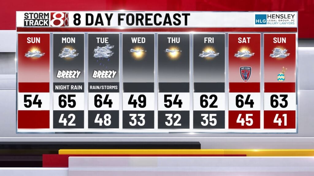
Seasonable Sunday, rain arrives Monday night
INDIANAPOLIS (WISH) — It was a cooler start to the weekend with highs on Saturday only getting into the mid-40s. Central Indiana rebounds today before widespread rain arrives Monday night.
TODAY: Partly cloudy skies are expected for the bulk of the day. A few stray showers may make it into western Indiana this morning, otherwise the vast majority will be dry. An east wind will be sustained at about 5 to 15 mph. High temperatures in the mid-50s.
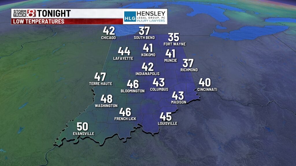
TONIGHT: Clouds continue to increase across the area. Low temperatures in the low to mid-40s.
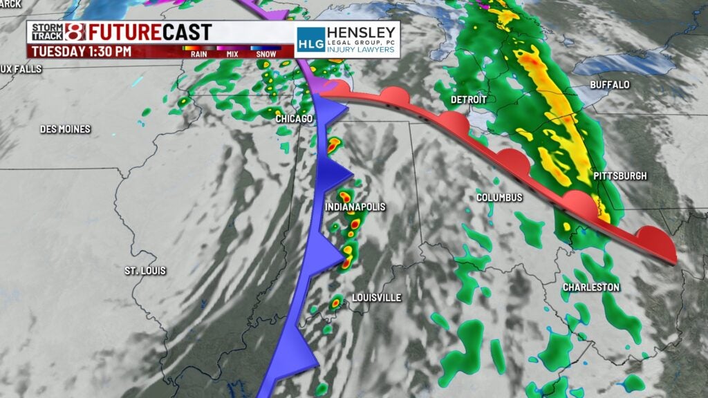
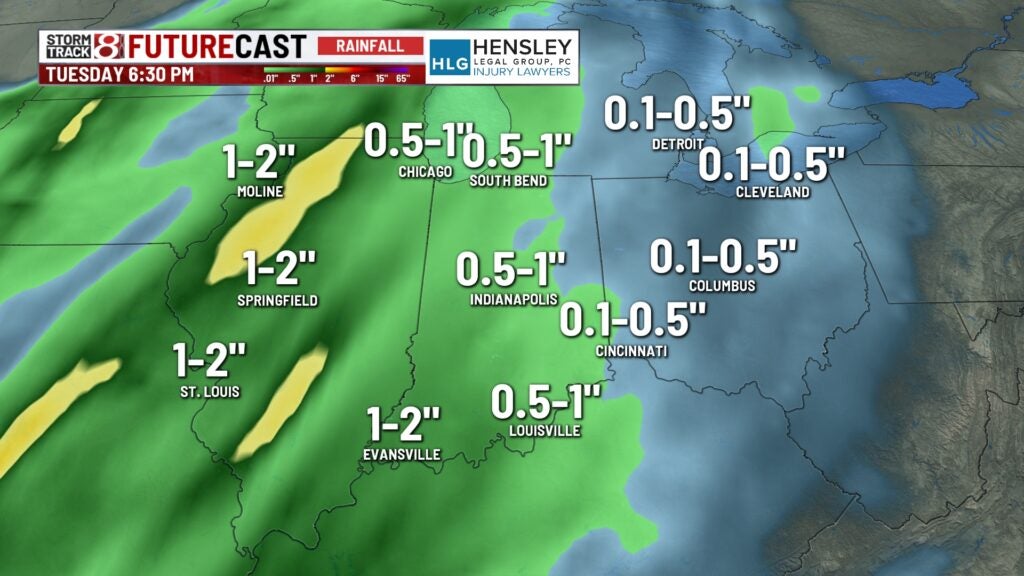
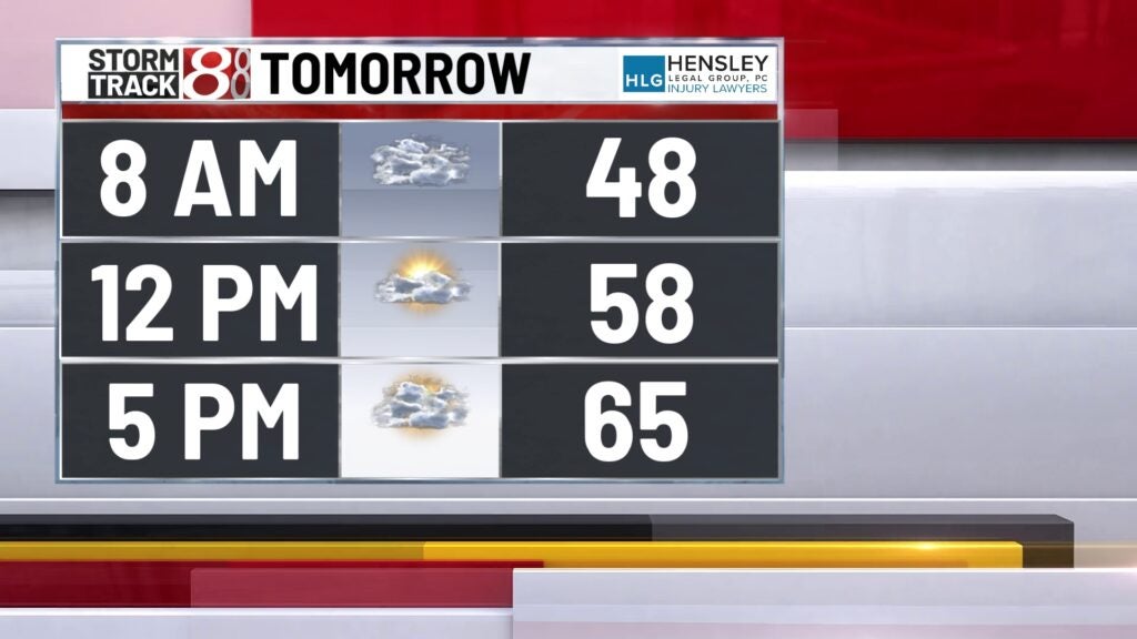
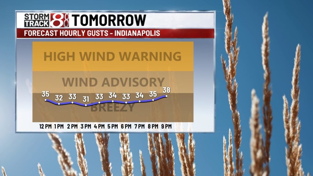
TOMORROW: Mostly cloudy and breezy. Wind gusts will climb to 30 to 40 mph later on in the day. Our next storm system will bring rain starting Monday night. Some rumbles of thunder will also be possible in this initial line. High temperatures in the mid-60s.
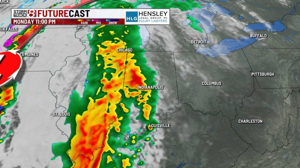
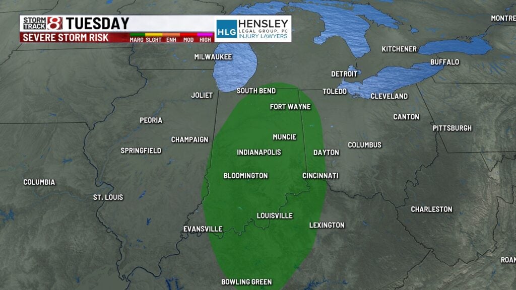
8-DAY FORECAST: Rain/storms will linger into Tuesday before the cold front fully crosses Indiana. A marginal (1/5) risk of severe weather has been added for Tuesday as storms may redevelop along the front. Quiet conditions then move in for Wednesday into the end of the week. Highs will be back into the 60s late week.