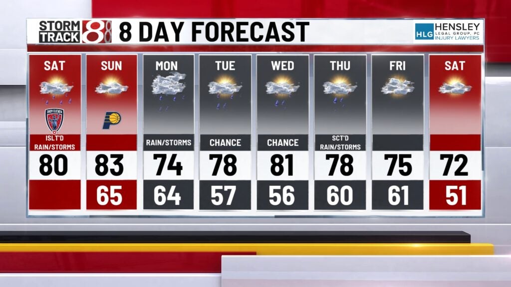
Warm last weekend of April, additional rain chances on the way
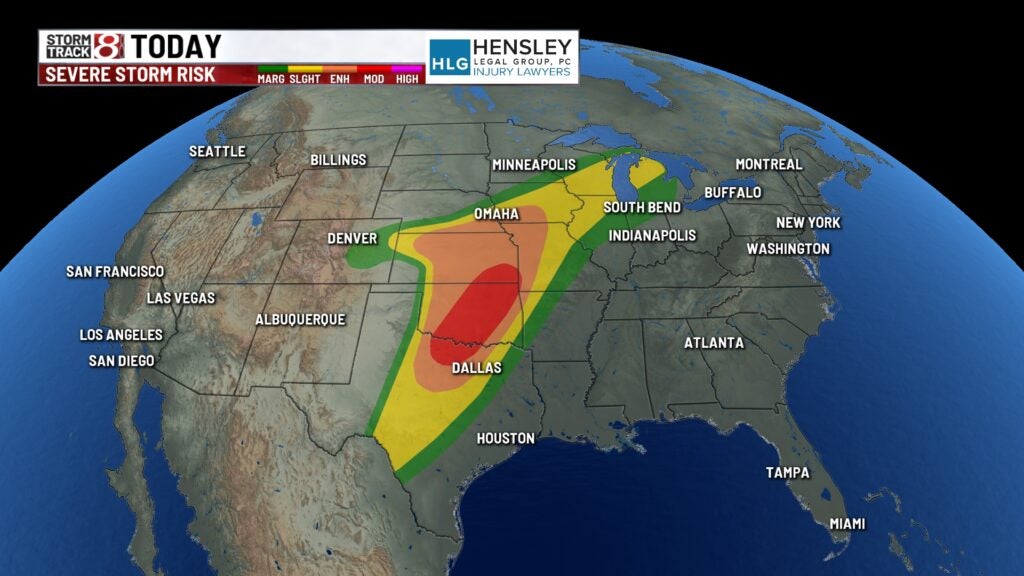
INDIANAPOLIS (WISH) — A strong system in the middle of the country continues to bring severe weather chances this weekend into early next week in those areas. For us in Indiana, this system will drive warm air for the last weekend of April.
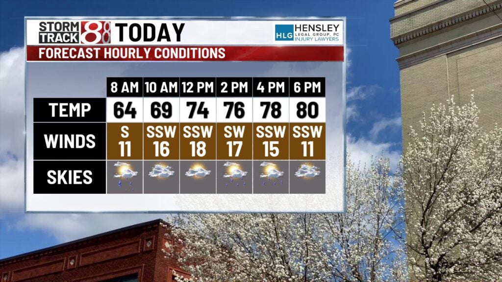
TODAY: Isolated showers and thunderstorms with a lot of dry time for Saturday. Mostly cloudy with wind gusts to 30 mph out of the south. High temperatures in the upper 70s and low 80s.
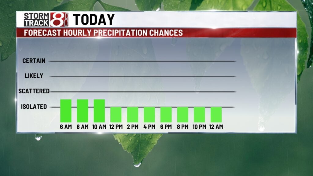
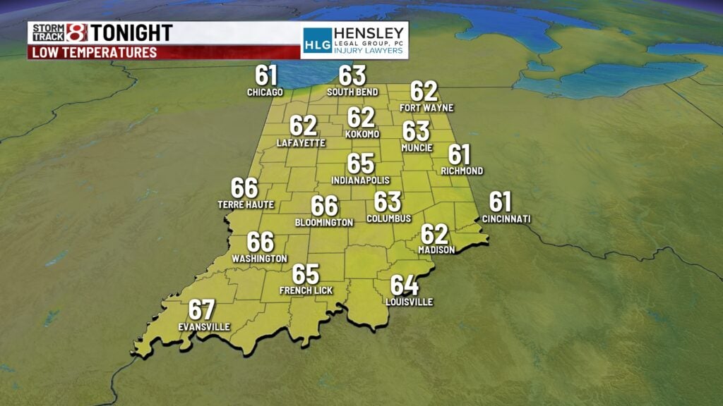
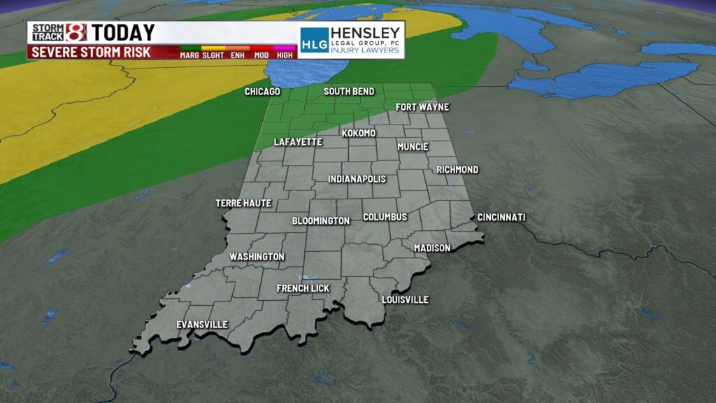
TONIGHT: Isolated chance of a thunderstorm north and early on. There is a marginal (1/5) risk of severe weather in place for northern Indiana during this time frame. Low temperatures in the mid to upper 60s.
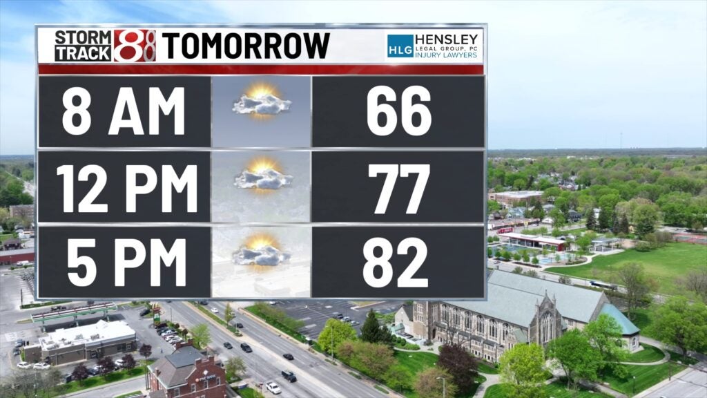
TOMORROW: Partly cloudy with wind gusts up to 30 mph. A few showers and storms will arrive Sunday night, but the daytime hours should remain dry. High temperatures in the low to mid-80s.
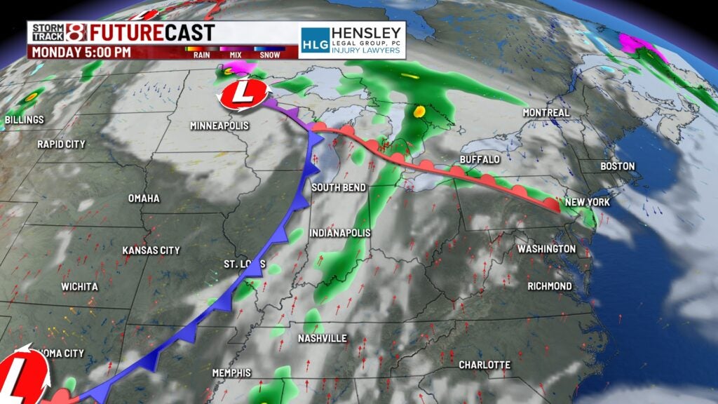
8-DAY FORECAST: Right now, Indiana is not under any major risk of severe weather even as the next strong system nears the state. Our best rain chance will impact us on Monday when the cold front finally arrives in Indiana. Behind this system, temperatures will still remain above average mid to late week with more small rain chances on the way.