


Tracking rain/snow mix by Sunday, stronger system rolls in next week
INDIANAPOLIS (WISH) — We endured a brisk end to the workweek as temperatures struggled to get into the mid 30s with breezy winds. Chilly air will hang with us this weekend with snow chances in play for Sunday. Then, a potentially significant system will make its move towards us next week.
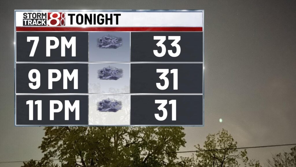
Friday night: It will be fairly chilly for tonight as temperatures fall into the mid 20s under mostly cloudy skies. Even though winds will become light, wind chill values will still sit in the upper teens to low 20s.

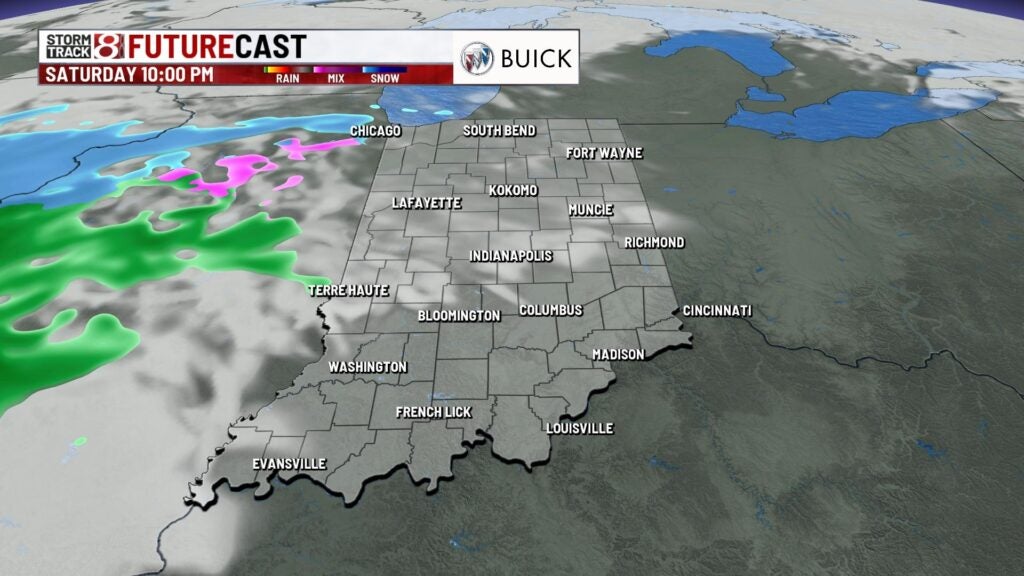
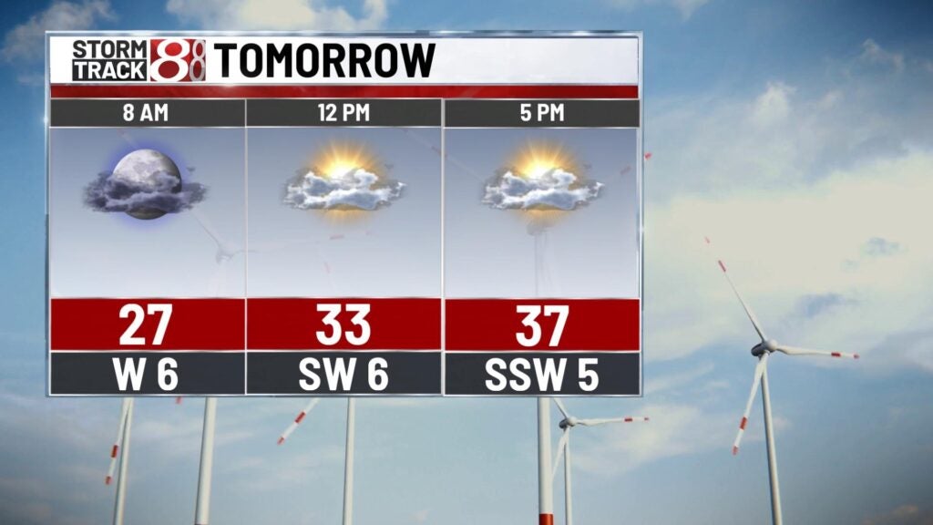
Saturday: We’ll wake up to some sunshine to begin our Saturday, but cloud cover will build back in during the latter half of the day. This will precede the development of a wintry mix that will start moving in by the overnight hours into early Sunday.

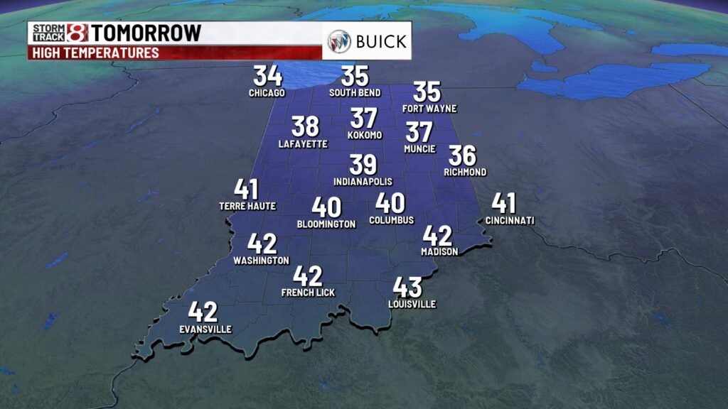
Near to slightly above normal high temperatures are in line for Saturday with numbers in the upper 30s.
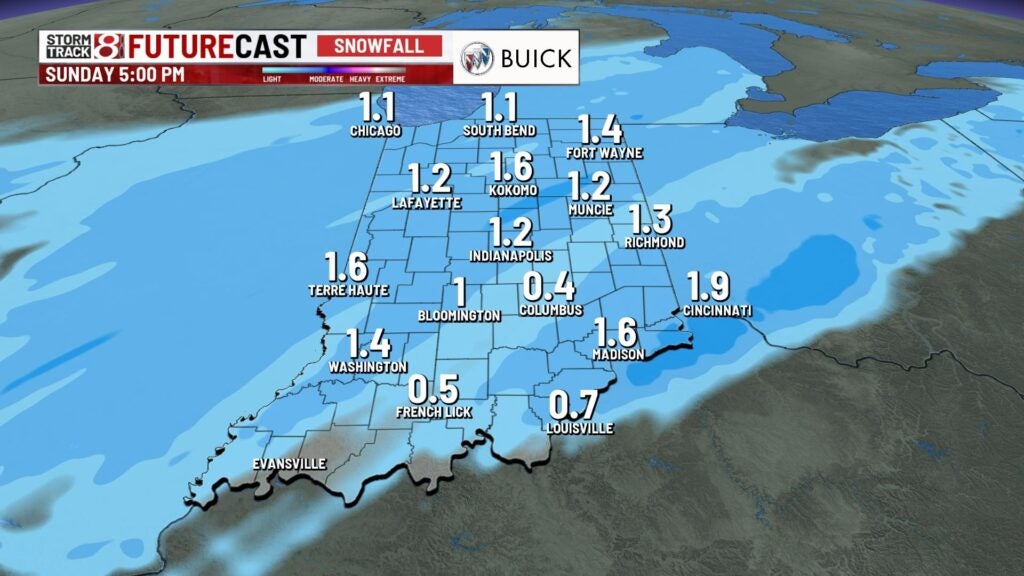
Sunday: Snow looks to become the main precip type for much of central Indiana by daybreak Sunday. This will continue until late Sunday morning as mixed precip enters back into the picture. The bulk of the activity will exit the state by the afternoon hours, but isolated to scattered rain/mix will remain possible until mainly sunset.


At this time, snow accumulation is shaping up to be on the light side with 0.5 to 1.5 inches possible. Locally higher snow amounts are possible.
Highs look to only top out in the mid 30s.

8-Day Forecast: We’ll briefly dry out to start the new workweek on Monday with highs in the upper 30s. Quiet weather won’t stick around long as we monitor a stronger system that will slide into our area by late Tuesday into Wednesday. This system will bring another chance for rain and snow. System track, timing, and potential snow accumulation is yet to be determined, but you will want to stay tuned to the forecast as we draw closer to Wednesday. By the second half of next week, we are confident that even colder air will sink into the state.
