


Over a 95% chance of El Niño this winter. What does that mean for Indiana?
INDIANAPOLIS (WISH) — The National Oceanic and Atmospheric Administration’s Climate Prediction Center is anticipating El Niño to remain in place this winter.
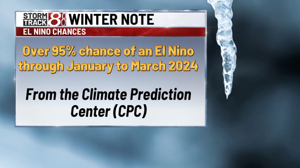
The center has forecasted over a 95% chance of an El Niño from January through March. Next year will be the first time an El Niño pattern will be present during the winter months — December to February — since the 2018-2019 season, which was a fairly weak El Niño.
What is an El Niño?
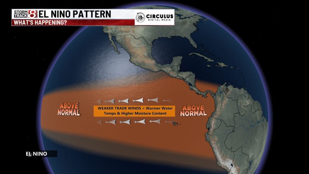
El Niño and La Niña are phases in the El Niño-Southern Oscillation (ENSO) climate pattern. During an El Niño phase, warmer-than-average temperatures set up off the western South American coastline due to weak trade winds. This acts as a domino effect for the jet stream through much of the Pacific region.
What this could mean for Indiana’s winter?
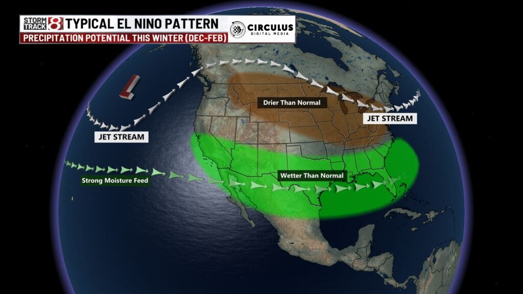
In a typical El Niño pattern, the moisture feed coming off of the Pacific Ocean tends to shift further south than its neutral position. Drier-than-average conditions are usually set up in the Midwest including Indiana.
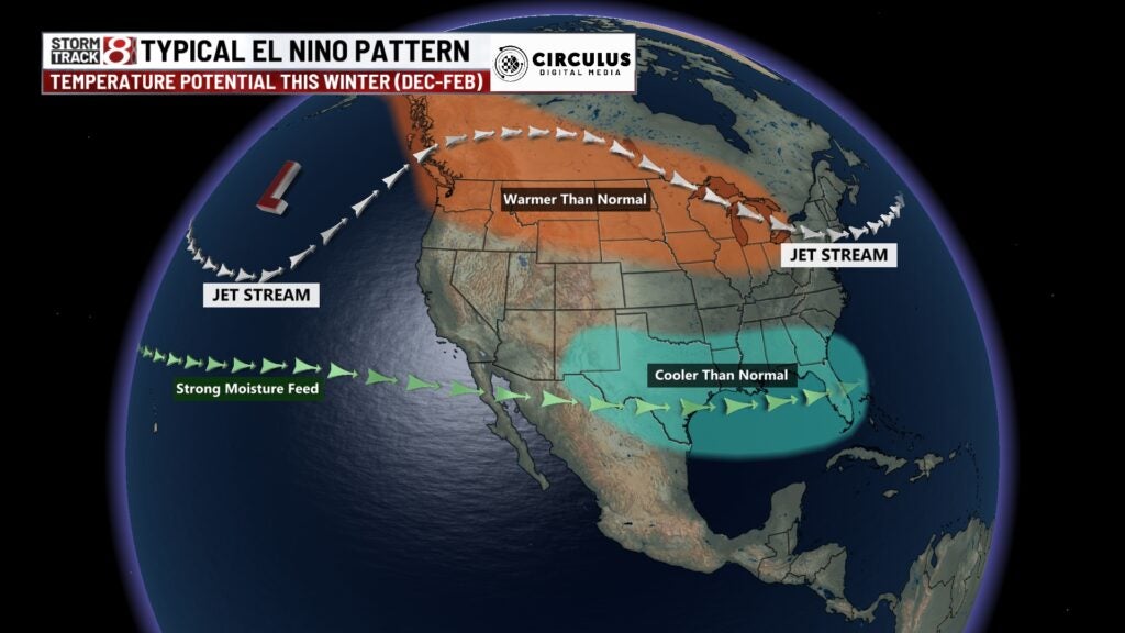
With regards to temperatures, above-average temperatures usually straddle the northern United States, while spots in the southeast remain cooler than normal.
Remember, this is just a guide, general outlooks and past patterns could be different on the local level.
Eight of the last 10 winters in central Indiana have produced below-normal snowfall, and 21.2 inches is the December to February average.
In the winter of 2022-2023, central Indiana finished with below-average snowfall and above-normal temperatures.
NOAA’s official winter outlook is released sometime in mid-October. Stay tuned to see if its prediction is in line with what a typical El Niño pattern produces in the U.S.
In August, the Old Farmer’s Almanac called for a “cold, snowy” winter in Indiana. Meanwhile, its counterpart, the Farmers’ Almanac, predicted a “cold, stormy” winter for our area.