


September weather stats and history in Indiana
INDIANAPOLIS (WISH) — September in Indiana is known as the transition month towards the fall season. This transition can feature some particularly interesting weather trends and events. Let’s dive into what this month is supposed to be like and the history behind it.
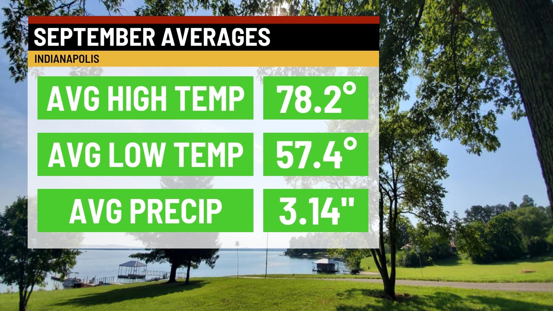
The month of September on average is typically on the warmer side, but not too hot like July and August. Here in Indianapolis, we start the month with average highs in the low 80s. Then, the average tumbles down to the low 70s by Sept. 30th. For the overall month, the average high across the board is 78.2°. We also begin to work in more cooler and comfortable fall-like nights. One important thing to note that will be revisited later is the average rainfall is just over three inches, thus marking it one of the less active months in the year.

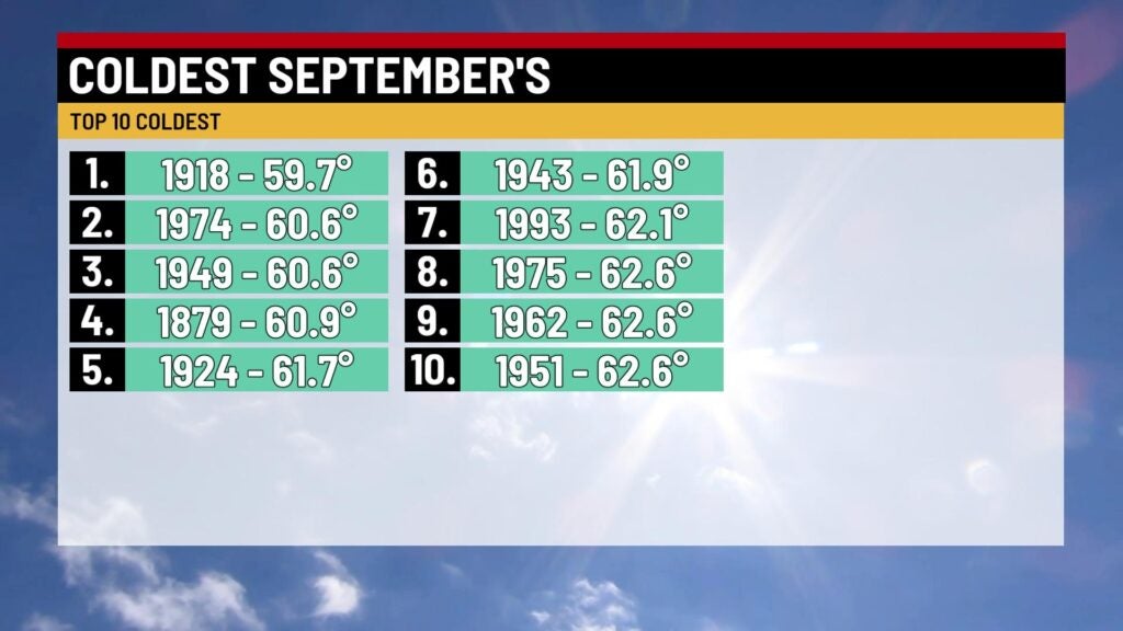
Let’s move forward towards Septembers that have been nowhere close to normal. There have only been two Septembers in the last 15 years to crack the top 10 warmest list (2019, 2007). Interestingly enough, 2019 not only featured the warmest September on record based on average general temperature, but it also became the third driest on record. To further note, Indianapolis’s record high for September is 100°. You want to take about a cold September? Well, that conversation hasn’t been needed in quite a while. The last time this month was featured in a top 10 coldest list was back in 1993 at number seven. Although this month is usually not as wet as others, there have been several instances that featured very active conditions. As mentioned in last Friday’s web weather story, 2003 showcased the wettest September on record. This month has also seen significant dry periods with five of the top ten driest on record occurring in the last 25 years (1998, 2007, 2010, 2017, 2020). September 2020 was so dry that it became tied for the fourth driest overall month of all-time.


September can also feature some intense weather and abnormal temperatures. Sept. 1, 2003 features Indianapolis’s wettest day on record with 7.20″ of rain, and the old record was set on Sept. 4, 1895 with 6.80″ of rain. On Sept. 12, 1988, an F1 tornado skipped along a 35-mile path from Indianapolis to Anderson and caused damage to businesses. A rarity occurred on Sept. 18, 1972 in Dover, IN (Dearborn county) when baseball sized hail fell, and we rarely see this kind of hail in this state. In 1983, Indy hit its 58th 90° day of the year on Sept. 19, which marked the most amount of 90s in a single year. Another bewildering rarity took place on Sept. 20, 2002 when the second longest tracked tornado (rated F3) in Indiana history cuts a 112 mile path from Ellettsville to Hartford City. Other cities that were impacted by this tornado included Martinsville, Indianapolis, and Anderson. The final day of September in 1899 featured the earliest freeze on record in Indy with a low of 30°.
That is just a few of many notable events that have happened in September. Although this month marks the move towards more refreshing weather with fall, there can be rocky weather scenarios that play out along the way.