


Warmer weekend temperatures
INDIANAPOLIS (WISH) — Our brief shot of arctic air is moving out, with milder temperatures moving in for the weekend and beyond.
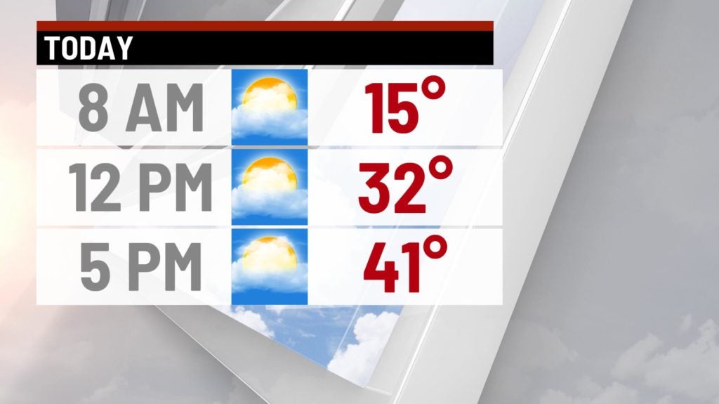
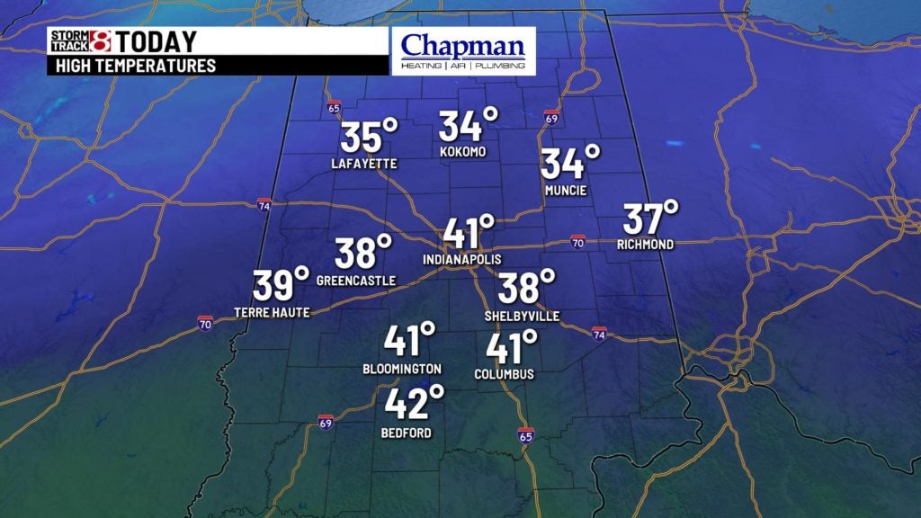
Today:
Another very cold start for the morning, but patience will pay off by this afternoon. Expect a gradual increase in cloud cover through the day. Temperatures should top out in the upper 30s and lower 40s.

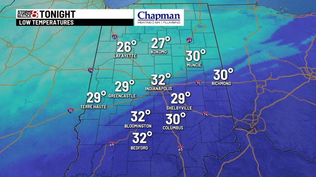
Tonight:
A very low chance for some of our northern counties to see a quick shot of light snow through the mid evening hours. Any accumulations will be light (if any).
The rest of the overnight is quiet, cloudy and not as frigid. Lows should hold in the lower 30s through daybreak Sunday.

Sunday:
Clouds early should make way for sunshine later in the day. Temperatures should warm a few degrees warmer, with afternoon highs in the lower to middle 40s.


Rain returns:
Very mild air moves in for Presidents Day, with highs surging to the 50s. Large system moves in Monday afternoon, bringing widespread rain to the area for the second half of the day, and likely carrying over into Tuesday morning. Around 1/4″ to 1/2″ of rain is possible for this period.

8 day forecast:
Canadian high pressure moves in for the second half of the week, sending our temperatures back down to the 20s and 30s for Wednesday and Thursday, before temperatures moderate heading into the next weekend.
