


Warmer end to the week, rain chances possible this weekend
INDIANAPOLIS (WISH) — Temperatures could reach the 80s as early as the weekend.
This morning:
The frost advisory remains in effect this morning for the northern third of the state. Temperatures fall into the low to mid-30s, allowing for some patchy frost to develop.


Skies are mainly clear across most of central Indiana, with a few areas of light fog in the east-central portions of the state.

Thursday:
High pressure settles, allowing for lots of sunshine today. The temperature is still cooler than average. Will have the highest topping out in the upper 50s to around 60°.


Thursday night:
Overnight temperatures will remain slightly below average, but not nearly as chilly. Frost should not be an issue overnight, with Lows dipping down to the mid-40s.

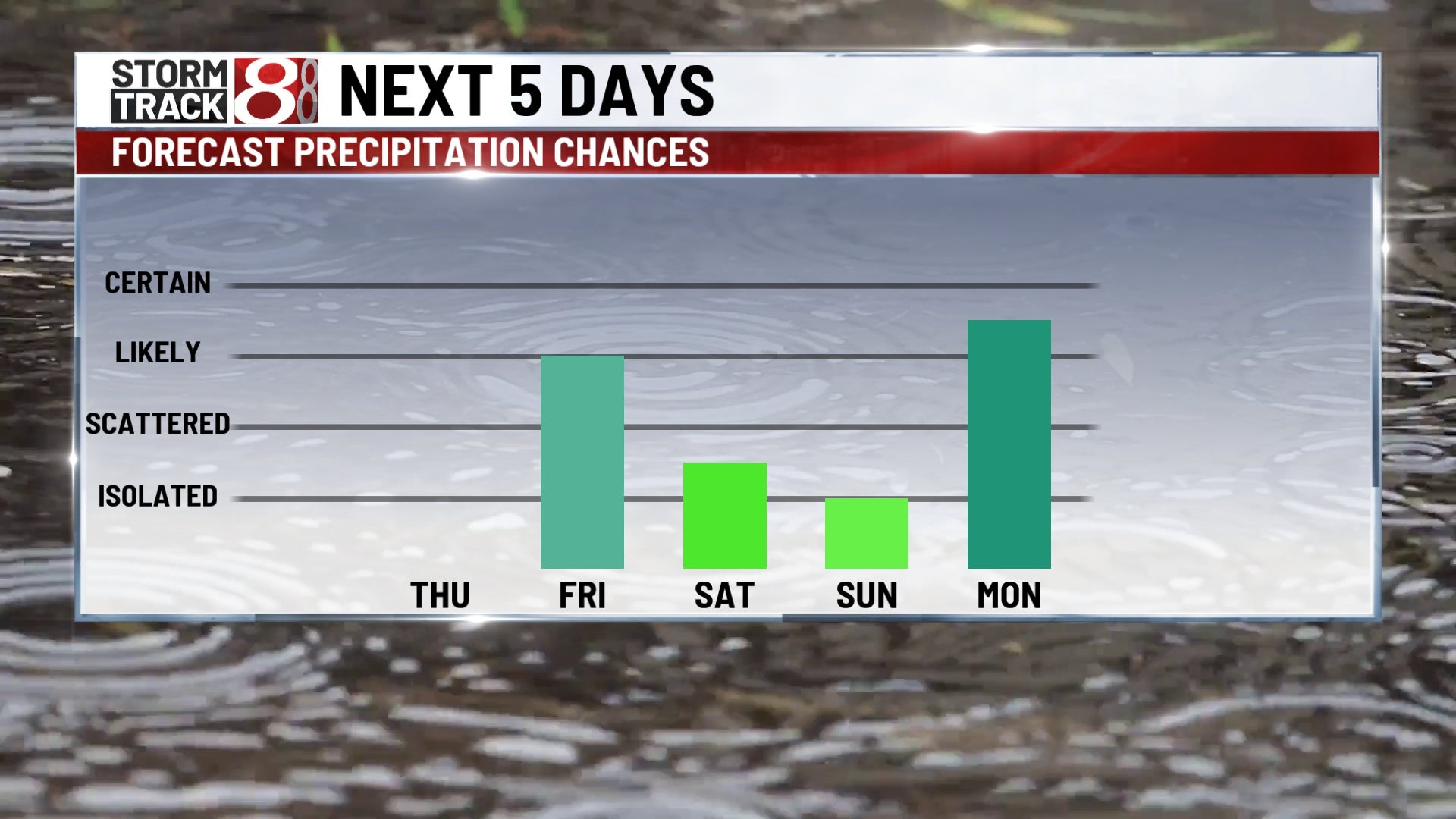
Friday:
A warm front will move through the region on Friday. This will spark scattered showers and thunderstorms to develop in the mid- and late-afternoon hours.

Highs top out in the mid-60s for Friday afternoon.


Weekend:
A few areas of convection will be possible to kick off the weekend on Saturday, specifically in the morning hours. A lot of the afternoon looks dry and very warm, with a high temperature close to 80°.

Warm and human conditions on Sunday could lead to a few scattered showers and thunderstorms, specifically later in the day and evening. There is also a chance that a few strong storms will develop, which we will keep an eye on.

8 day forecast:
The extended forecast looks pretty warm, with highs in the mid-70s as we kick off the week. Showers and storms are likely for Monday, and there is a chance of possible upper 70s with dry weather as we open up the month of May by midweek.
