Much colder temperatures, wintry mix possible Saturday
INDIANAPOLIS (WISH) — We’re back to the 30s and 40s across much of the region, with a mixed bag of rain and snow to open the weekend.
Today:
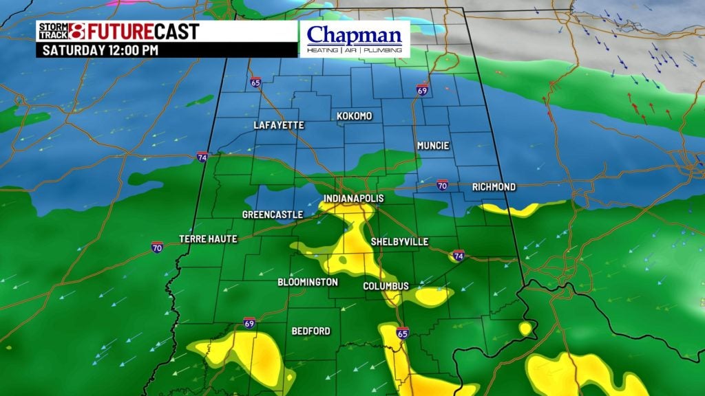
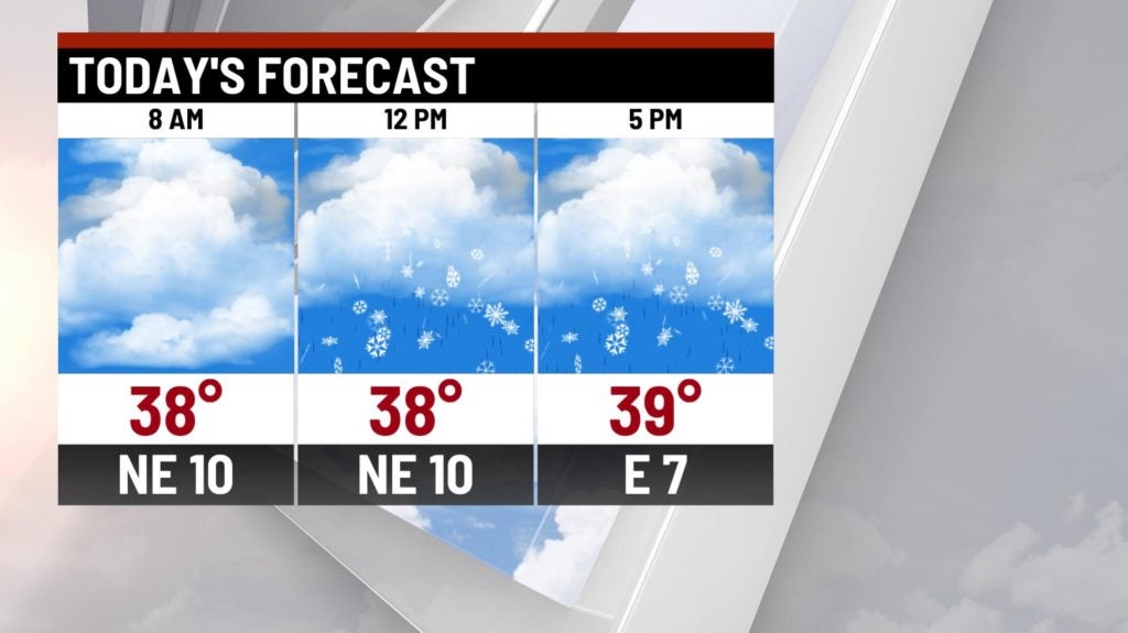
Strong upper level system moves through the Midwest today. We’ll start to see precipitation moving in by mid-to-late morning. While temperatures in the upper levels will be cold enough for snow, we should be a bit warmer near the surface, leaving us with a mix of rain and snow through much of the day. Combine that with well above freezing surface temperatures, accumulations will be minor and mostly confined to grassy areas through the day.


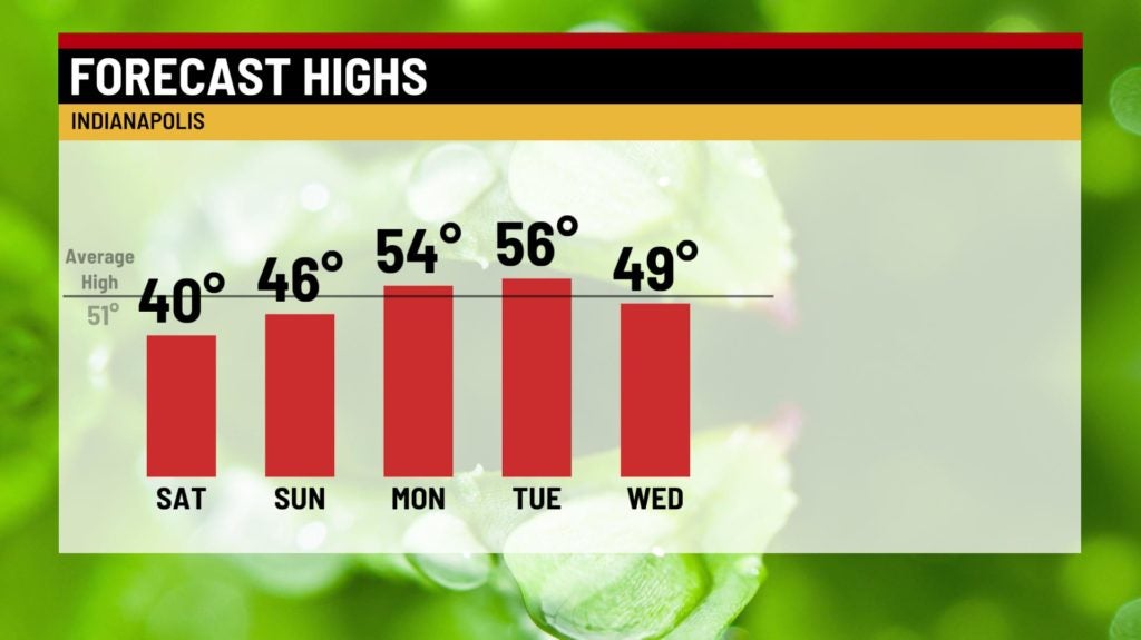
Highs top out in the upper 30s and lower 40s.
Tonight:
Precipitation will slowly pull away from the region late tonight into the early overnight hours. Clouds should slowly break up during the overnight hours. Lows fall to the upper 20s and lower 30s.


Sunday:
Quiet and cool weather to wrap up the weekend. Expect mostly sunny to partly cloudy skies. Highs hit the middle 40s.

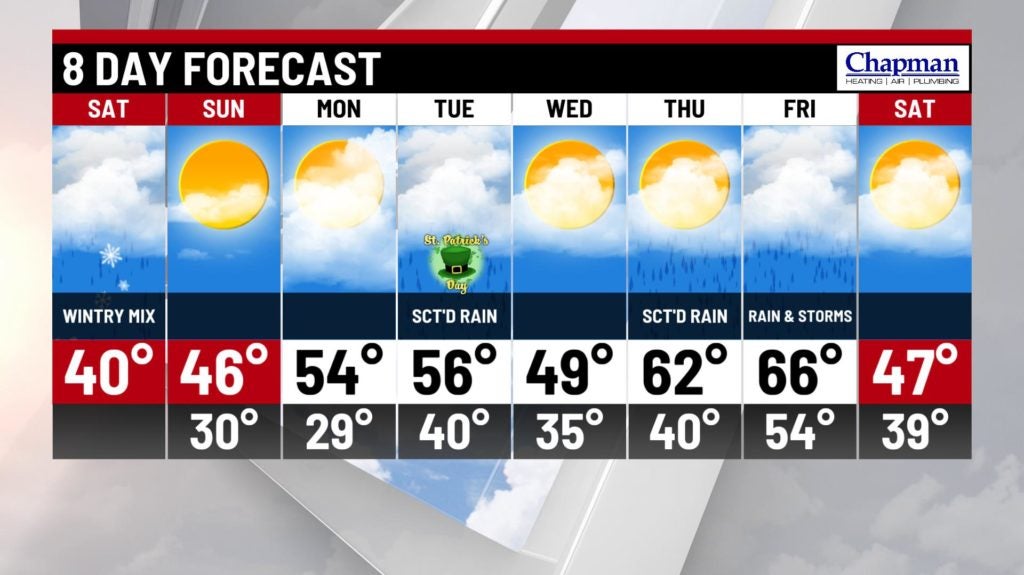
8 day forecast:
Milder temperatures return to open the work week, as highs hit the 50s Monday and Tuesday. Cold front swinging through on Tuesday sparks showers in parts of the area. Colder temperatures briefly move in for Wednesday. Big warm up on tap with showers returning Thursday and highs move into the 60s. Some thunderstorms will be possible for Friday.