


Active end to the week
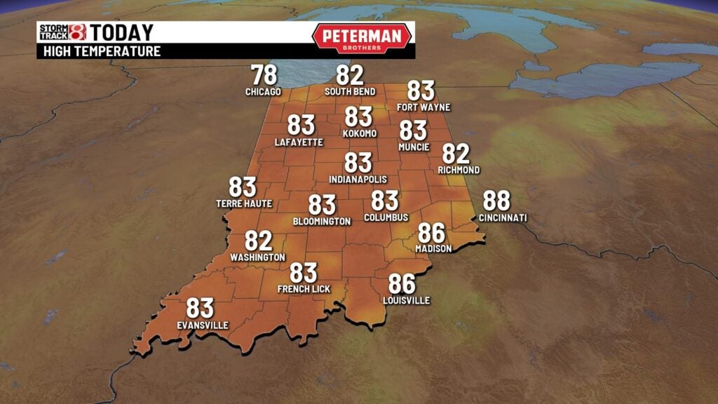
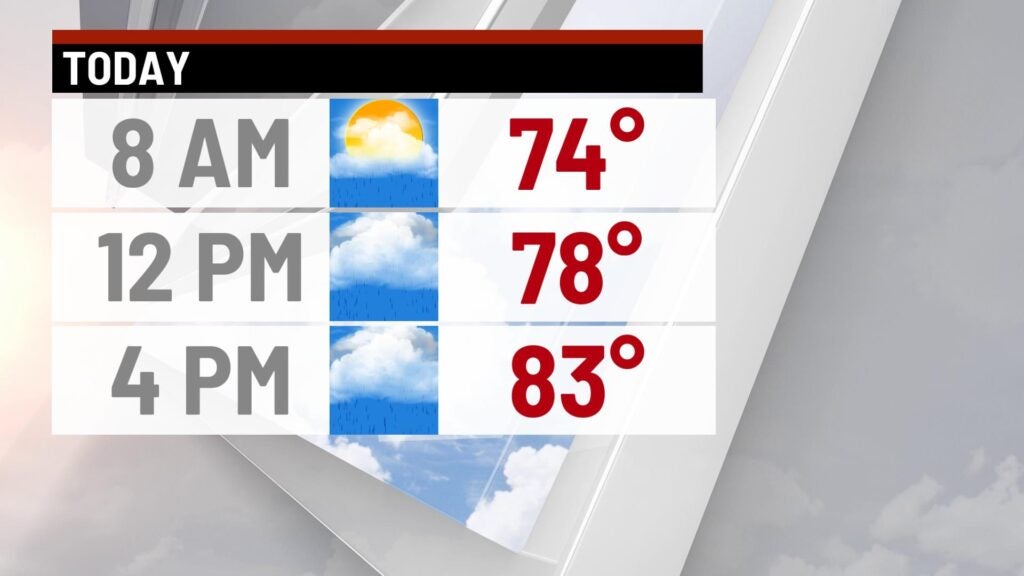
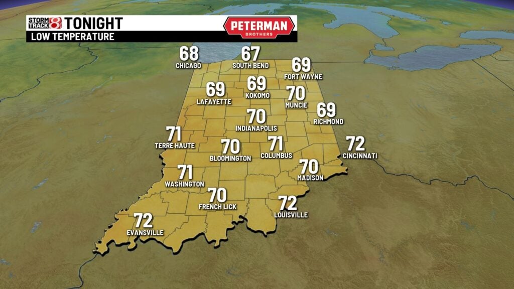
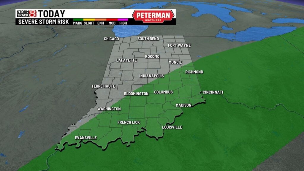
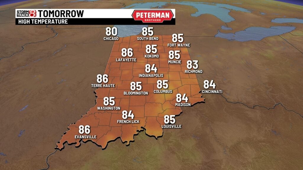
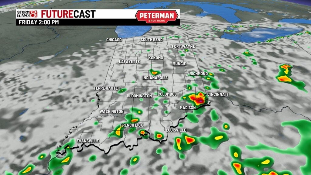
A few light showers around this morning especially NW of the city. This is associated with a slow moving cold front that will continue to sag to SE and will generate the shower and storm chance through the day. We have a marginal risk SE of the city today with gusty winds as the main therat. Highs will be running cooler today with most spots in the lower 80s. Rain chances will continue over night with lows in the lower 70s. Should be a seasonal but active end to the week with highs in the mid 80s Friday with scattered shower and storm chances.


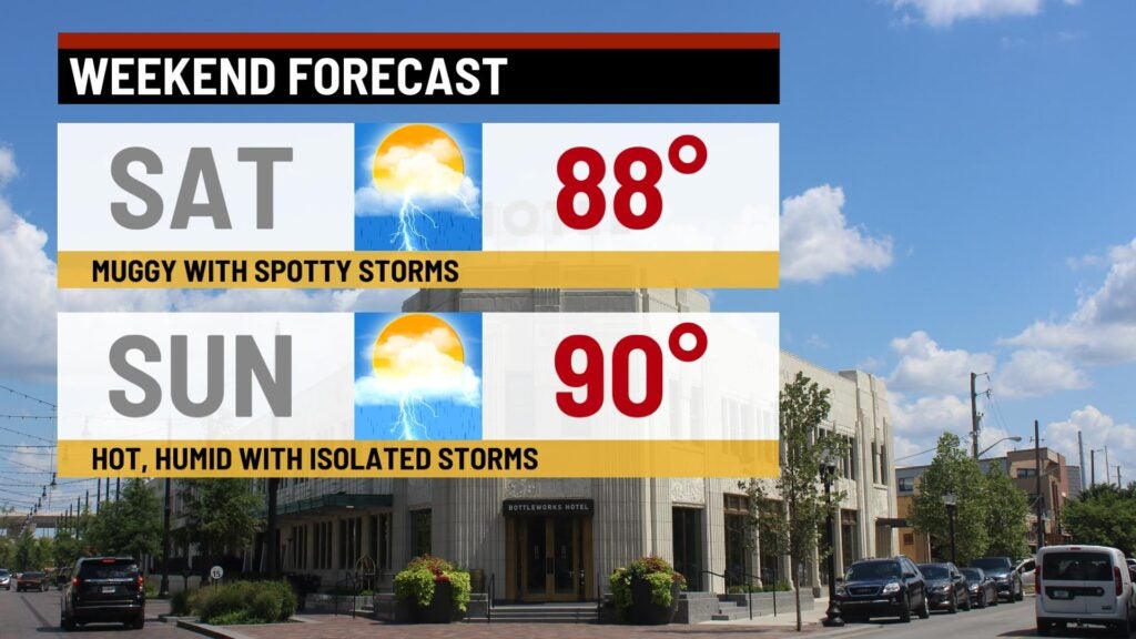
A toasty weekend will be ahead of us with highs warming to the upper 80s to near 90° both Saturday and Sunday with spotty rain and storm chances.
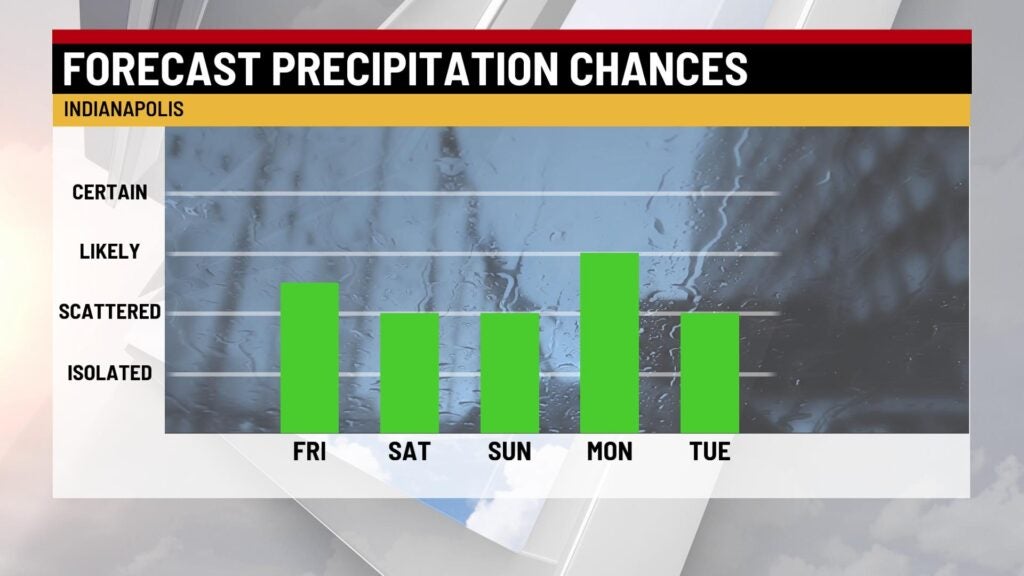
Unsettled weather will continue through early next week with rain and storm chances Monday and Tuesday with highs in the mid 80s. Mid week we’ll begin to quiet down with highs holding in the mid 80s.
