Active Thursday
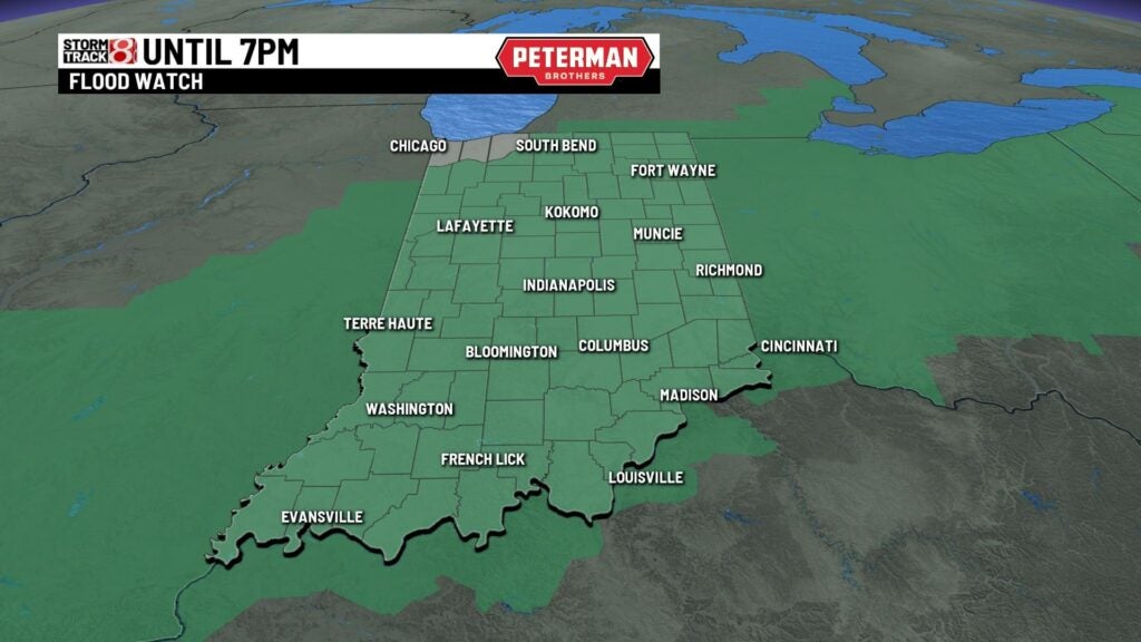
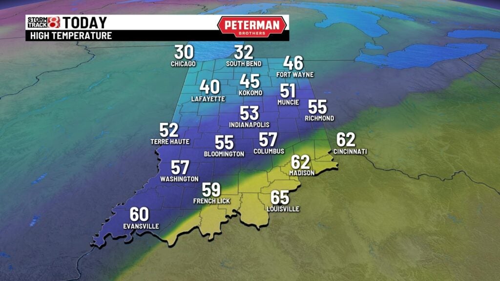
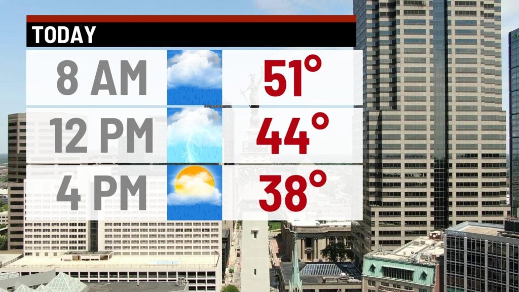
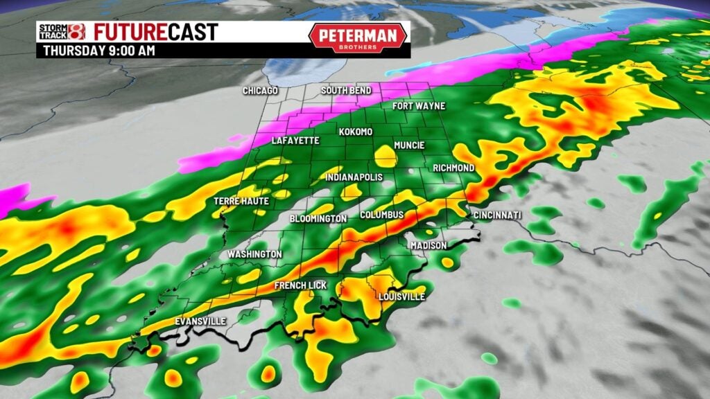
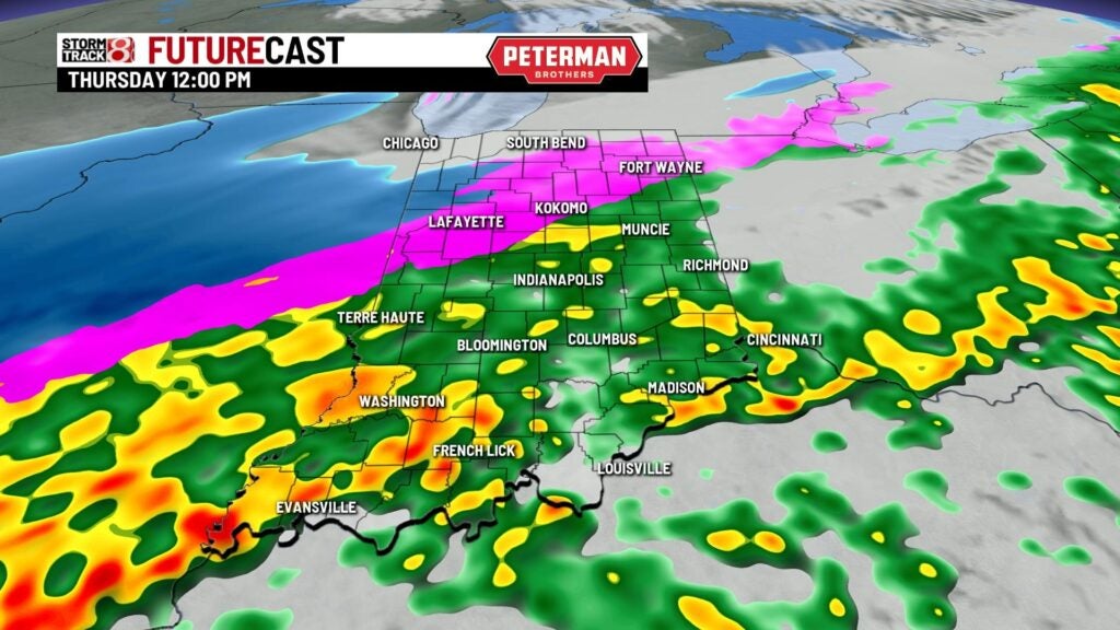
INDIANAPOLIS (WISH) — Very wet and warm start to the morning with temperatures in the lower 50s with widespread showers to start the morning drive. Rain will stick around through the morning and the early half of the afternoon with temperatures falling through the 40s through the day. We’ll have a second wave of precipitation move in which will also usher in some much colder air.
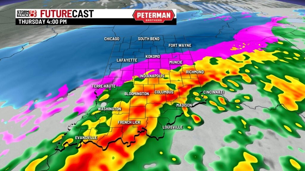
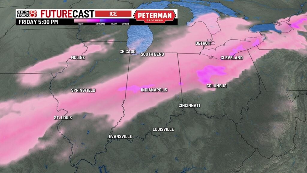
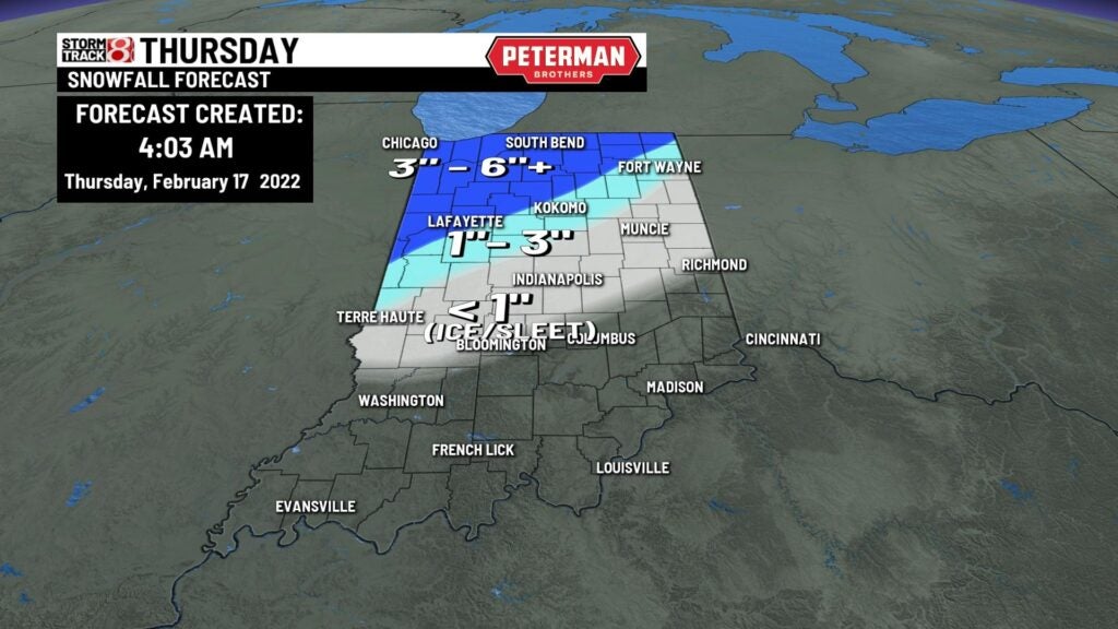
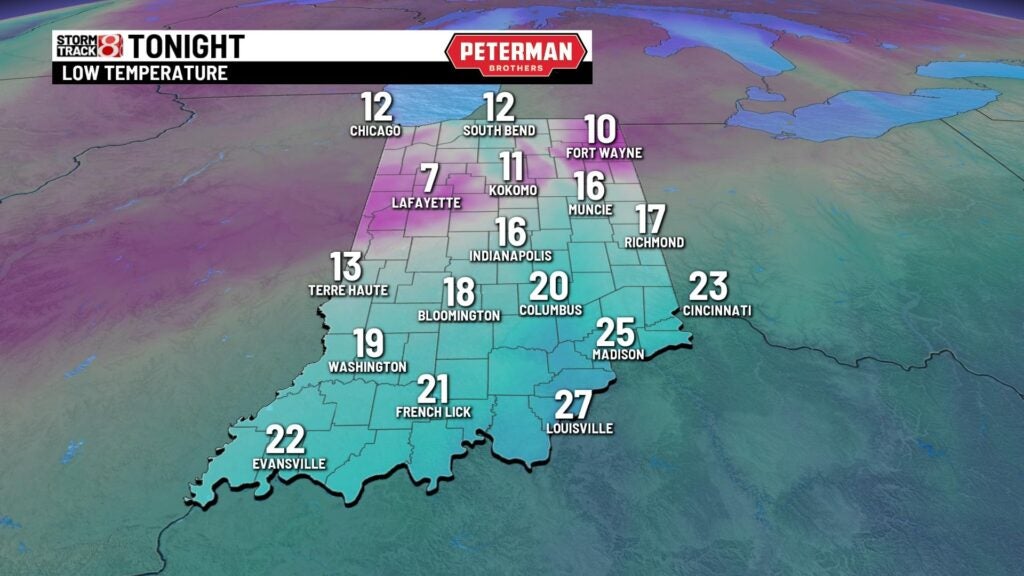
As temperatures continue to drop we will see a transition over to freezing rain and sleet creating slick spots in the evening drive. Areas of heavy snow in the northern third of the state. By the end of the day light snow will spread in and will be spotty in nature with light accumulation in the metro area with heavier amounts in northern Indiana. Temperatures overnight will fall to the mid teens.

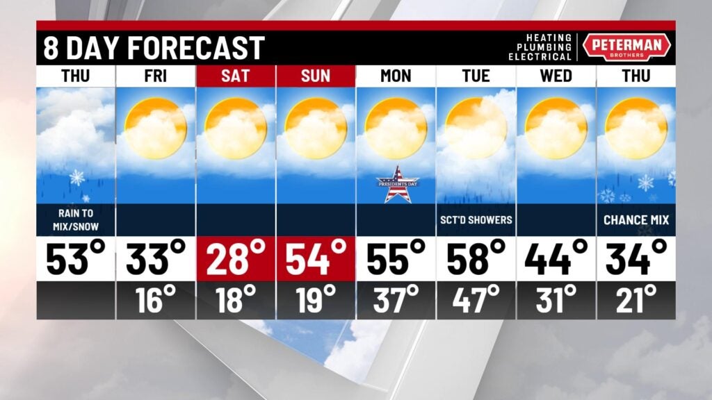
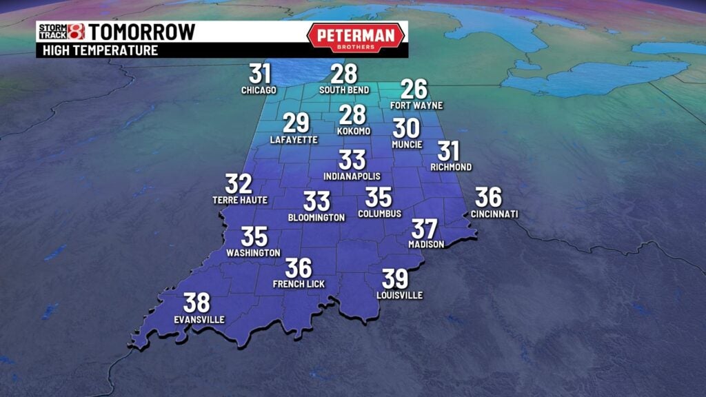
It’ll be a chilly end to the week with highs in the lower 30s with a mix of sun and clouds.
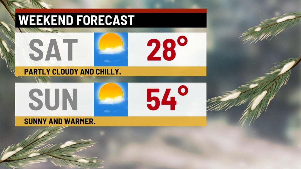
It’ll be a split weekend with highs Saturday in the upper 20s with mostly sunny skies. Highs will soar to lower to mid 50s with mostly sunny skies! It’ll be a warm and quiet start to the work week with highs in the upper 50s. Next chance of rain arrives Tuesday with highs in the lower to mid 50s. Temperatures will cool through the remainder of the week with highs in the 40s Wednesday then 30s with a light mix by the end of the week.