


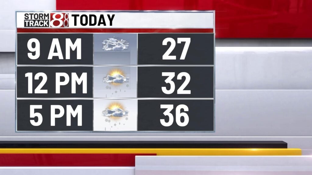
Cold start to the week
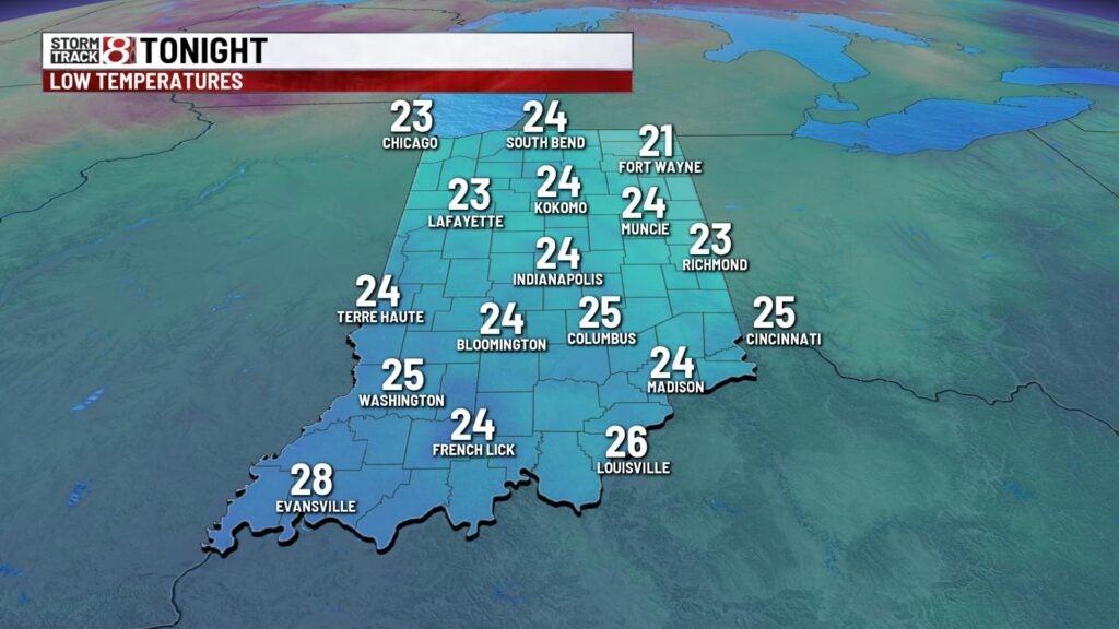
It’s a chilly start to the work week with temperatures in the lower 30s with feel like temperatures in the upper teens and lower 20s. Highs today will top out in the mid 30s. We’ll have a few light snow showers developing this afternoon with a few pockets of heavier snow developing during the evening. A quick inch at most could accumulate on grassy surfaces. Lows tonight will bottom out in the mid 20s.


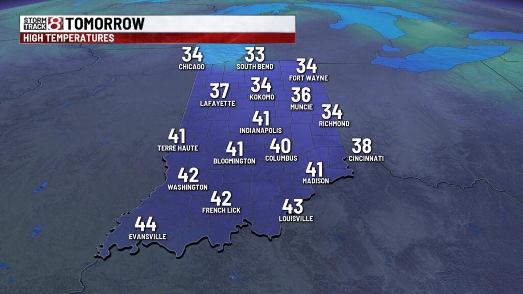
Tuesday will be a slightly warmer day with highs in the lower 40s. We’ll trend warmer through the middle part of the week with highs in the lower 50s Wednesday.

Rain chances return Thursday afternoon with highs flirting with 60°! St. Paddies day will be a mild one to start with temperatures in the mid 50s early. Rain, wind and snow will return durng the day with falling temperatures through the day.

Right behind the cold front temperatures will drop like a rock with highs on Saturday in the upper 30s. We’ll see a slight up tick in temperatures Sunday with highs in the lower 40s.
