David’s Sunday Evening Update
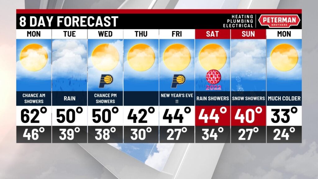
A changeable weather pattern settles in over the next several days. there will be some ups and downs in temperature but it stays above average all week. Also, a couple periods of rain in the forecast. The first area of mostly light showers moves in Sunday evening and continues overnight. Some heavier rain on Tuesday could cause some flooding problems.
Tonight – Off and on rain showers with mild temperatures. Low Monday morning 46.
Monday – A few showers possible in the morning but then drying out and really warming up again. High 62.
Tuesday – Still mild with a high of 50. There will be rain – heavy at times – that may cause some flooding problems into Tuesday night.
Some sunshine early in the day was replaced by cloudy skies Sunday afternoon.
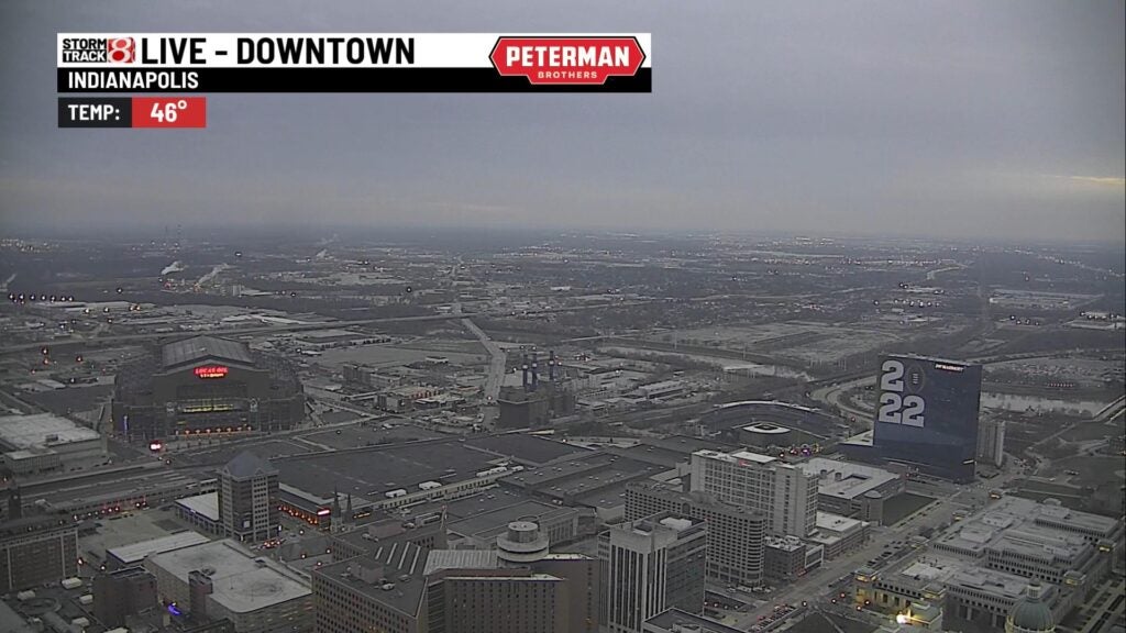
The clouds are in advance of some rain showers developing out west of us.

This evening those showers will start to move into Indiana.

By Monday morning, most of the rain should be gone.

Monday looks like another amazing and unseasonably warm day in the low 60s.

That 62 in Indy is more than 20 degrees above average for late December. The record for 12/27 is 68.

The next weather system come along Tuesday. Rain moves in early in the morning.
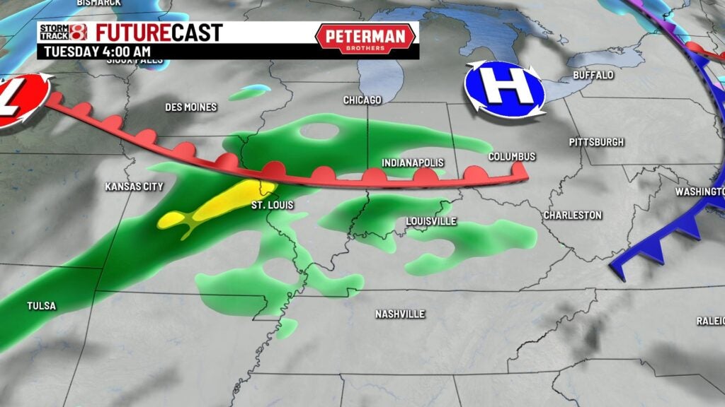
Several periods of rain, heavy at times could cause flooding problems Tuesday.

8 Day Outlook – Drying out for Wednesday Thursday and Friday. More showers for Saturday New Years Day. Temperatures cool off a bit to the 40s each day. But that is still a little above the average of highs in the upper 30s. A big change to typical winter weather is possible next Monday.