Gradual warm up this week
INDIANAPOLIS (WISH) — Our temperatures will slowly climb out of the freezer as we head into the middle of the week.
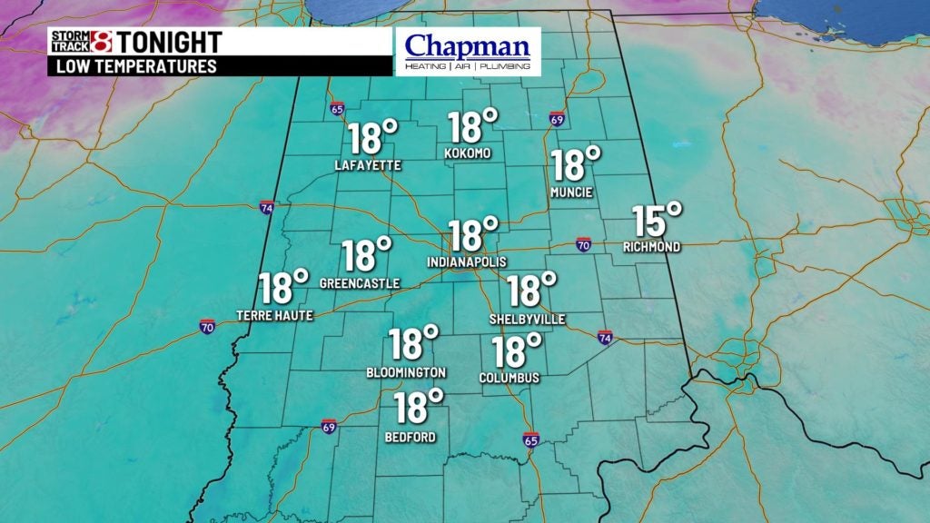
Tonight:
Upper level system will push south of our area, which should slowly decrease cloud cover across the area. This will make for a cold overnight, but with lighter winds, wind chills shouldn’t be as cold as the past few morning. Lows fall to the middle to upper teens.

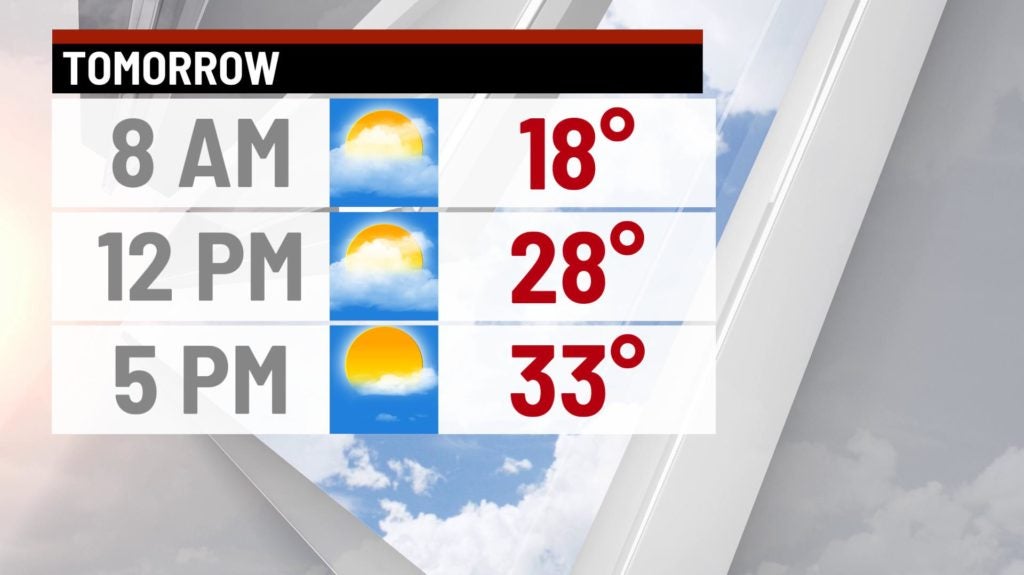
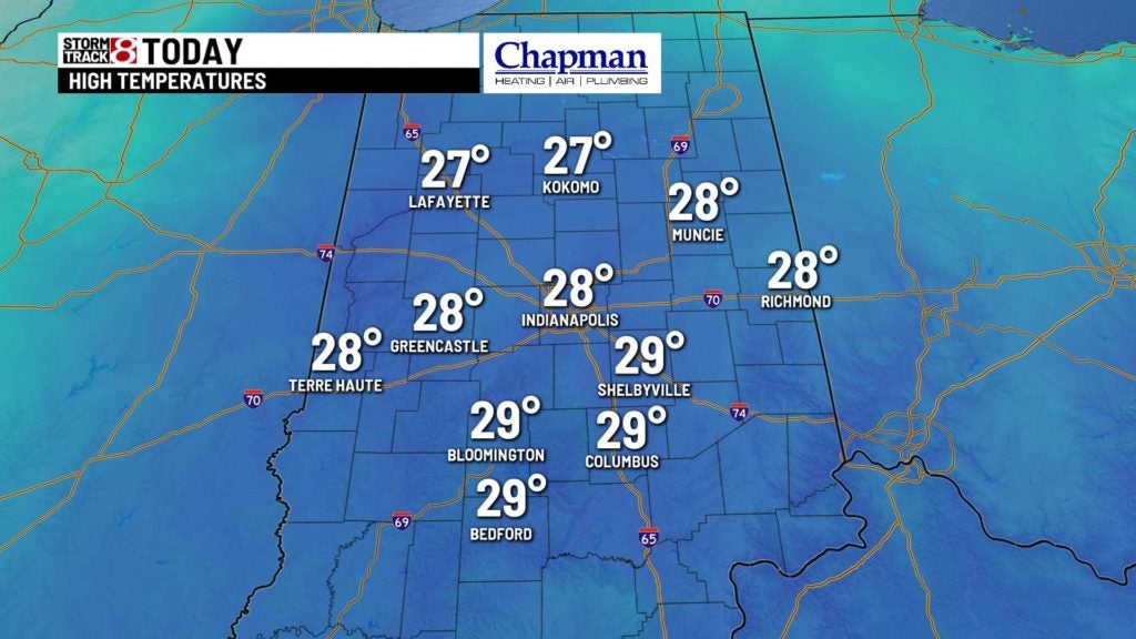
Tuesday:
A few clouds in the morning make way for a relatively clear and quiet day for much of the day. Temperatures should be a touch warmer than Monday, as highs should barely break the freezing mark.
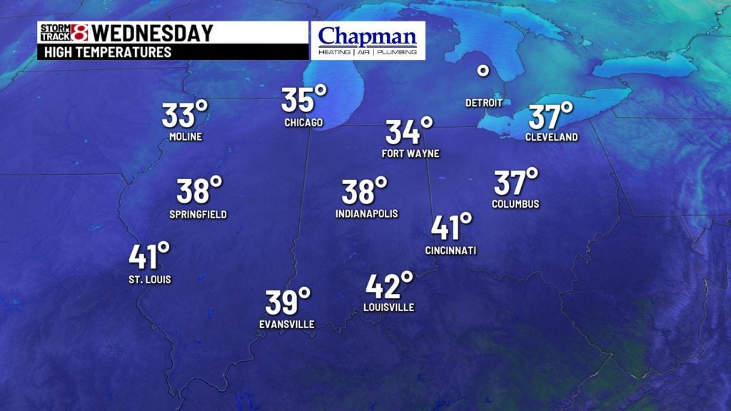
Wednesday:
An increase in cloud cover across the area – especially heading into the afternoon. Temperatures should return to the lower 40s.
End of the week/weekend system:
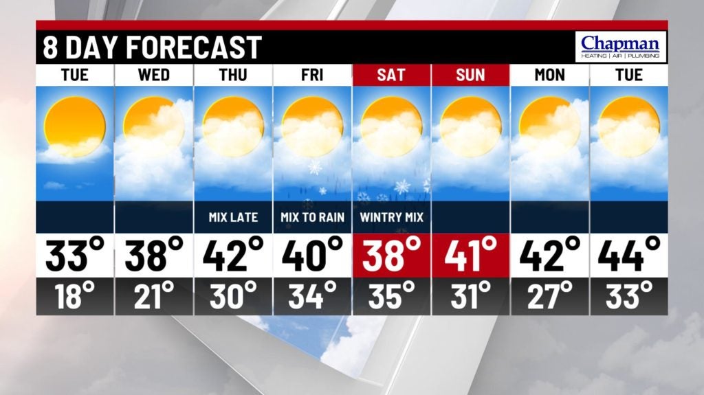
Another potent system takes aim on the Midwest starting as early as Thursday night, and should impact the state Friday into Saturday. Still some questions on exact track, which will play a role in precipitation type. For now, we’ll call for a wintry mix late Thursday, eventually changing over to rain on Friday, and back to a wintry mix Friday night into Saturday.

8 day forecast:
Overall pattern looks to remain above average for the end of the extended and beyond. The Climate Prediction Center (CPC) outlook for the 6-10 and 8-14 days call for above average temperatures through the beginning of February.