Hazy Tuesday morning, a few showers possible late
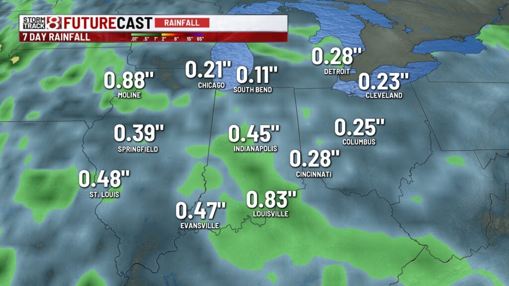
INDIANAPOLIS (WISH) — The dry pattern continues for much of the week, with only spotty light rain chances possible for parts of the state leading into Wednesday morning.
Tuesday:
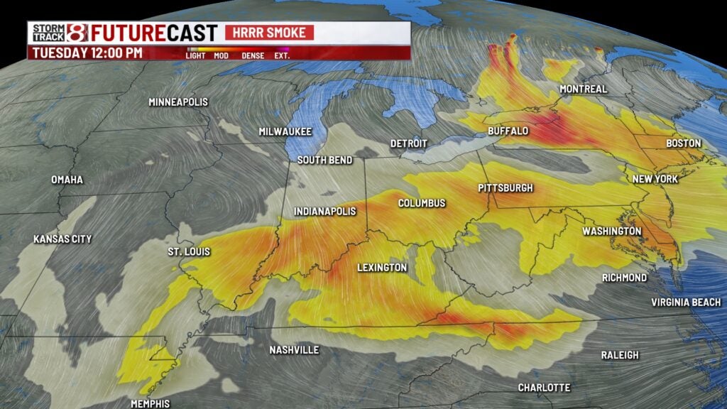
Wildfire smoke continues to hover overhead this morning, with a few stations around the state reporting some of that smoke has reached the surface. Expect a hazy look for much of the morning before winds shift this afternoon, which should push the overhead smoke south of the area.

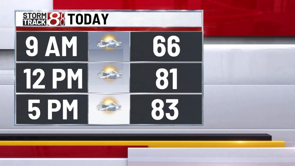
An approaching cold front will slowly move in from the north. Probably won’t have enough moisture or instability for any showers during the day, but clouds will likely increase later this afternoon.
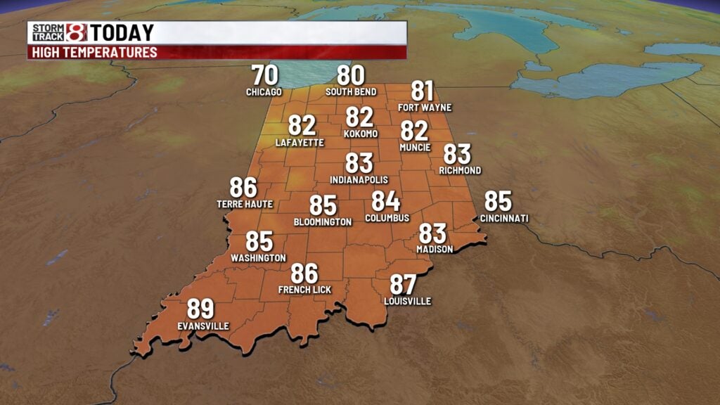
Highs top out in the lower/middle 80s.
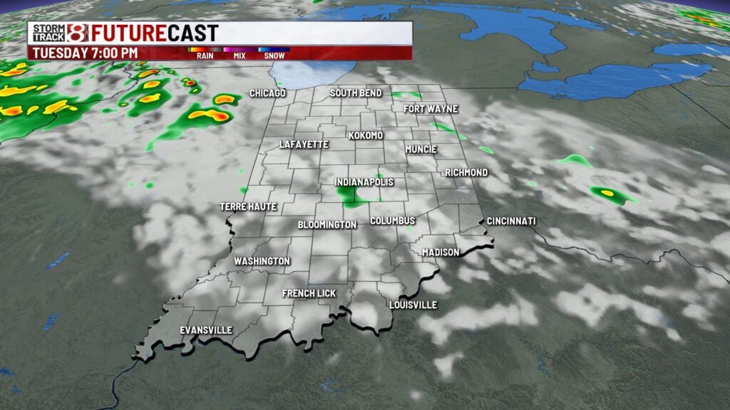
Tuesday night:
Previously mentioned front will push through the state, sparking a few showers across our area. Unfortunately, rain will be very light and spotty at best for the overnight hours.
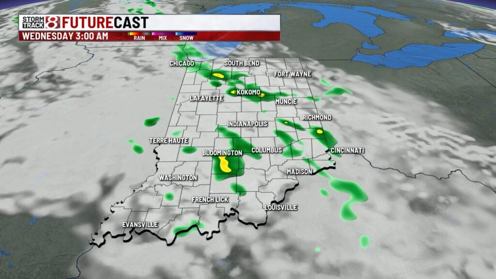
Lows fall to the lower 60s.
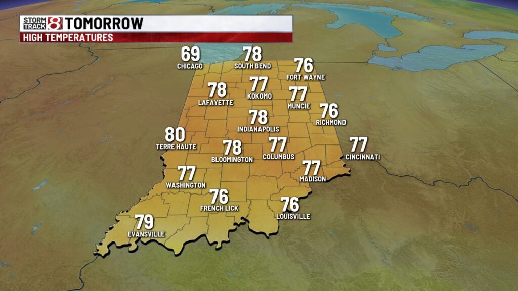
Wednesday:
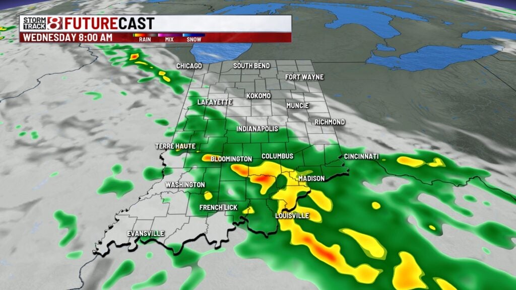
Some lingering showers will be around for the morning hours in the wake of the cold front moving through – mainly south of I-70.
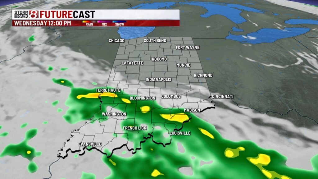
The rest of the day is dry and a bit cooler, with highs in the mid/upper 70s.
8 day forecast:
Quiet weather with gradually warming temperatures expected through Saturday. Still hopeful for our best chance for rain and storms in weeks by the end of this weekend. We could see showers as early as Saturday night, but looking more likely for Sunday.