


Heavy rain, flooding and gusty storms possible today
INDIANAPOLIS (WISH) — Another dose of heavy rain will agitate flooding concerns across much of the area Saturday.
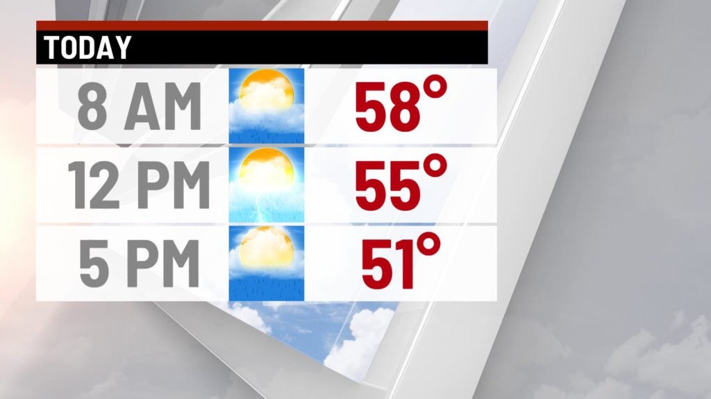
Saturday:
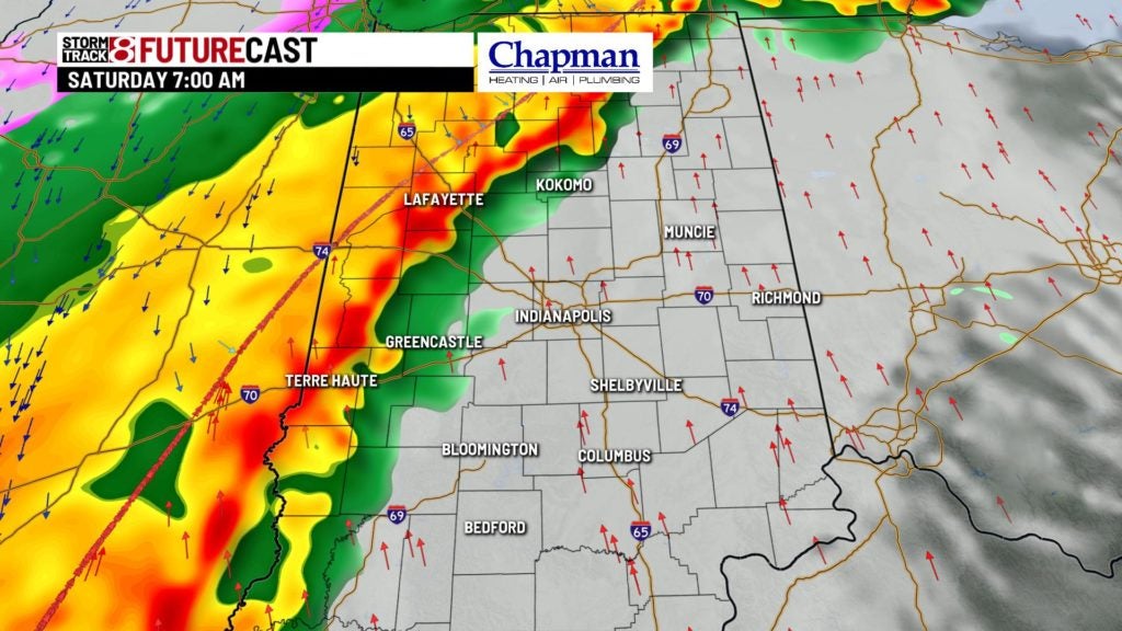
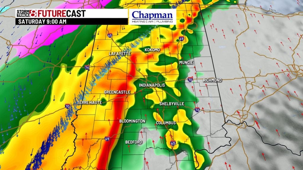
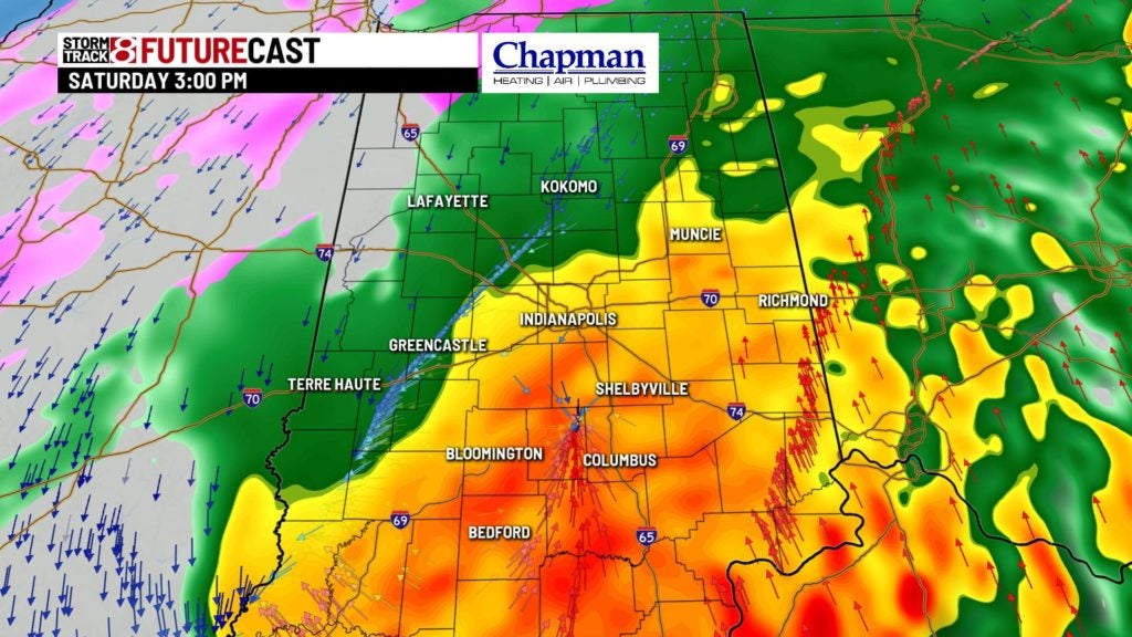
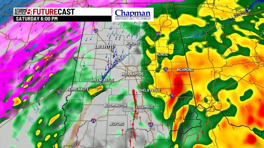
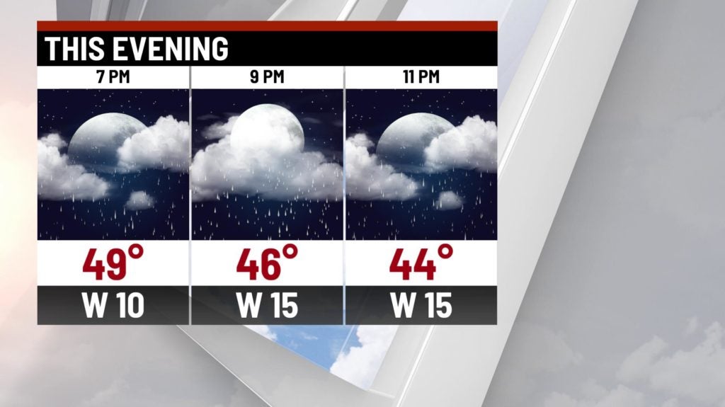
A strong area of low pressure will ride along a cold front positioned just to the west of the state as of Saturday morning. This will bring widespread, steady rain across the area for much of the day. Embedded thunderstorms will be possible at times.

Flooding concerns:
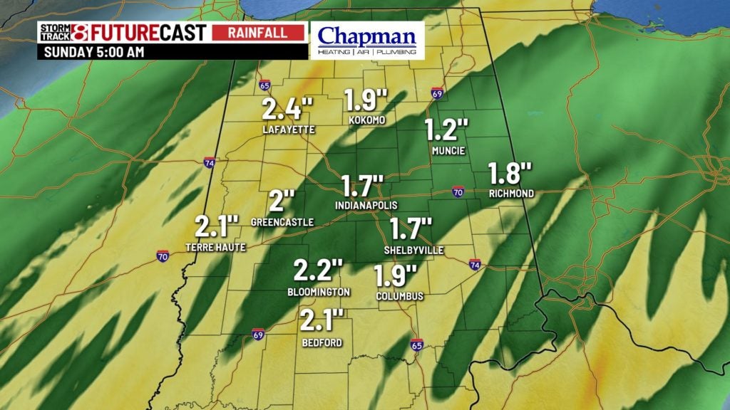
Many areas across the state have picked up close to 2″ of rainfall since Thursday night, and the thinking is we’re only halfway home from our final totals. An additional 1″-3″ of rain will be possible for most of the area today. A flood watch will remain in effect until later Saturday night.

Severe threat?
While most of the area isn’t included in the Storm Prediction Center’s risk for severe weather, the threat for some gusty storms will be possible. Winds at about 5,000 ft above the surface will be quite strong – around 70-80mph. With some stronger storms, some of those winds could mix down to the surface.

In addition, non-thunderstorm wind gusts will exceed 40 mph at times. With an already saturated ground, trees could get knocked down in some areas from both thunderstorm wind gusts, along with non-thunderstorm wind gusts.
Temperatures should hold steady, if not slowly fall through the day.
Saturday Night:
Rain will (thankfully) come to an end by mid/late evening. We may see a quick changeover to snow, but the thinking is most of the moisture will be gone before the really cold air moves in.
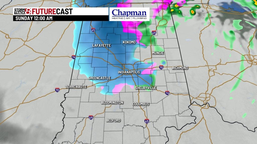
Temperatures will fall to the lower to middle 30s overnight.
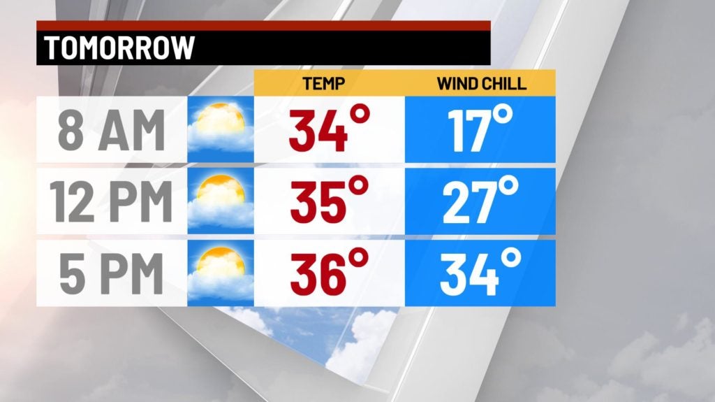
Sunday:
Quieter and colder weather is on tap to wrap up the weekend. It will be mostly cloudy for the morning, with partly cloudy conditions for the afternoon. Temperatures should hold in the middle 30s for much of the day.
8-Day Forecast:
Conditions will be quiet with above-average temperatures on tap for the first half of the week. A cold front moving through on Wednesday should spark scattered rain across the area. Temperatures will turn sharply colder by Thursday. We could see some snow chances returning to the forecast heading into next weekend.
