High heat continues this week
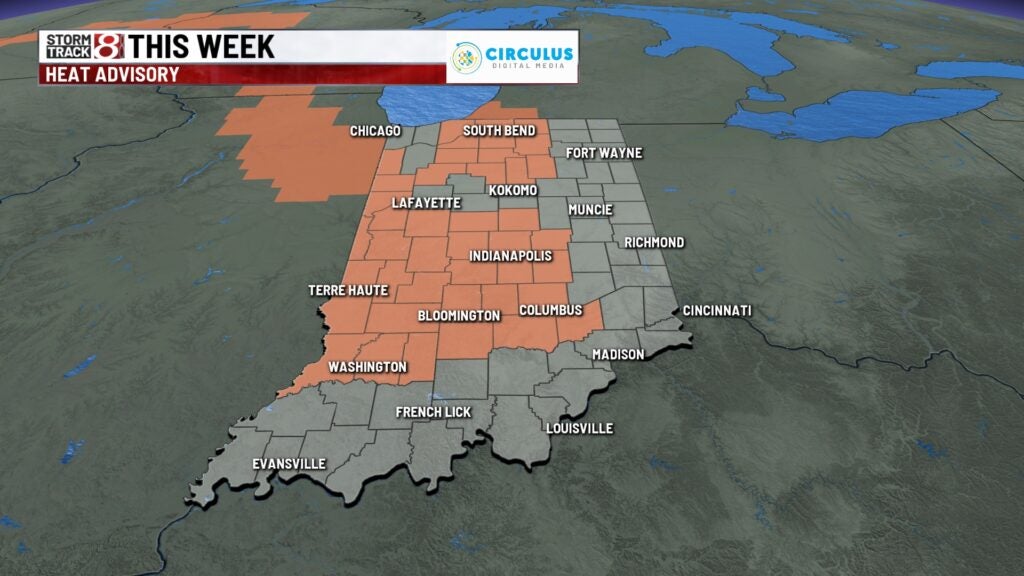
INDIANAPOLIS (WISH) — A heat advisory is in effect Tuesday, excessive heat warnings for dangerous heat index levels Wednesday and Thursday.
Tuesday:
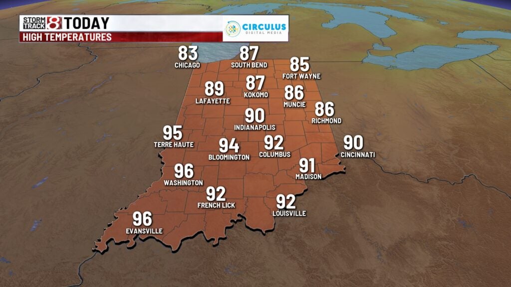
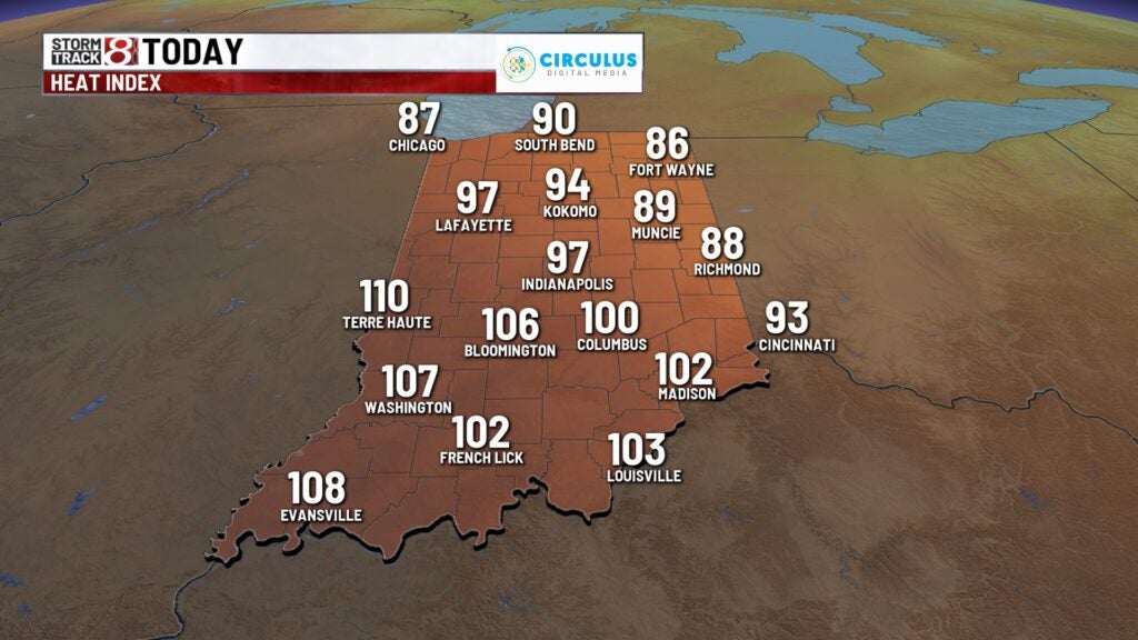
Some patchy areas of fog possible this morning, otherwise a mostly sunny and hot day on tap. A heat advisory is in effect for much of central and southwestern Indiana for today.
Highs top out in the upper 80s up north, to the lower 90s in central and southern Indiana.
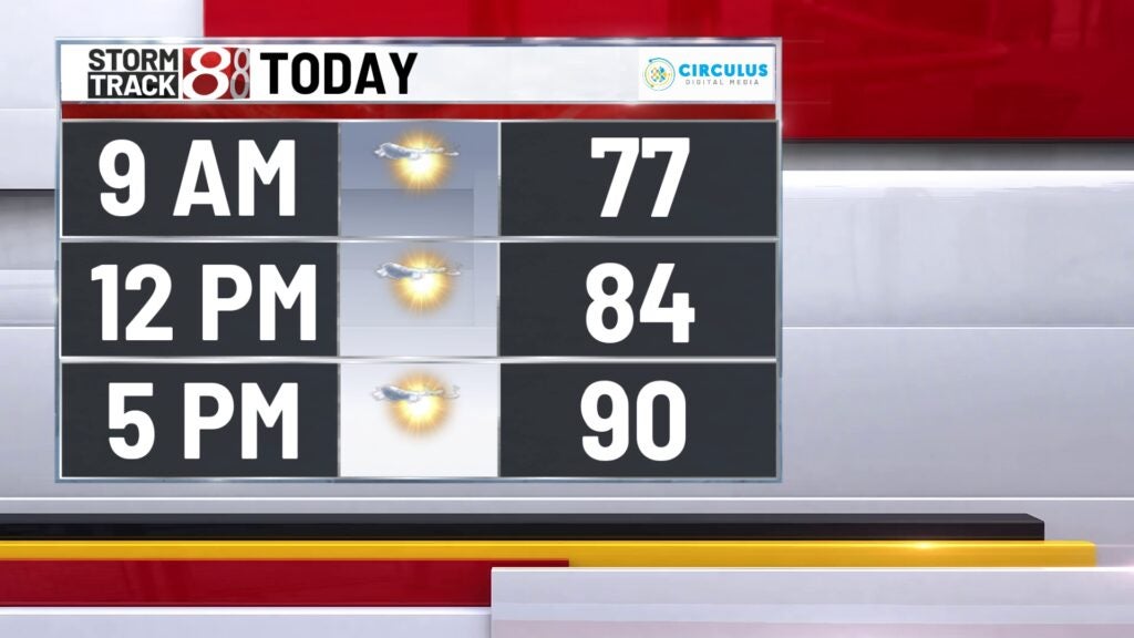
Heat index values will hover around 100° for the afternoon.
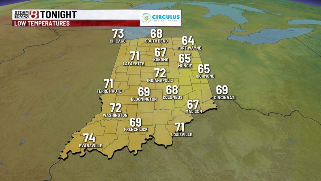
Tuesday night:
Clear, quiet and muggy. Low fall to the lower 70s.
Wednesday:
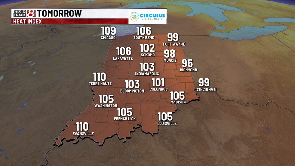
Heat dome moves a little closer to central Indiana of the next couple of days, making for some pretty intense heat across the area. An excessive heat warning is in place for Wednesday and Thursday across much of central Indiana.
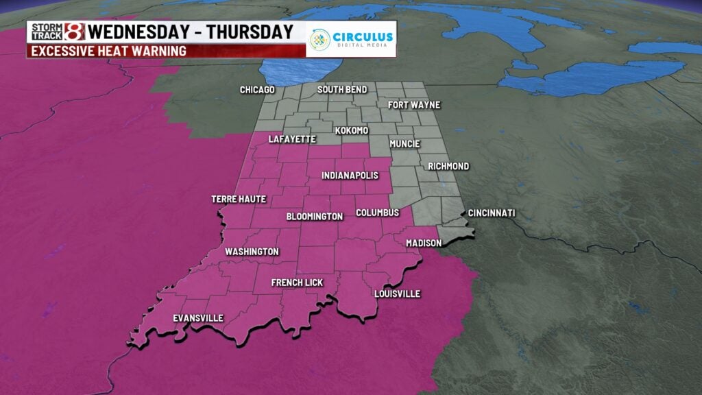
Highs temperatures will surge to the mid 90s for the afternoon across the metro area.
With high dew points, heat index values will range between 105-110°.
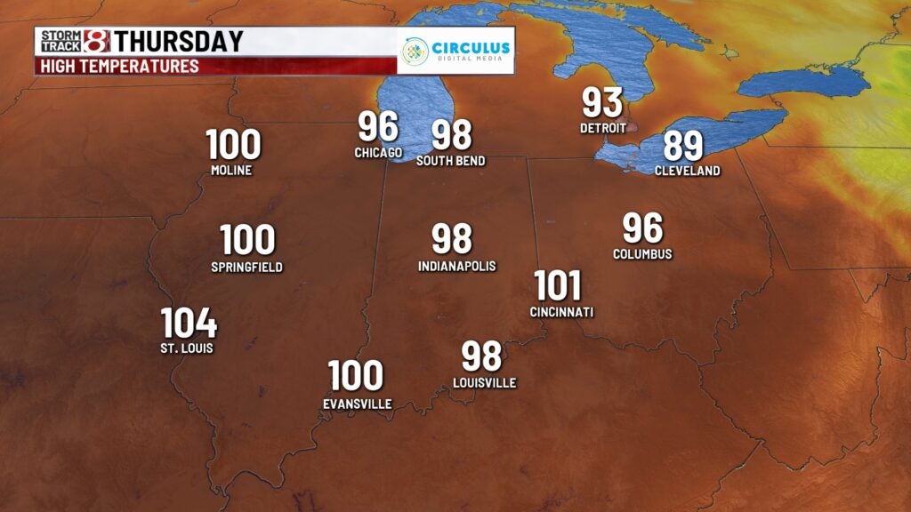
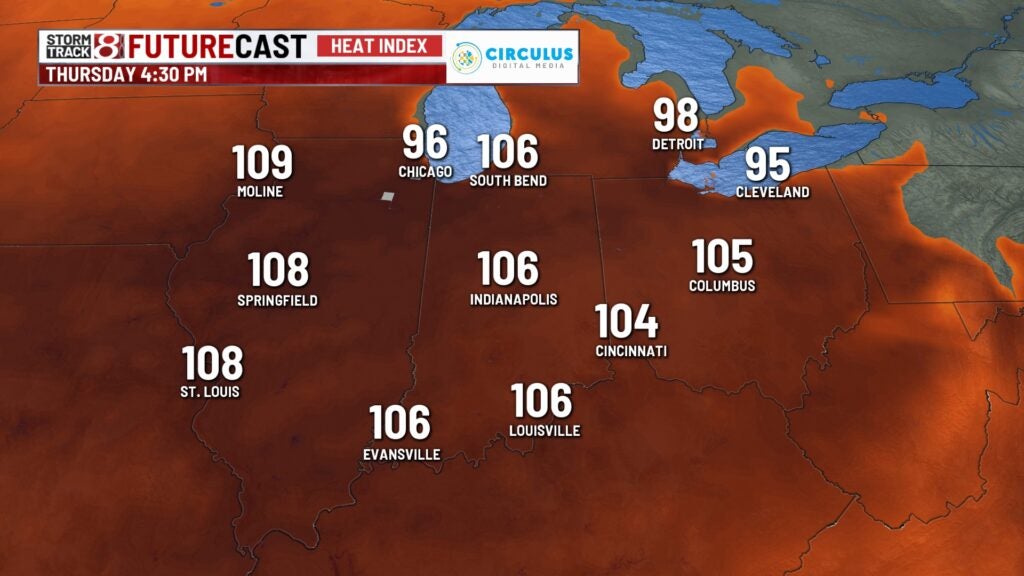
Thursday:
Similar setup to Wednesday, but air temperatures will likely run a few degrees hotter. Some areas may push close to 100° for the afternoon.
Heat index values could exceed 110° during the peak heating of the afternoon hours, Thursday.
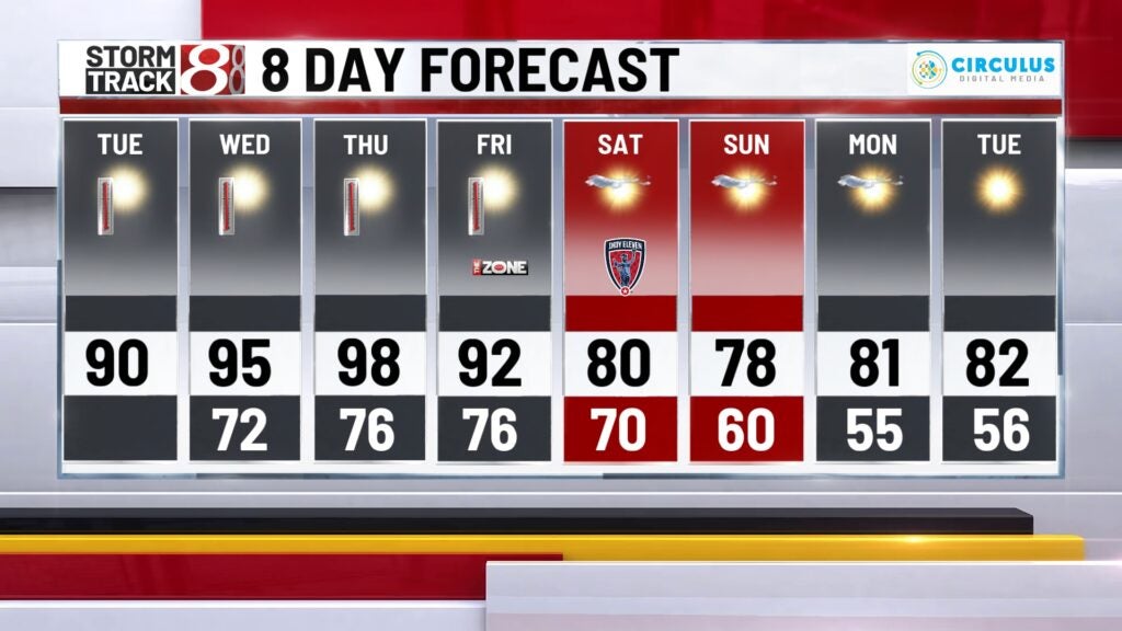
8 day forecast:
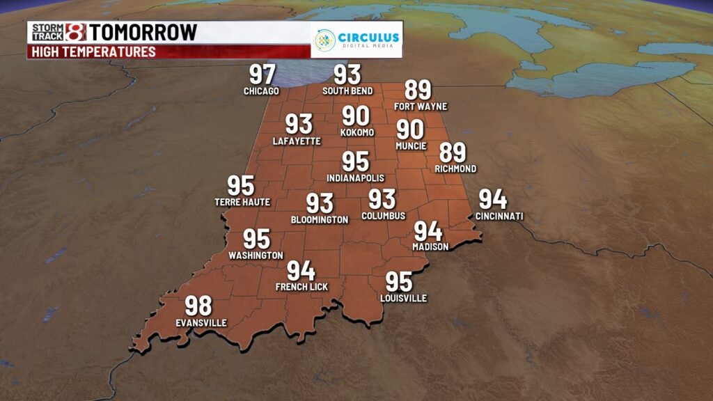
One more hot day, with a little less intense heat on Friday. Highs will top out in the lower 90s. There’s also an spotty storm chance Friday afternoon for southern portions of the state. Relief moves in for the weekend and beyond, as the heat dome breaks down. Highs will hover around 80° both Saturday and Sunday, and hang out in the lower 80s early next week.