Storm chances return Monday afternoon
INDIANAPOLIS (WISH) — Temperatures will remain well above average this week.
This morning:
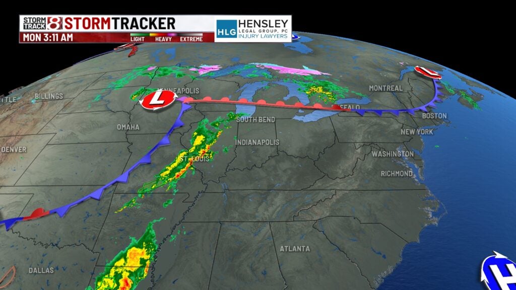
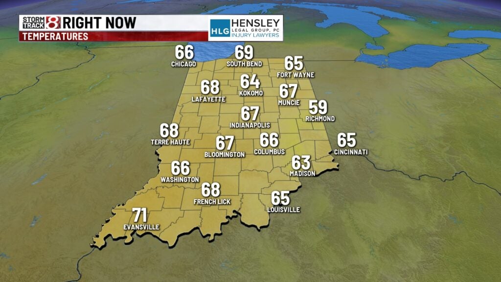
We’re dealing with very mild temperatures this morning, with clouds increasing as a powerful low-pressure center moves across the upper Great Lakes this morning.
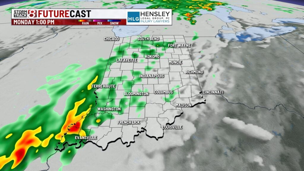
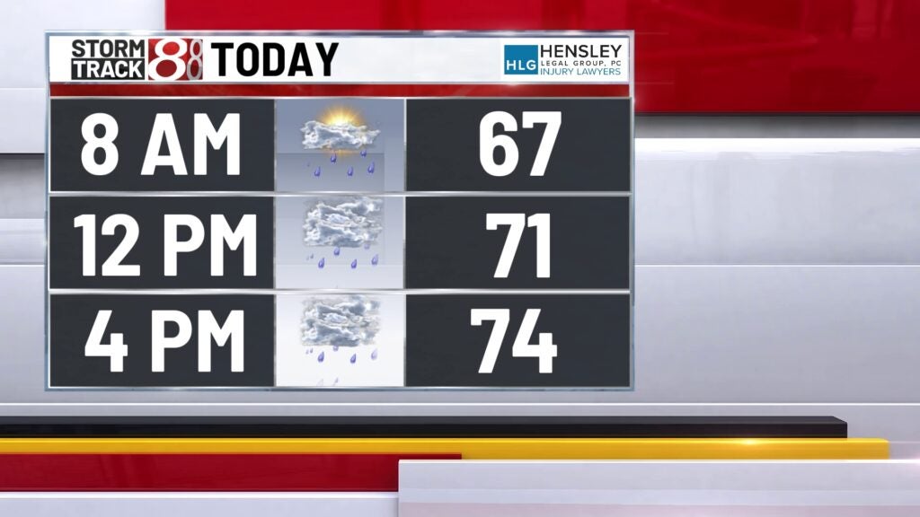
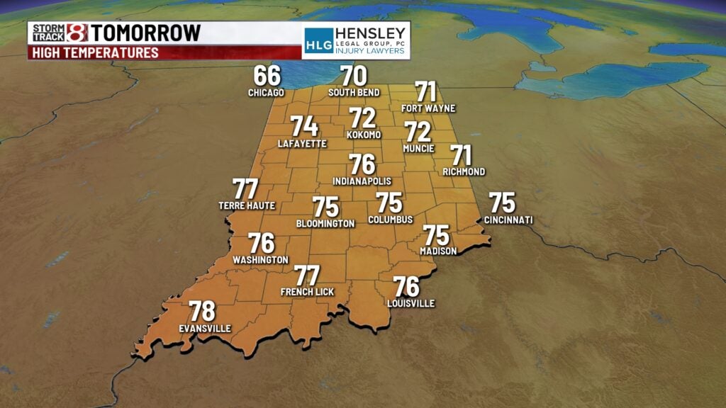
Monday:
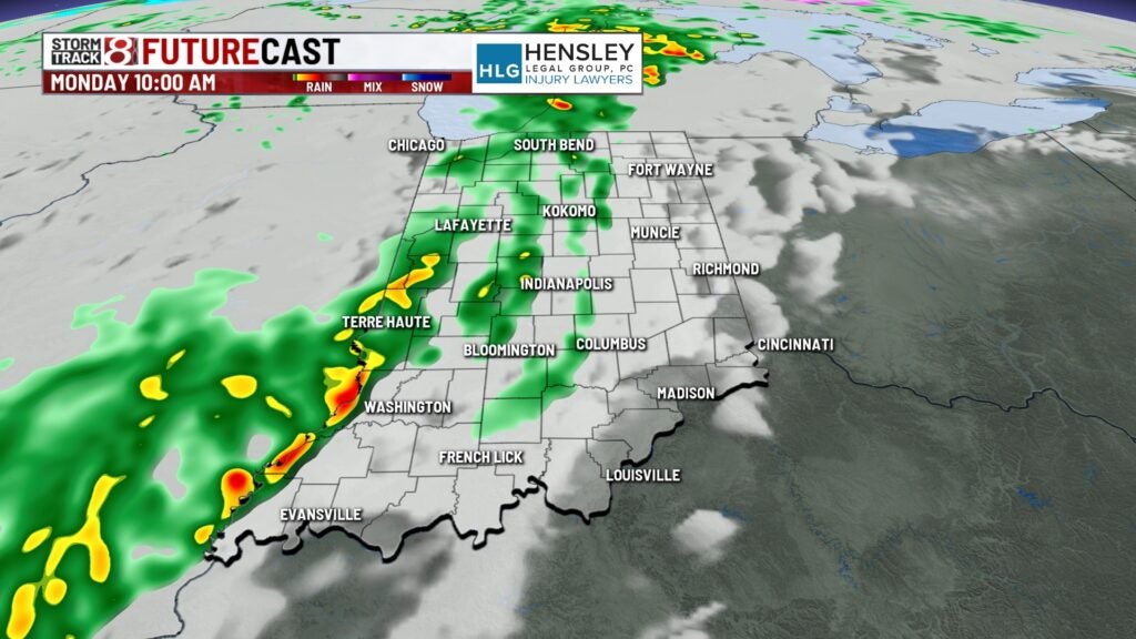
Some light showers will be possible in the far western portions of the state during the morning hours. Central and eastern Indiana have better chances for scattered showers and thunderstorms later this afternoon, although coverage will not be widespread.
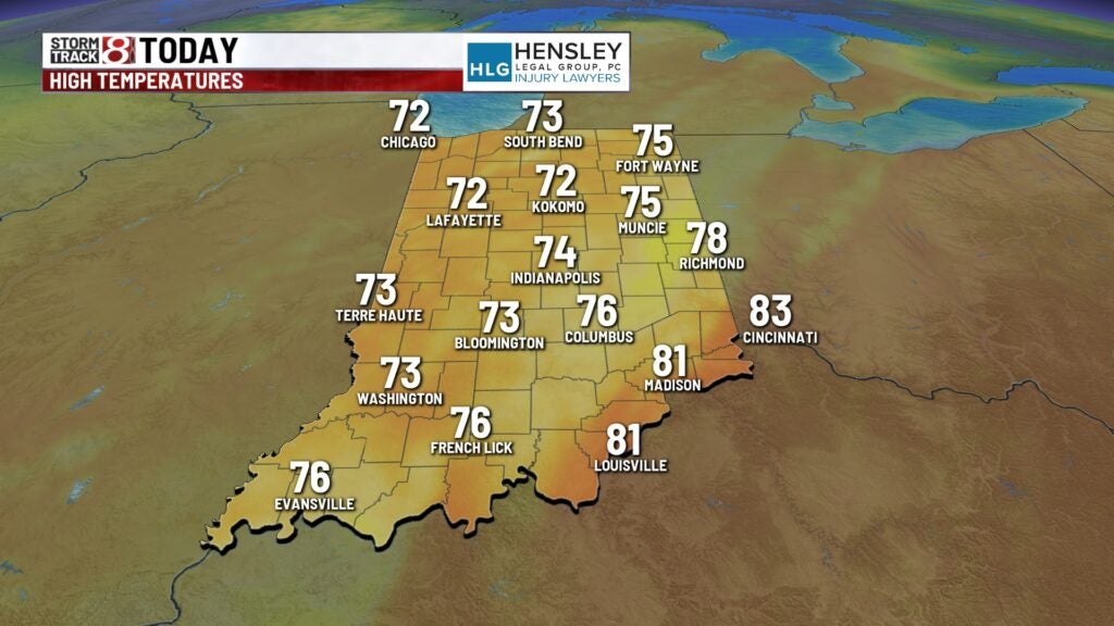
Afternoon high temperatures will jump to the mid-70s this afternoon.
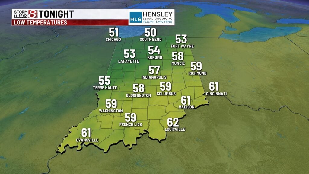
Monday night:
The cold front will work through the state this evening, bringing better chances for scattered showers and a few weeks of thunderstorms this evening into the overnight hours.
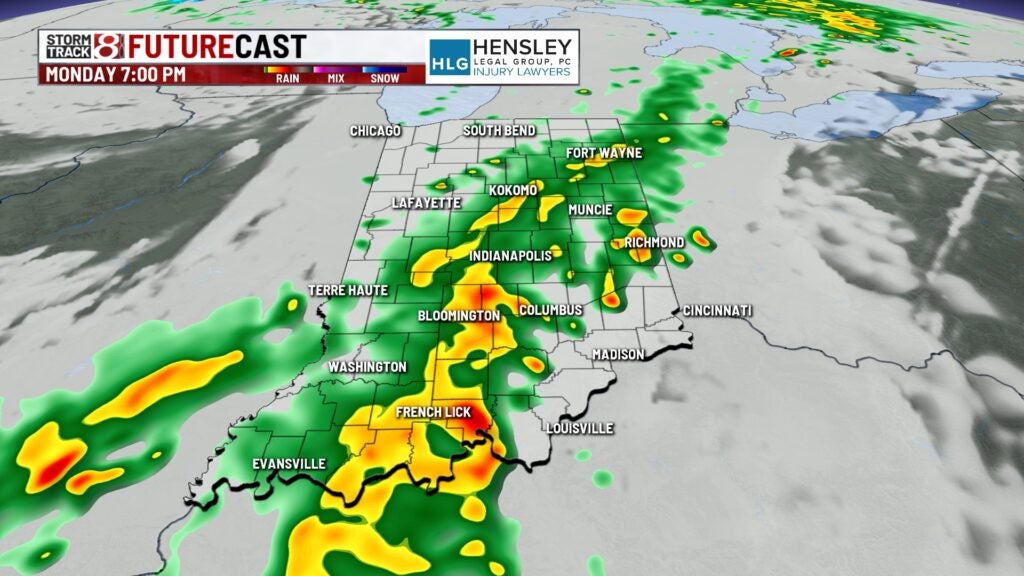
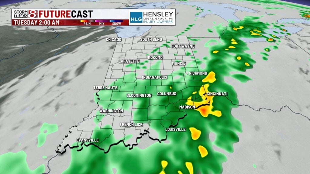
Lows fall to the mid-50s.
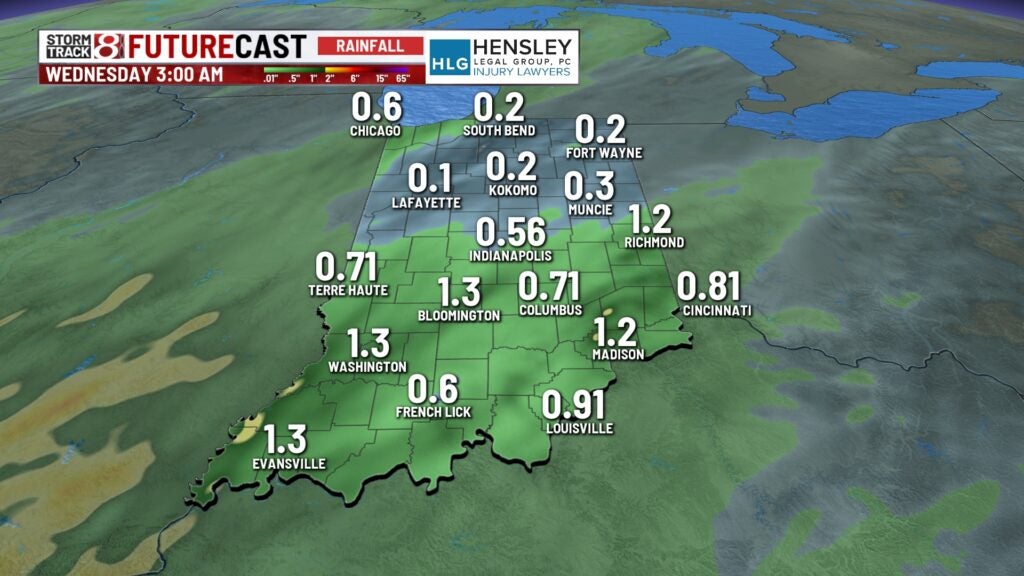
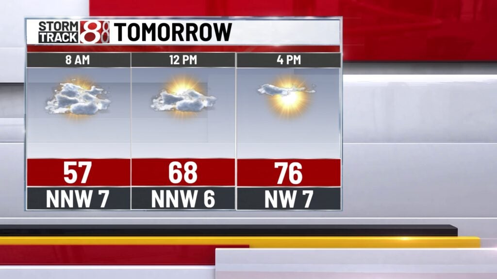
Tuesday:
There could be a few lingering showers early Tuesday morning, but much of the day will be mostly cloudy to eventually partly cloudy. Highs remain above average, topping out into the mid-70s for the afternoon.
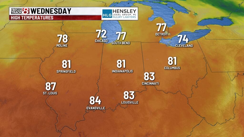
Wednesday:
Lots of sunshine on Wednesday, with well-above-average temperatures. Highs top out into the low 80s.
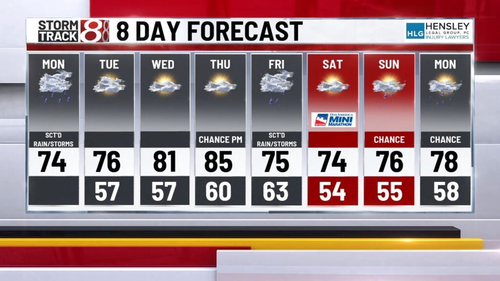
8 day forecast:
The warmest day of the week will come on Thursday, with highs in the mid-80s. Storms come in late Thursday night and Friday, scattering showers and thunderstorms to wrap up the work week. There’s also a low probability of some precipitation on Saturday and Sunday for the weekend.