Much cooler temperatures Wednesday
Some areas will dip below freezing Wednesday night.
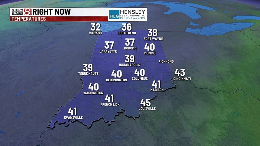
Right now:
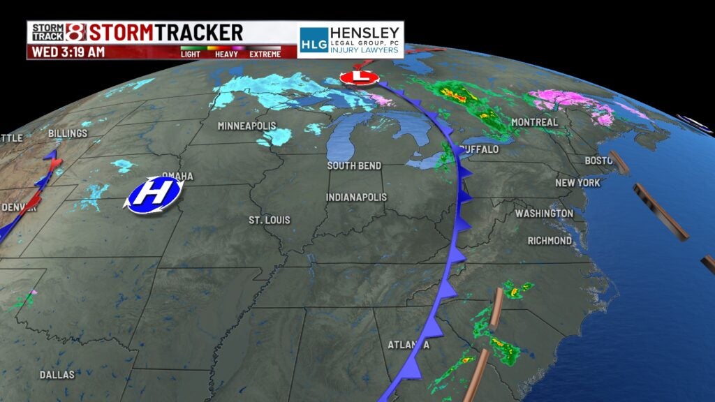
The clouds are stubborn this morning, with a very cool northwest flow following our cold front that moved through on Tuesday. Temperatures are running about 10 to 15° colder than Tuesday morning.
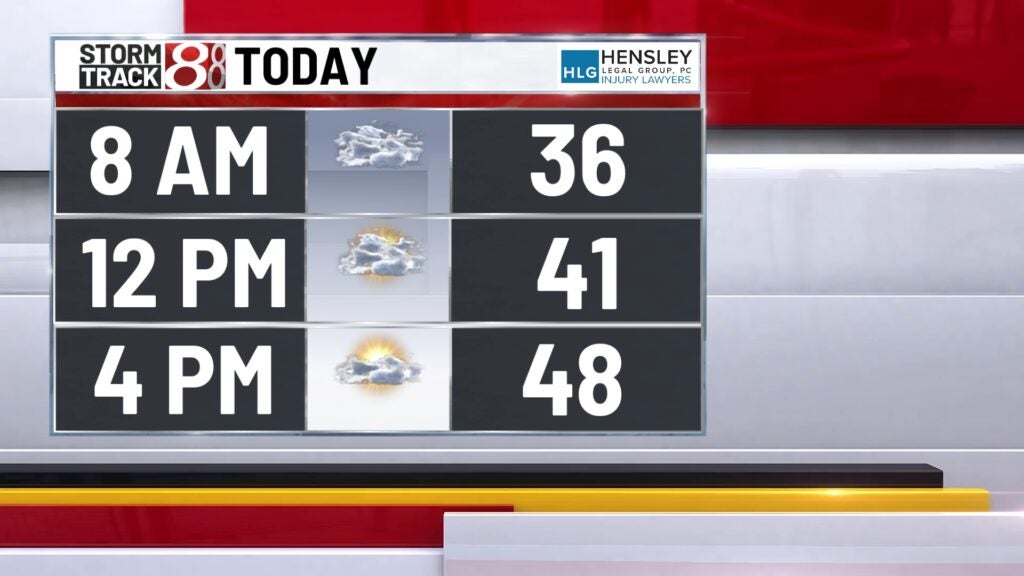
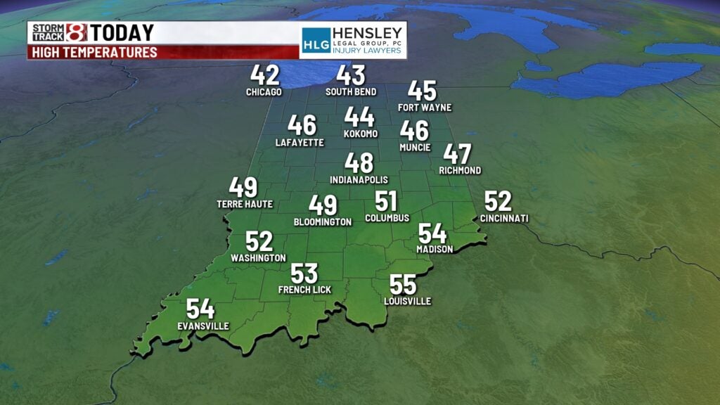
Wednesday:
We expect clouds to gradually decrease throughout the day, leaving us with partly cloudy skies later this afternoon. Temperatures won’t rebound a whole lot, with highs only in the mid to upper 40s later this afternoon.
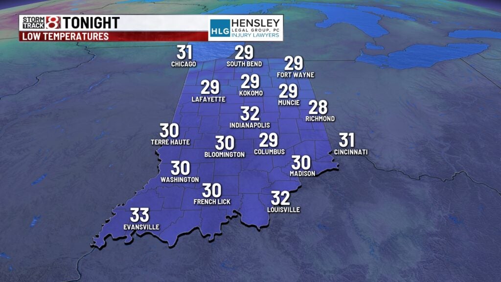
Wednesday night:
We will likely see numbers dipping to or below freezing statewide. This will create damaging cold temperatures for vegetation that’s already popped up early this season.
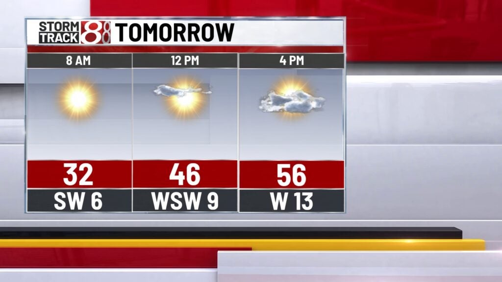
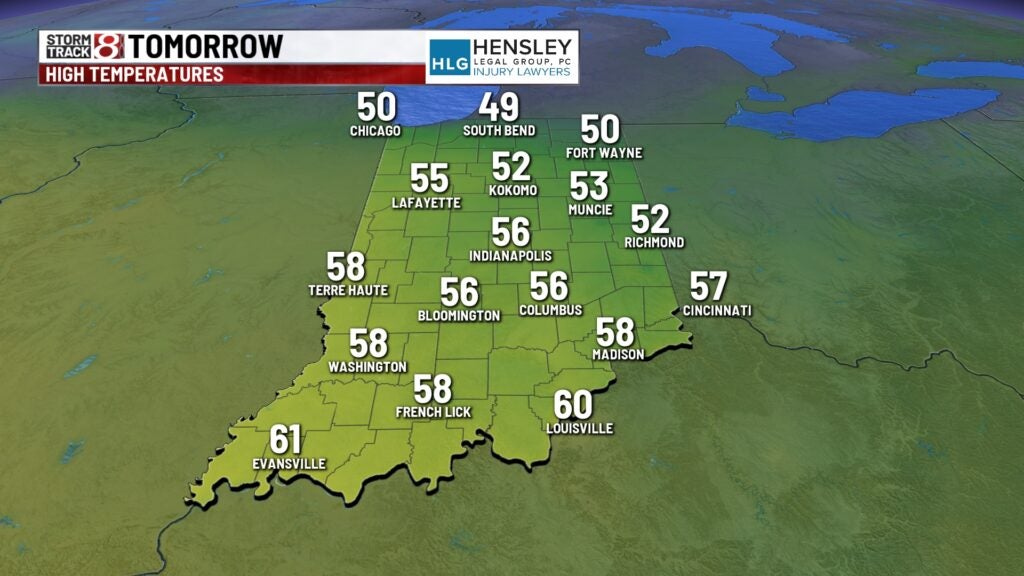
Thursday:
Despite the colder start Thursday morning, we’ll bounce back nicely as we head into the afternoon. Lots of sunshine as high pressure settles in for the next couple of days and highs return to the mid and upper 50s Thursday afternoon.
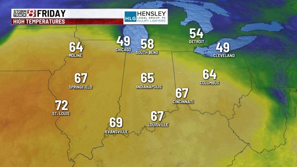
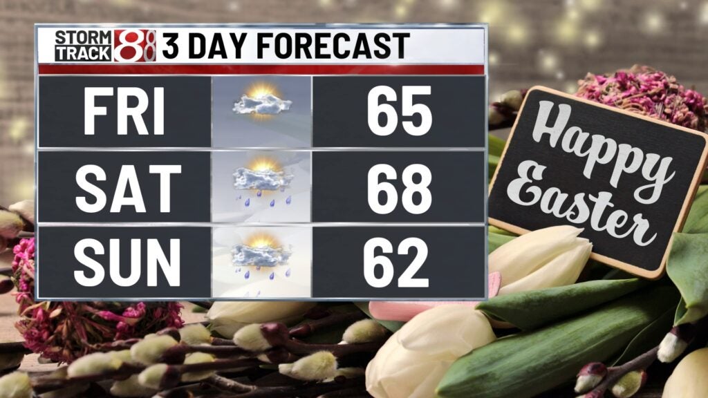
Friday:
Friday looks even better, with a few clouds and very mild temperatures. Highs return to the mid-60s,
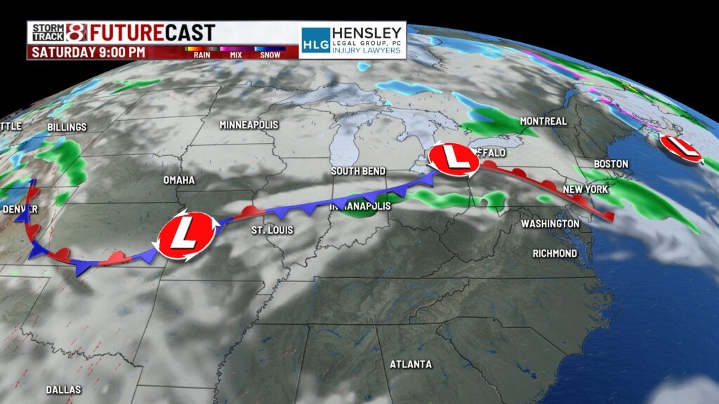
Easter weekend:
The pattern flips a bit for the holiday weekend, with chances for showers and storms on Saturday. There are better chances for showers and thunderstorms to evolve later on Easter Sunday.
8 day forecast:
Rain chances look to continue heading into Monday, with our best chance for rain likely over the extended. Some leftover showers linger on for Tuesday. Temperatures remain well above average for this time of year as we open up the month of April next week. Some signs of a cooldown are on the way through the middle of next week by Wednesday, when highs only top out into the mid-50s.
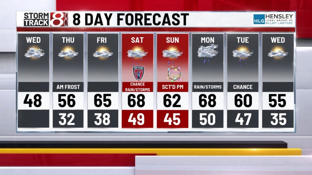
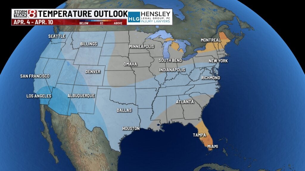
The 8- to 14-day outlook also shows a weak signal of below-average temperatures as we go through the middle of April.