


Rain, storm chances set to ramp up
INDIANAPOLIS (WISH) — After a breezy and dry Wednesday, rain and storm chances are set to increase for the rest of the work week.
Wednesday night:
Isolated showers will develop tonight with mostly cloudy skies continuing. Showers and storms will become numerous overnight before sunrise Thursday.

Thursday:
Prepare for an active Thursday with stormy weather on and off throughout the day.


There is the chance for strong to severe storms in the evening hours as there is a Slight Risk of severe weather for the northern half of Indiana. This area north of interstate 70 has the best chance to see severe storms with damaging winds and large hail as the primary threats. However, we cannot rule out an isolated tornado.

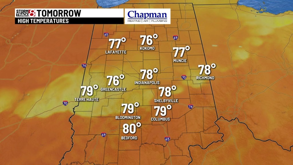
Warmer air will push in across central Indiana, which will bring our high temperatures into the upper 70s.

Friday:
Keep the rain gear handy as showers and storms will be on and off through your Friday. Heavy downpours are possible at times, and we will be concerned for the threat of flooding. We will also keep the warm temperature trend going with highs topping out in the mid 70s.


8 Day Forecast:
If you love the warmer temperatures, you are in luck as we will be in the upper 70s to near 80° through the weekend. However, with these warm temperatures, rain and storm chances will continue for Saturday and Sunday with some showers lingering into Monday morning. We finally dry out by Monday afternoon, and enjoy a warmer pattern with high temperatures being near or above normal through midweek.
