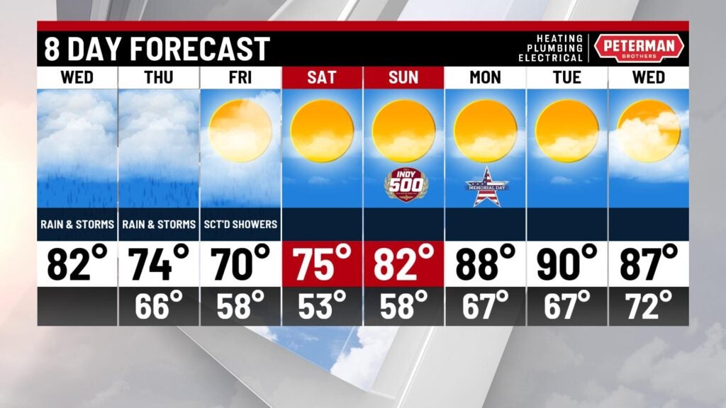
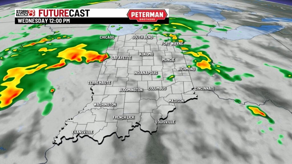
Showers and storms return
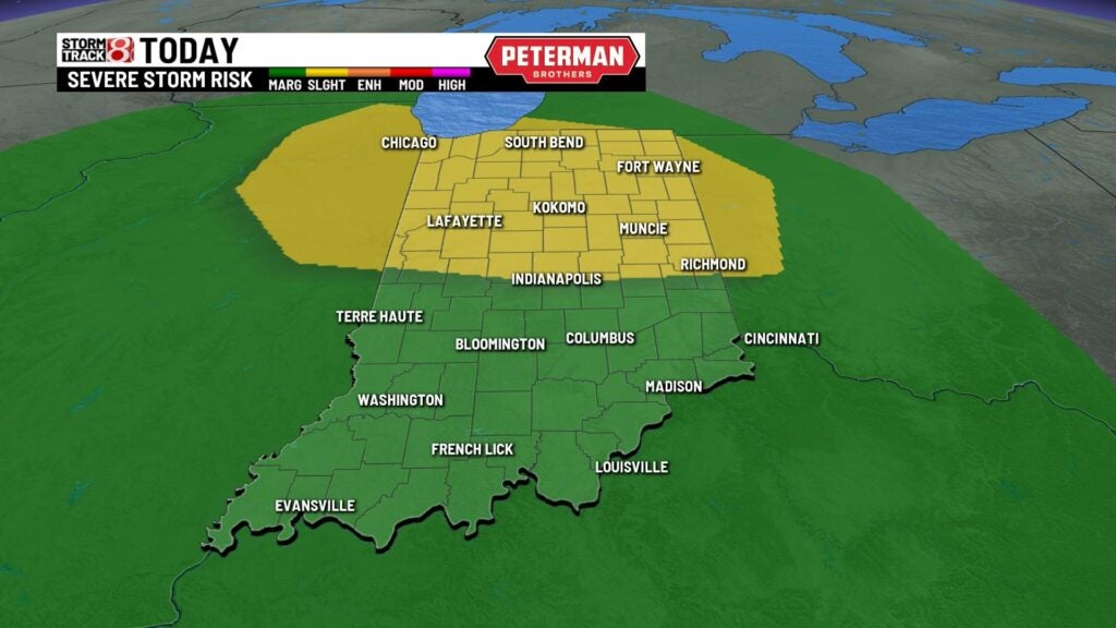
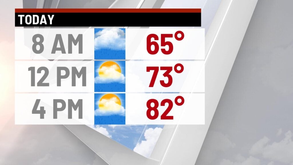
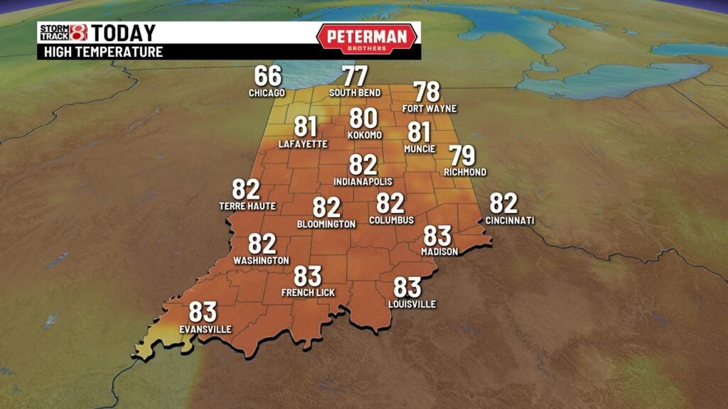
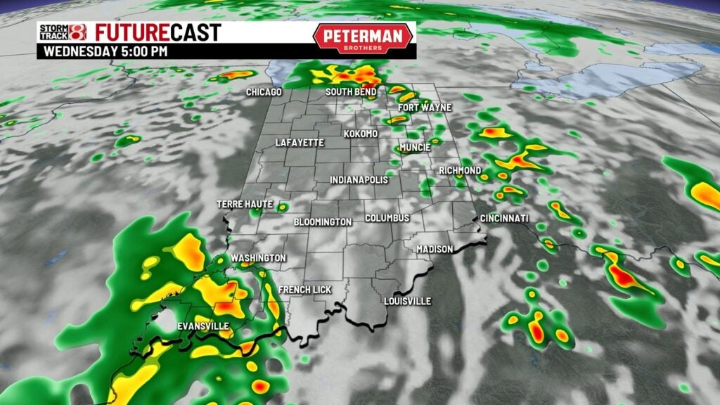
A few light showers will be around through the morning drive with temperatures starting off in the lower 60s. Shower chances will remain around through the day with highs warming to the lower 80s. There is a threat for a stronger to severe storm later this afternoon and evening with all severe weather modes in play. There is a slight risk for central and northern Indiana and a marginal risk for the rest of the state. Strong winds, heavy rainfall and an isolated tornado possible across the state this afternoon and evening. Lows tonight will fall to the mid 60s.

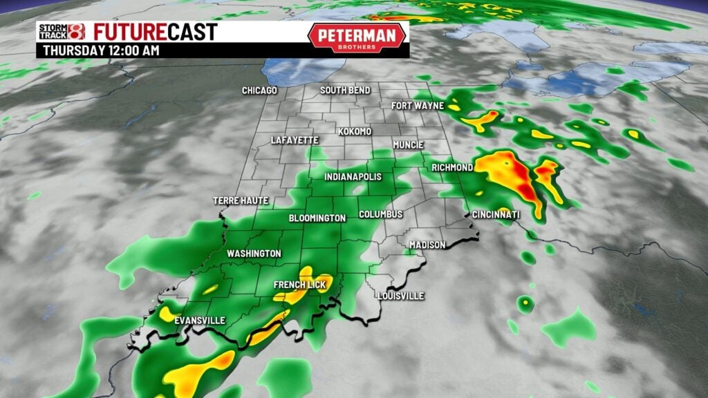
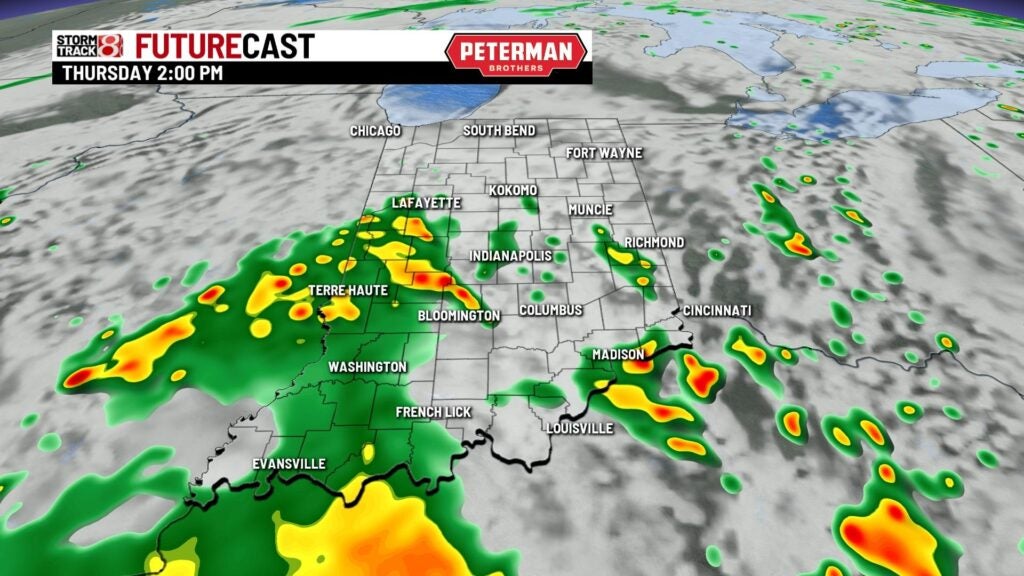
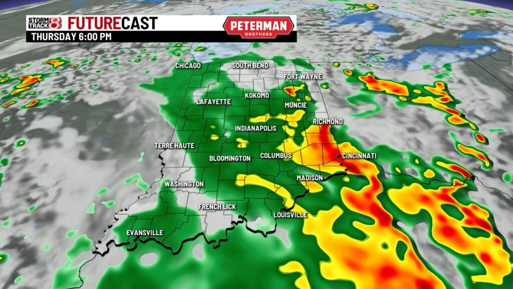
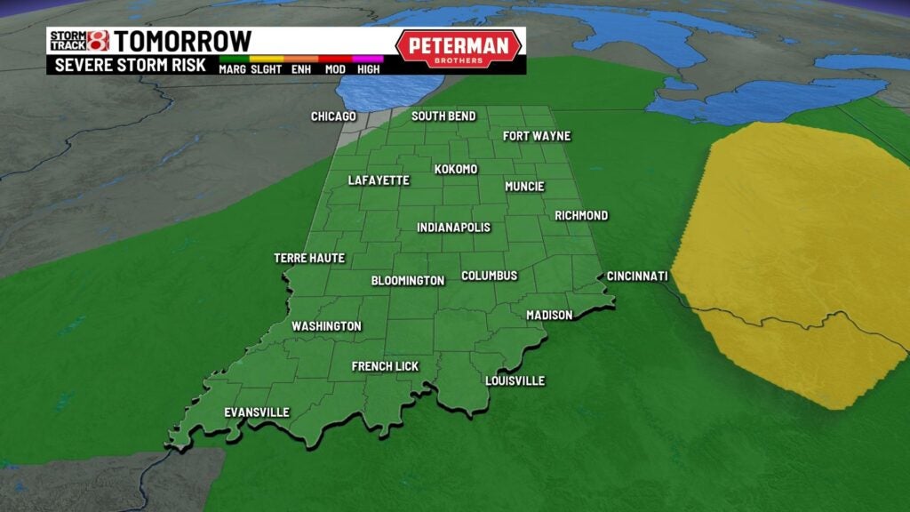
Rain will stick around through Thursday with highs cooling as the cold front approaches the state. Highs will top out in the mid 70s. Some of the storms that develop tomorrow afternoon could also become gusty to severe. Spotty on and off showers will linger through the end of the week for Carb Day with highs in the lower 70s.

Clears out just in time for the weekend! Loads of sunshine for the parade on Saturday with highs in the mid 70s. Gets warmer and slightly humid Sunday for the Indy 500 with lots of sunshine and highs in the lower 80s. The heat will continue through next week with highs flirting with 90°.