


Unusually mild winter continues; hints of cold in sight
INDIANAPOLIS (WISH) — Most of the weather chatter around central Indiana over the last few weeks has been the springlike temperatures and the lack of snow.
It should come to no surprise that for the month of January 2020 is ranked the ninth-warmest to date (through Jan. 13) with an average temperature of just under 40.
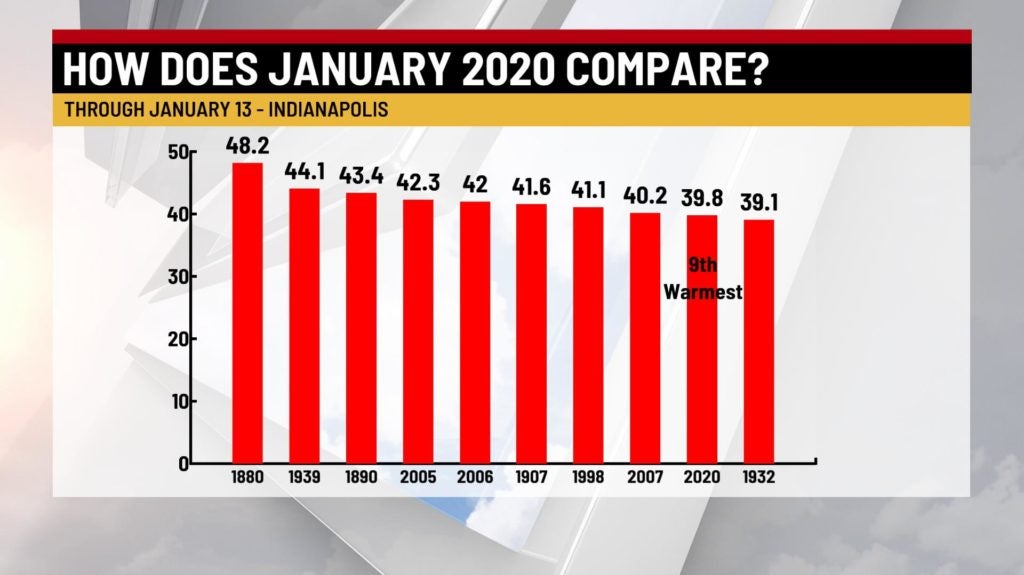
In fact, looking at the data, we have yet to have a high temperature at or below average for the entire month. Typical high temperatures for the month hover in the middle 30s. In most cases, we were well above-average.

But it hasn’t just been January. December was warm, too, especially around the holidays. Since Dec. 1, our average temperature is just under 38 — good for 10th warmest to date.

So what is causing this unusual surge of milder air? You can thank a big dip in the jet stream to the west, which is helping to bottle up all of the arctic air in western Canada. The opposite is true for the eastern half of the country, where temperatures are well above-average, along with a very active and wet pattern over the last several weeks.

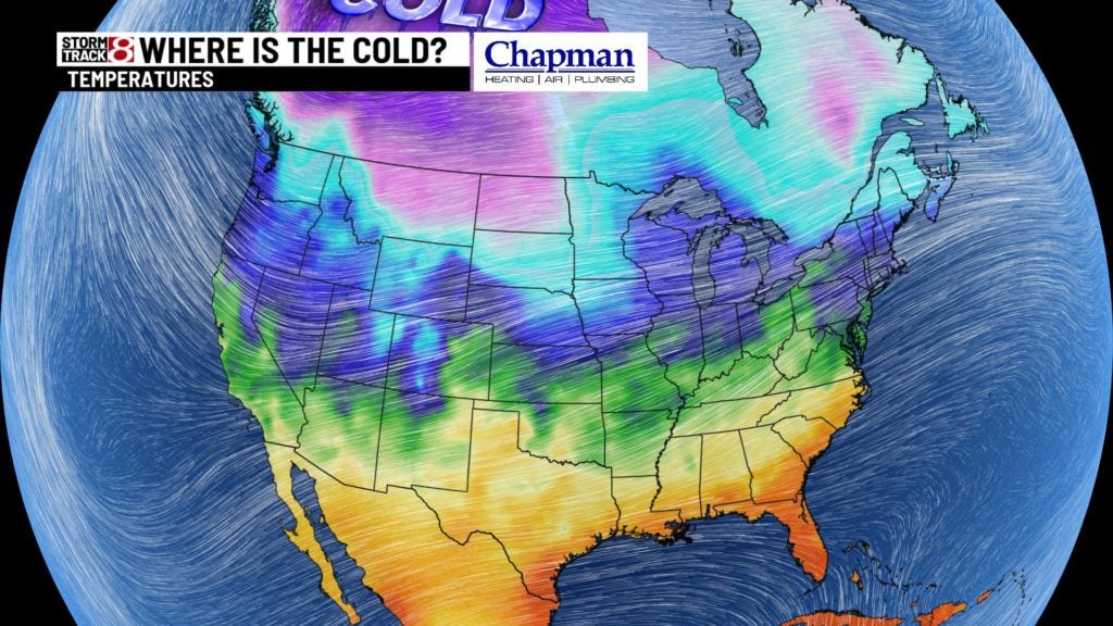
A “strong” polar vortex is also keeping the winter chill in far portions of the Arctic. A strong polar vortex means the circulation of Arctic air is tight and stays close to the center. A weaker vortex would mean better chances for chunks of bitter cold to swing farther away from the center.
But, there are signals of a change, or pattern flip, for the second half of January. Many models are on board with slightly below average temperatures starting on Martin Luther King Jr. Day, Jan. 20, and hanging around for a week or two. While it doesn’t appear to be significant chill, it certainly will be a shock to the system compared to where we have been for the past several weeks.

