Below normal weekend ahead with breezy stretch shaping up
INDIANAPOLIS (WISH) — Cloud cover did a big number on a good portion of the state today as some locations struggled to get out of the 40s. Some showers also slid in during the afternoon hours.
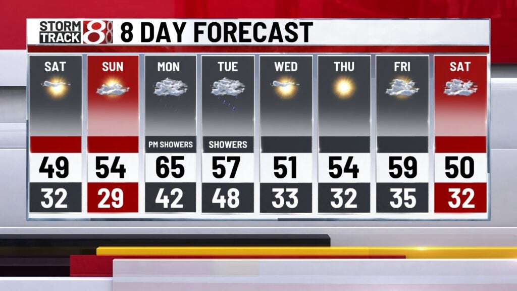
We’re going to stick with an inconsistent temperature trend as we work towards next week with rain chances increasing by then.
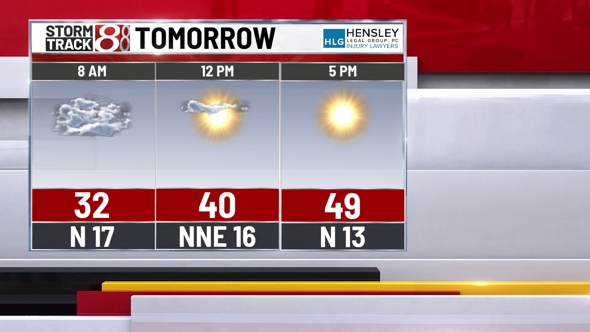
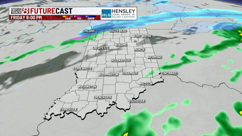
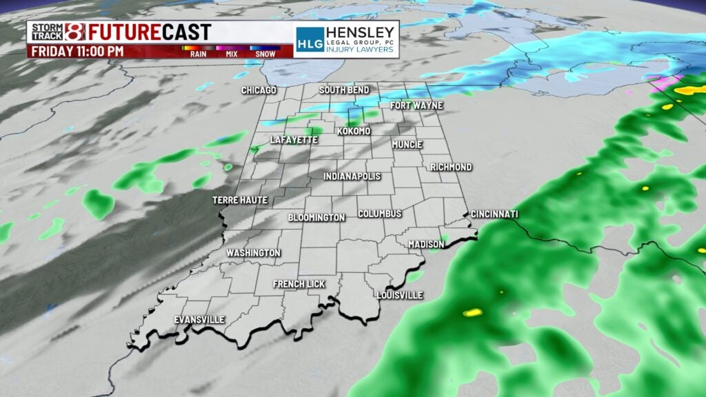
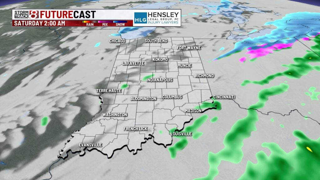
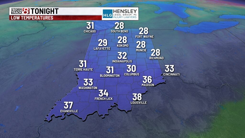
Friday night: We’re going to stay mainly cloudy tonight with a few showers possible as a cold front slides through. Some snow could work into the mix as well in the northern third of Indiana.
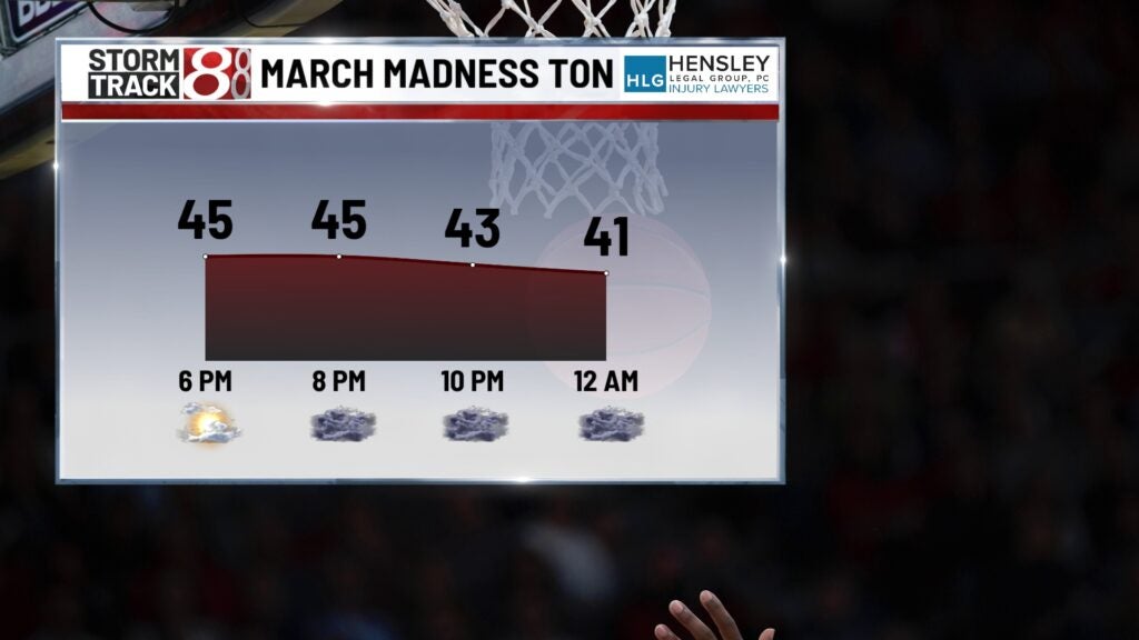
Lows will drop into the low to mid 30s. If you’re heading to the back half of tonight’s March Madness action at Gainbridge Fieldhouse, be sure to have a couple of warm layers on.
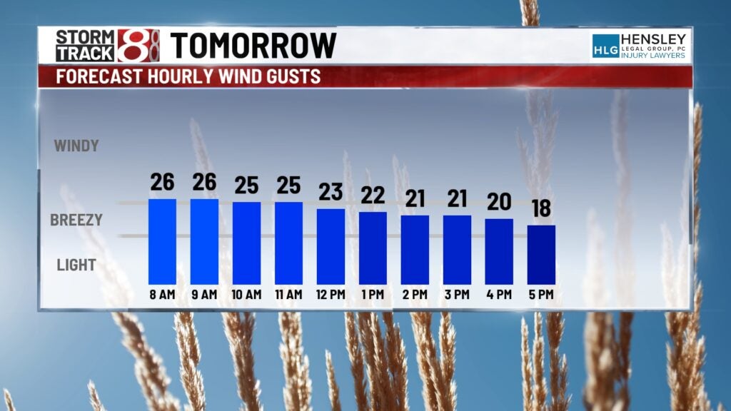
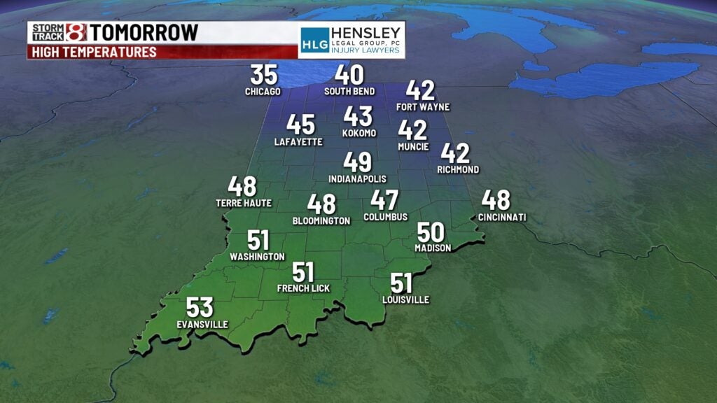
Saturday: Friday night’s front will cause winds to shift and turn more breezy out of the north. We’ll also decrease cloud cover throughout Saturday morning with skies eventually turning mostly sunny. Wind gusts will be up to 20-30 MPH at times, and these northly winds will hamper our high temperatures a bit.

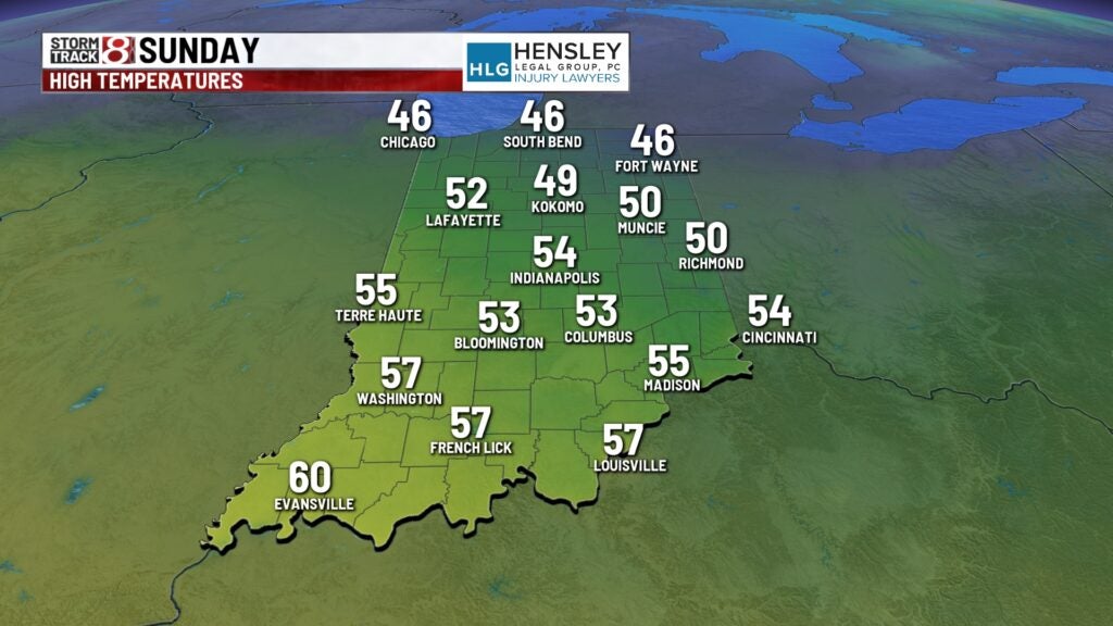
Sunday: Winds will quickly turn back out of the south and help us turn a little warmer. It will remain breezy as well with gusts of 20-25 MPH. Skies will also become partly cloudy as highs approach the low to mid 50s.
8-Day Forecast: Temperatures bounce back into the 60s with southerly winds turning even stronger. Wind gusts could approach 30-35 MPH at times on Monday. A few showers will be possible as well before rain turns likely Monday night and Tuesday. This rain will be in association with a bigger system. Heavy rainfall and some rumbles of thunder are possible in this timeframe, but severe weather is still not expected thankfully. We’ll cool back down into the 40s by Wednesday before we warm right back up.