Brief cooldown with hard freeze possible tomorrow night, warmup to follow
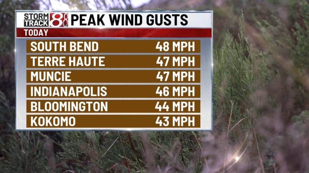
INDIANAPOLIS (WISH) — Today was no doubt even more windy than Monday with some spots gusting near 50 MPH. We also dealt with early morning rain with some afternoon re-development.
Today’s system is going to pave the path for our temperature pendulum swing to continue through the remainder of the month.
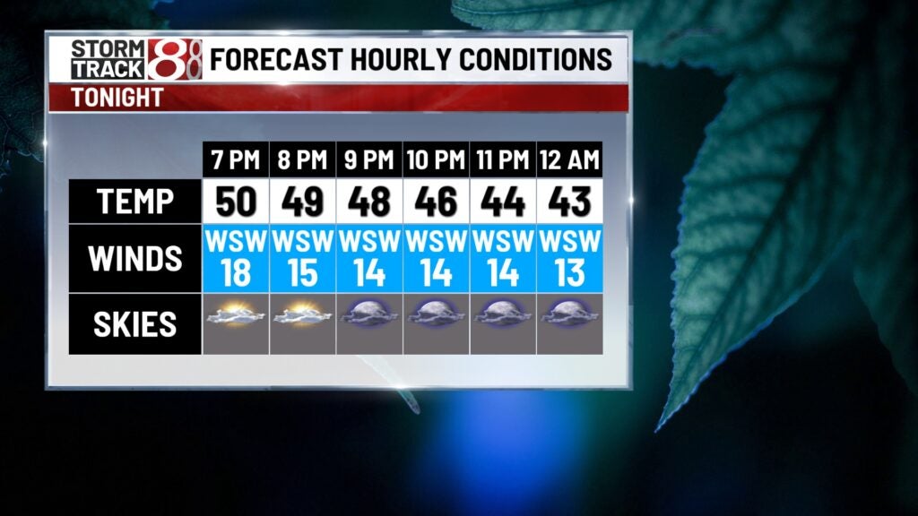
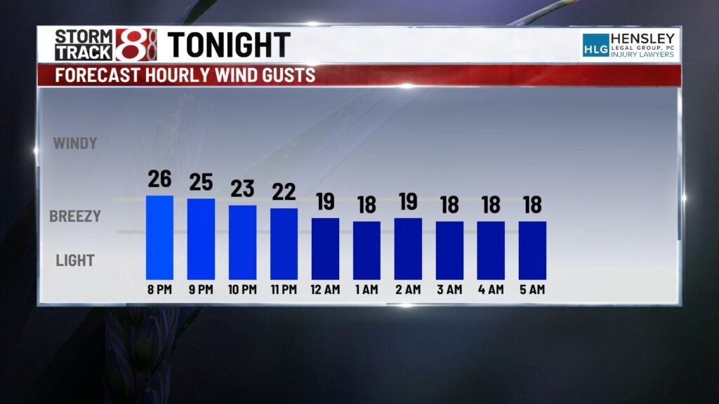
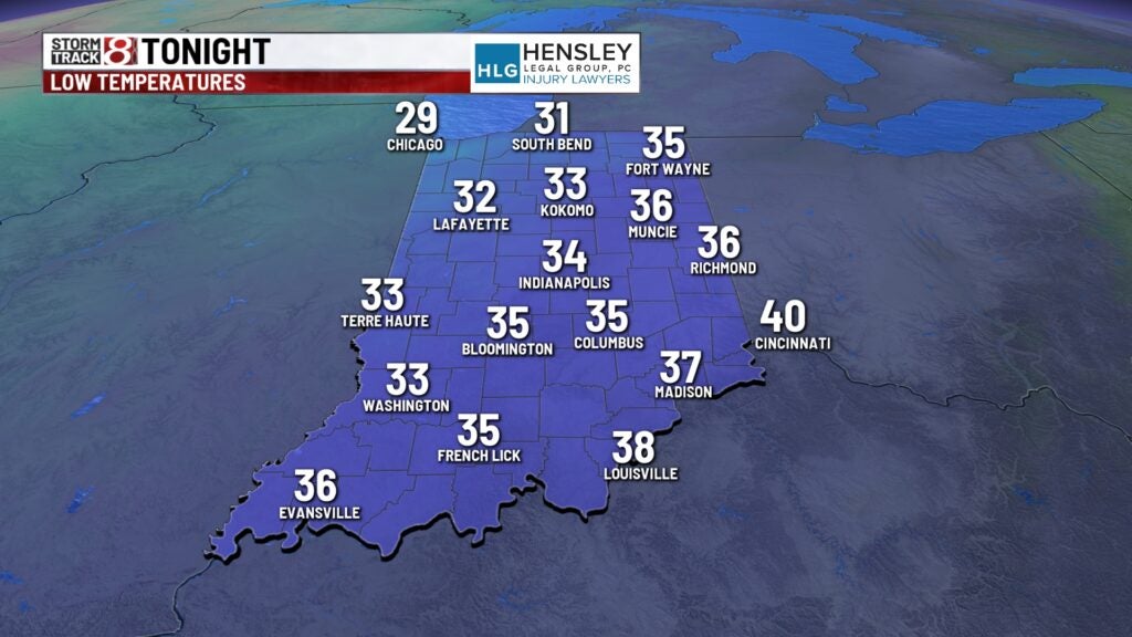
Tuesday night: We’ll lock in on a mostly cloudy and much colder night with winds gradually dying down. Lows will fall into the mid 30s. Some patchy drizzle may emerge during the overnight hours.
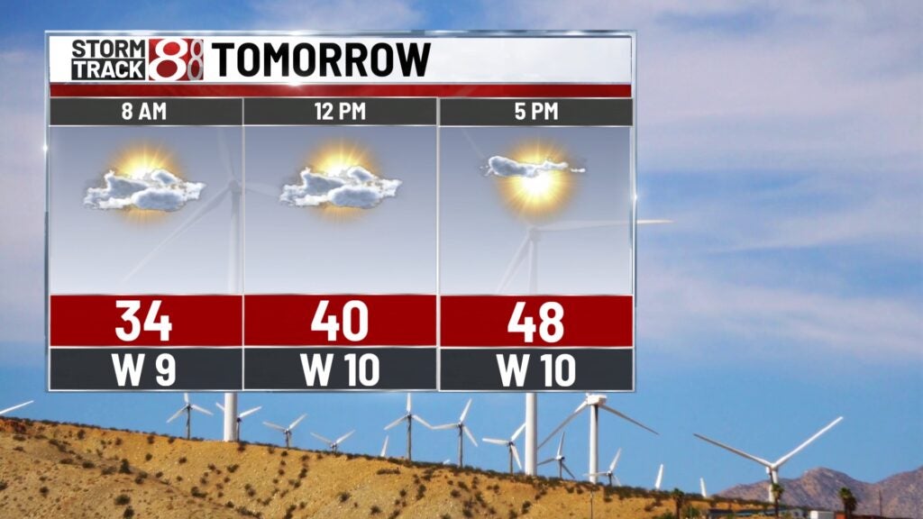
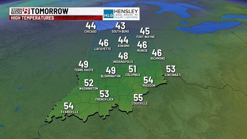
Wednesday: Patchy drizzle will remain possible into Wednesday morning. Cloud cover is set to slowly decrease throughout the day, but we will be a bit colder and below normal. Highs will only rise into the upper 40s. Winds will also be a lot lighter at 5-10 MPH.
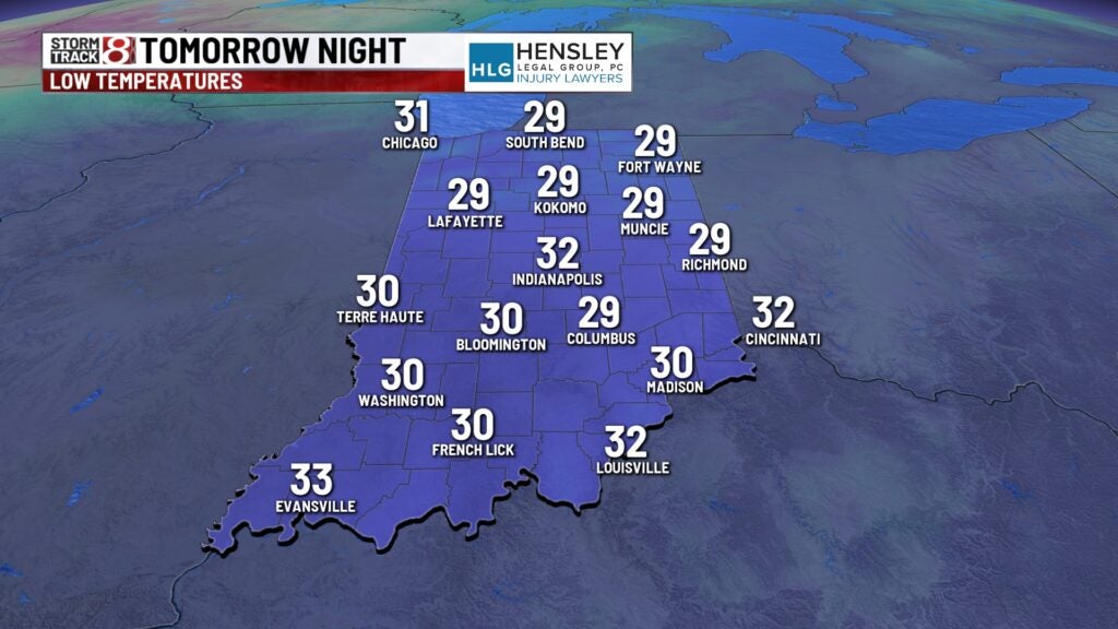
By Wednesday night, a combination of mostly clear skies and light winds will cause a widespread frost going into Thursday morning. It is possible some locations see a hard freeze.
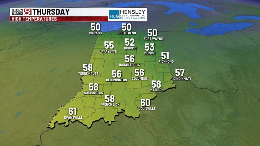
Thursday: We’ll quickly find ourselves warming right back up starting Thursday after a cold start to the day. Plentiful sunshine and a westerly breeze will help temperatures top out in the mid 50s.
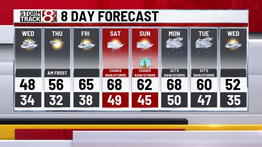
8-Day Forecast: The warmup continues into Friday and Saturday with highs nearing 70 for the first half of the final weekend of March. We will also be watching a frontal boundary that is looking to hover around the state starting Saturday and stay within our area into next Monday. Rain chances will remain low Saturday and Sunday with Easter Sunday slated to be slightly above normal. Better rain chances will settle in next Monday and Tuesday with even the possibility of a few storms.