Coldest night of the season ahead; schools announcing delays, e-learning days
INDIANAPOLIS (WISH) — We are setting the stage for the coldest air of the season to arrive for our Tuesday night. Dangerous wind chill values are expected by Wednesday morning.
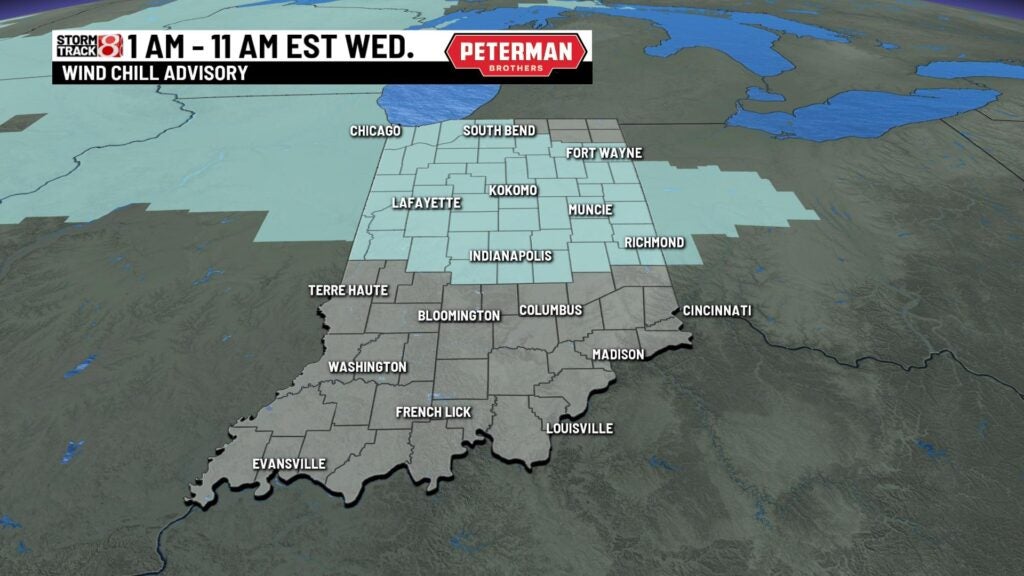
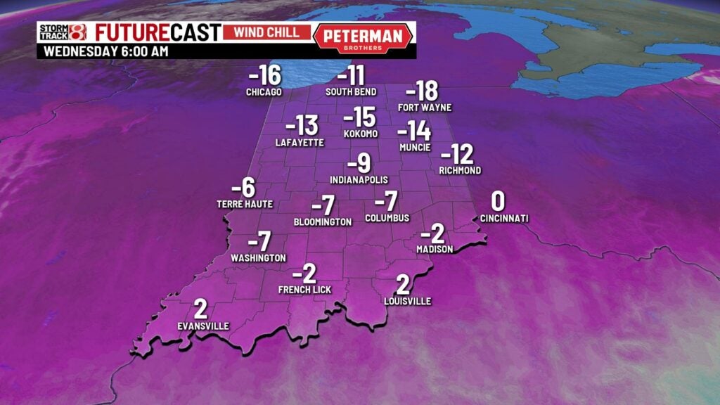
Tuesday night: A Wind Chill Advisory will be in effect from 1 AM EST until 11 AM EST Wednesday morning for the northern half of Indiana. This advisory accounts for wind chills that could be as low as -15° to -20°.
Schools are announcing delays and e-learning days for Wednesday due to the frigid temperatures.
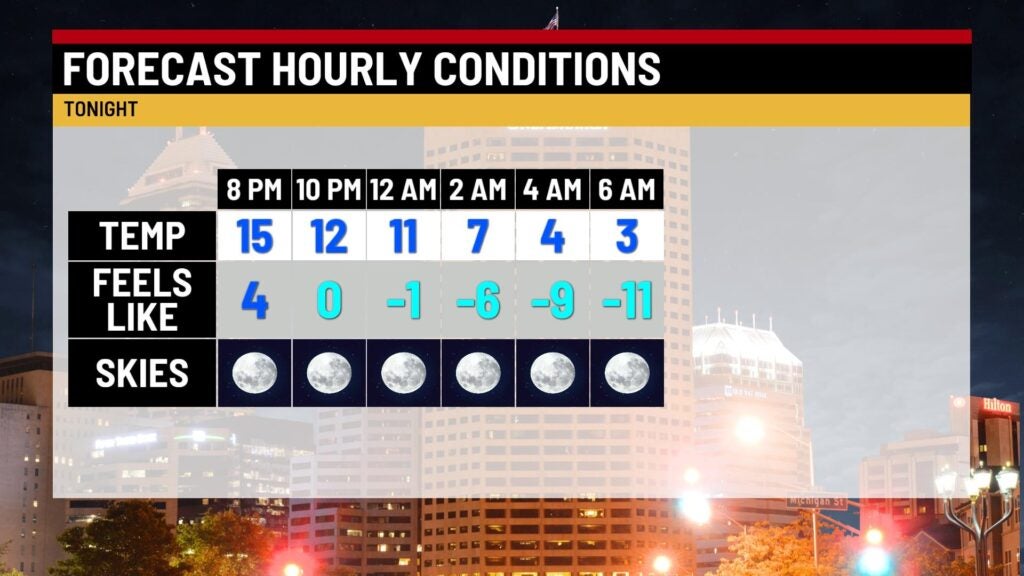
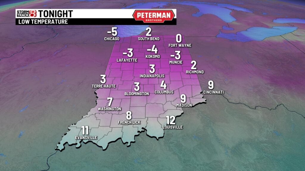
Be ready for a frigid Tuesday night as temperatures drop into the single digits overnight. Some areas by Wednesday morning could have air temperatures below zero. Wind chill values will range from mainly -5° to -20° across the state. The risk of frostbite and hypothermia runs higher in these conditions in which they can occur in as little as 30 minutes if you’re not dressed properly outdoors.
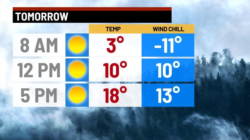
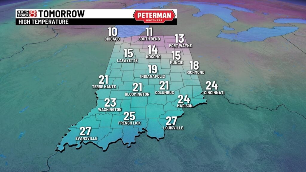
Wednesday: A rather blistering cold start to Wednesday is expected. You will want to be bundled up from head to toe for your morning commute. A good chunk of the state will struggle to get out of the teens with highs in the mid-teens to low 20s.
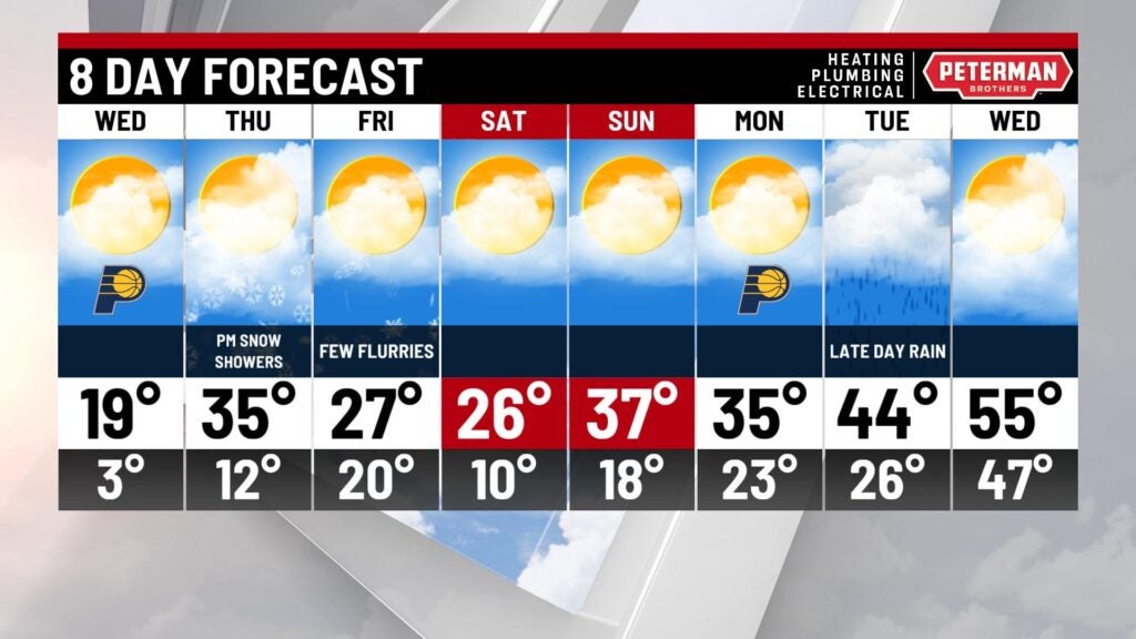
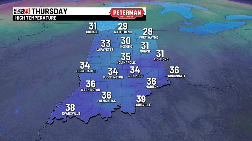
Thursday: Big improvements are ahead in the temperature department for our Thursday. Highs look to jump into the mid 30s with increasing cloud cover. We can’t rule out flurries during the afternoon hours.
8-Day Forecast: Colder air will quickly swing back into the state as we head into the weekend. Highs only manage to get into the mid 20s for Friday and Saturday. Flurry chances linger into Friday before we dry things out for the weekend. As we roll into February by next Tuesday, the forecast looks to take a nice warmer turn.