


High heat, humidity with strong storms possible
INDIANAPOLIS (WISH) — It is going to be incredibly hot and humid today. Temperatures may climb to the hottest we’ve seen this year. Strong thunderstorms may be possible during the next few days as well.
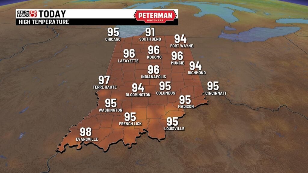
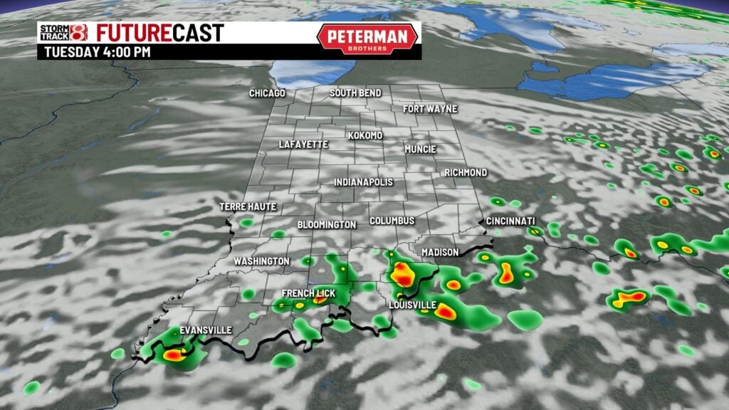
TODAY: We have a Heat Advisory in place for the entire state from 1 p.m. until 9 p.m. Heat index values climb into the triple digits this afternoon. Temperatures climb into the middle 90s this afternoon, which may end up being the hottest we’ve seen all year long. Showers and thunderstorms will also be possible during the day. Some of the thunderstorms may be on the stronger side. Much of the state is under a slight risk of severe weather. Strong winds, heavy rainfall, and hail are possible with these.


TONIGHT: Showers and storms may be possible during the night. It stays mild and muggy with temperatures staying in the 70s.

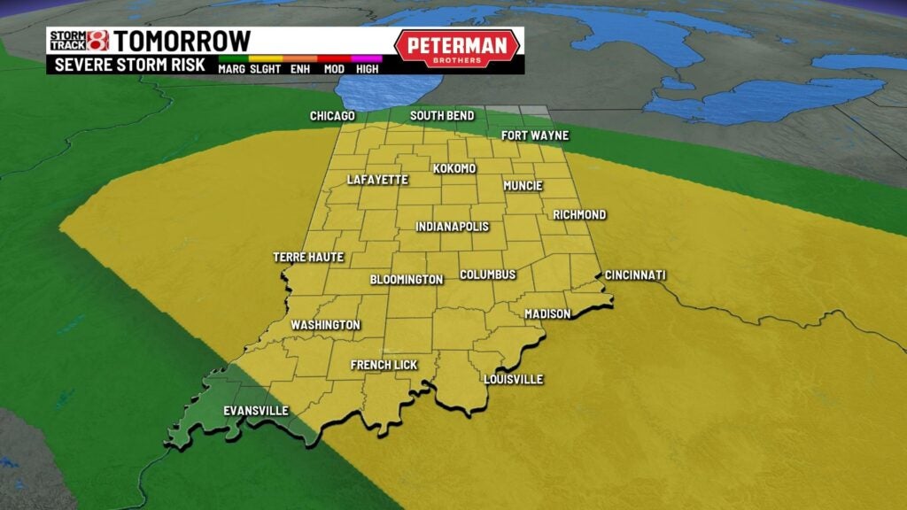
WEDNESDAY: Another round of showers and thunderstorms will be possible. Some thunderstorms that pop may be on the stronger side as well. We are again under a slight risk that some of the thunderstorms may reach severe criteria. Gusty winds and hail are possible with any thunderstorms that form. It stays hot and humid. Highs near 90.


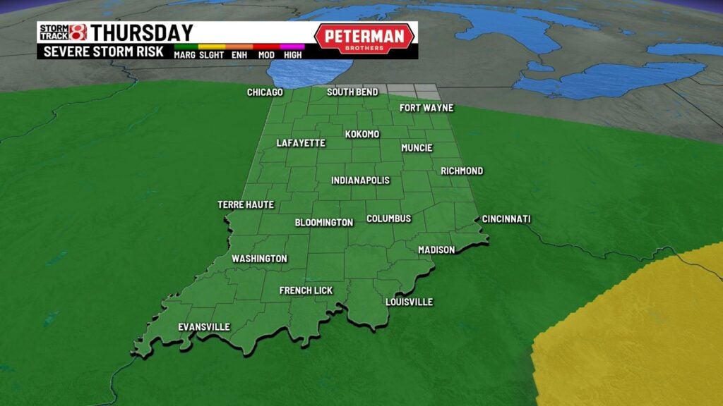
THURSDAY: Another possible day with showers and thunderstorms. It stays humid with temperatures in the upper 80s.

8DAY FORECAST: It looks like we will finally see some relief from this summer pattern just in time for the weekend. Look for highs to fall into the middle 80s for Saturday and Sunday under partly cloudy skies.
