


Mainly cloudy Thursday with additional snow chances
INDIANAPOLIS (WISH) — After a cold start to our Wednesday, we got to work in a little bit of sunshine before cloudy skies took over for the remainder of the afternoon hours.
Wednesday night: A Winter Weather Advisory is in effect until 1 AM EST Friday for Dearborn, Franklin, and Ripley counties in southeastern Indiana. Prepare for slippery road conditions from additional snow accumulations and from what fell back on Monday.

Snow chances will increase going into our Wednesday night. This will not be like the heavy snow event we had back on Monday. Snow will remain on the lighter side across central Indiana.


We will not be as cold as last night, but our numbers will still be below average. Lows will dip into the mid teens.


Thursday: Snow showers will continue through much of our Thursday morning before we eventually work the snow out of the state by Thursday afternoon. The morning commute will be slick at times.
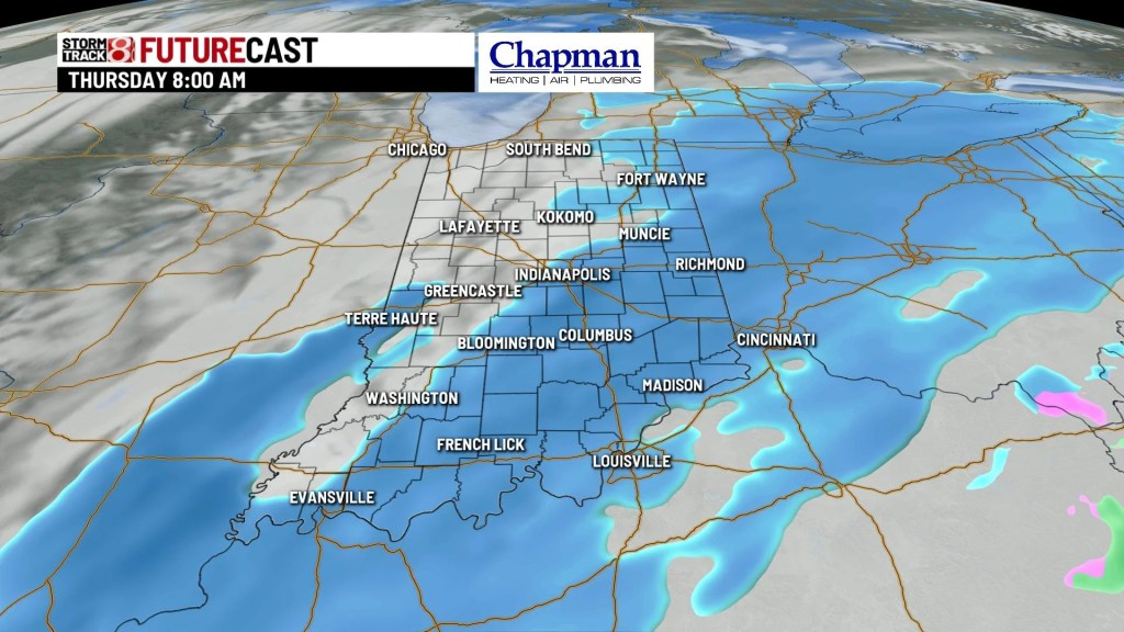


We could rack up light snow accumulations by Thursday afternoon. Higher amounts will be to the south.

Highs will be slightly warmer as we will top out in the mid 20s.


Friday: The end to our workweek will feature more sunshine, but we will retreat back a little bit with our high temperatures. Highs will only manage to rise into the low 20s.

8 Day Forecast: Another quick shot of bitter air will move in Friday night before we work in a gradual warm-up. As we look to push into the upper 30s, more precipitation chances will attempt to swing in for Sunday and Monday morning. Then, relief will really settle in with our high temperatures pushing into the low to mid 40s through part of next week. If you have been begging for warmer air, just hang tight for a few more days.
