Marvelous temps for Friday, daily rain chances shaping up through Easter weekend
INDIANAPOLIS (WISH) — We can’t lie, it was not that bad of a Thursday for us with bright skies and near normal temperatures. It will only get better temperature wise as we move into Easter weekend, but we’ll be tracking multiple rain and storm chances.
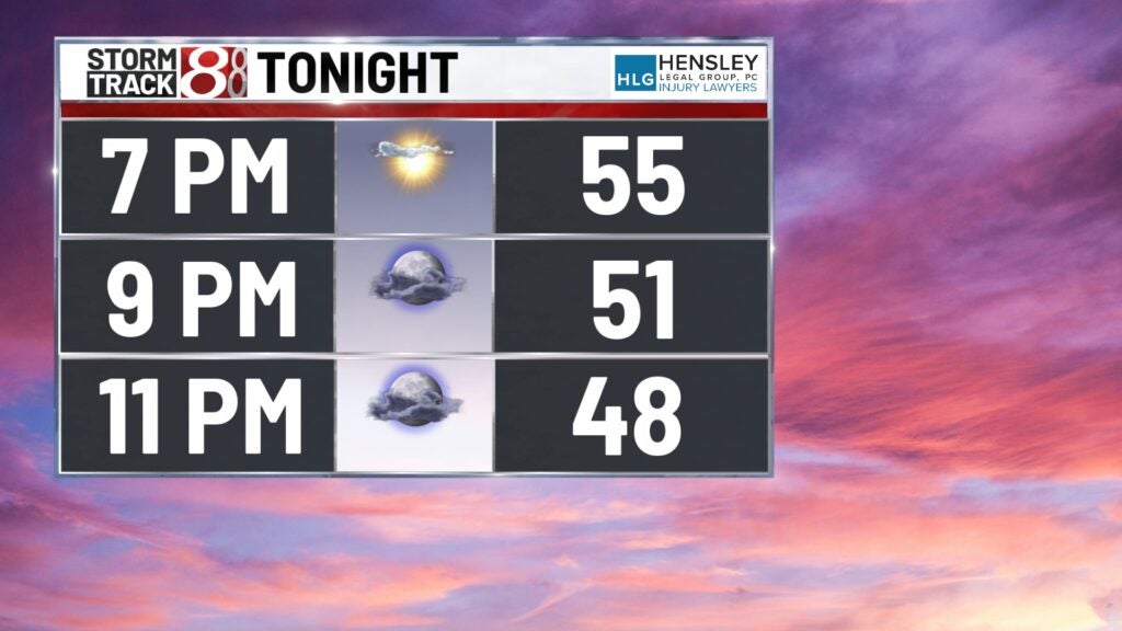
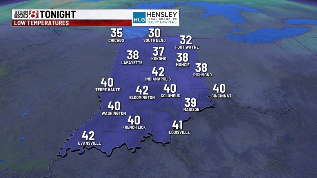
Thursday night: Skies will turn mostly cloudy tonight with the possibility of a few sprinkles/light showers. Lows will fall into the low 40s.
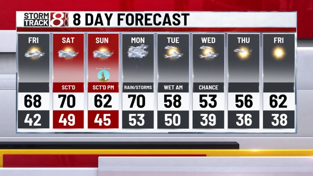
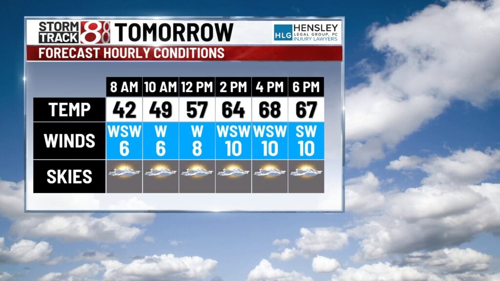
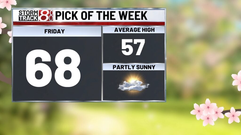
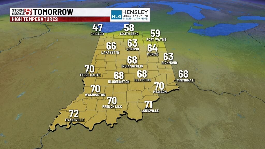
Friday: We’re in store for a fantastic temperature day on Friday with plenty of sunshine to go around. Highs will push towards the upper 60s.
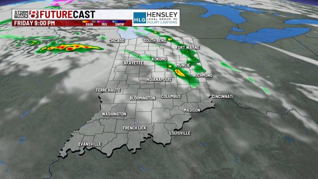
However, we will engage in a prolonged active pattern beginning Friday night with scattered showers and storms developing. This will be due to a warm front moving northward.

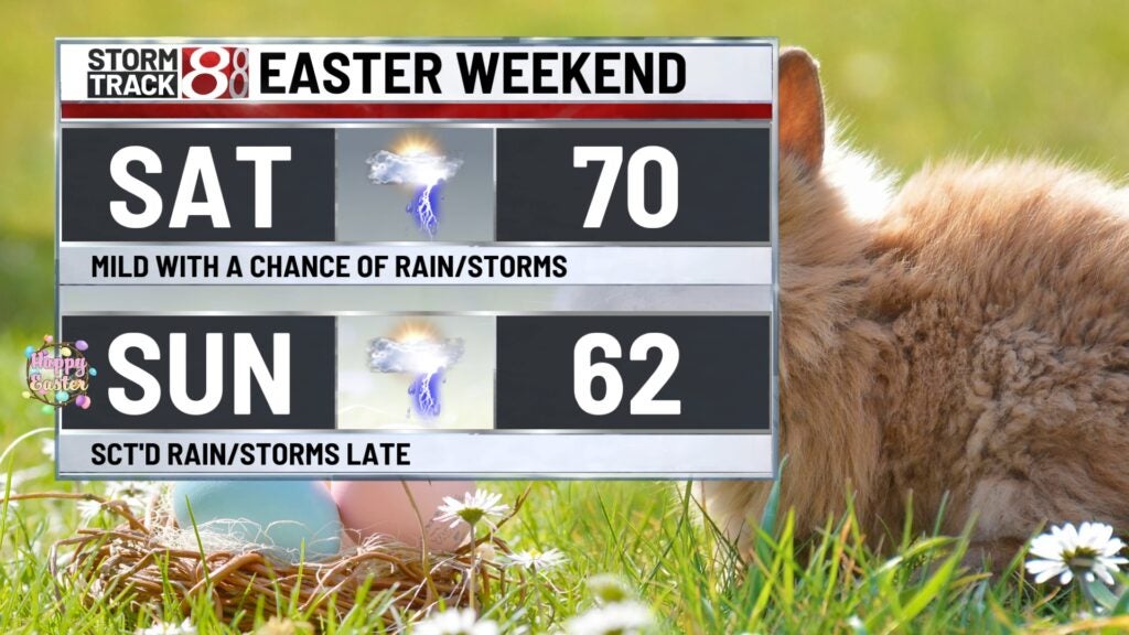
Easter weekend: The aforementioned front will practically stick within our state for the final weekend of March. Neither Saturday or Sunday will be a complete washout, but there will be the chance for scattered showers and storms at any point in the weekend. It will turn quite windy Saturday with gusts approaching 25-30 MPH at times as highs get to around 70. Sunday will be slightly cooler, yet above normal, with highs in the low 60s.

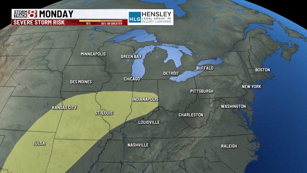
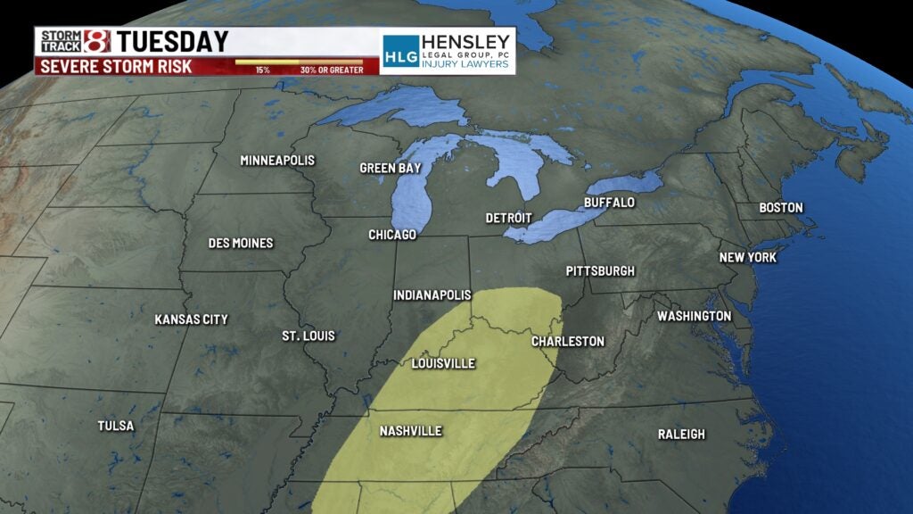
8-Day Forecast: The best chance for rain and storms will arrive Monday and Tuesday to open April. There is now enough model agreement for there to be a strong to severe storm risk outline early next week. The timeline for the potential of stronger storms looks to be late Monday into early Tuesday at this time, although that could certainly change. We do know that temperatures will cool back down by midweek next week.