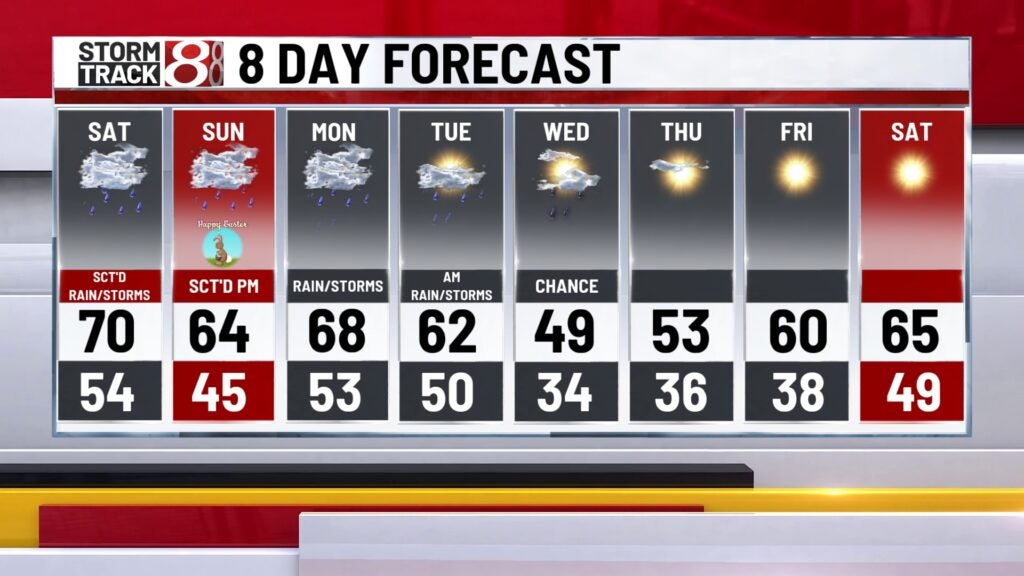
Several rounds of rain and storms Easter weekend and into the start of April
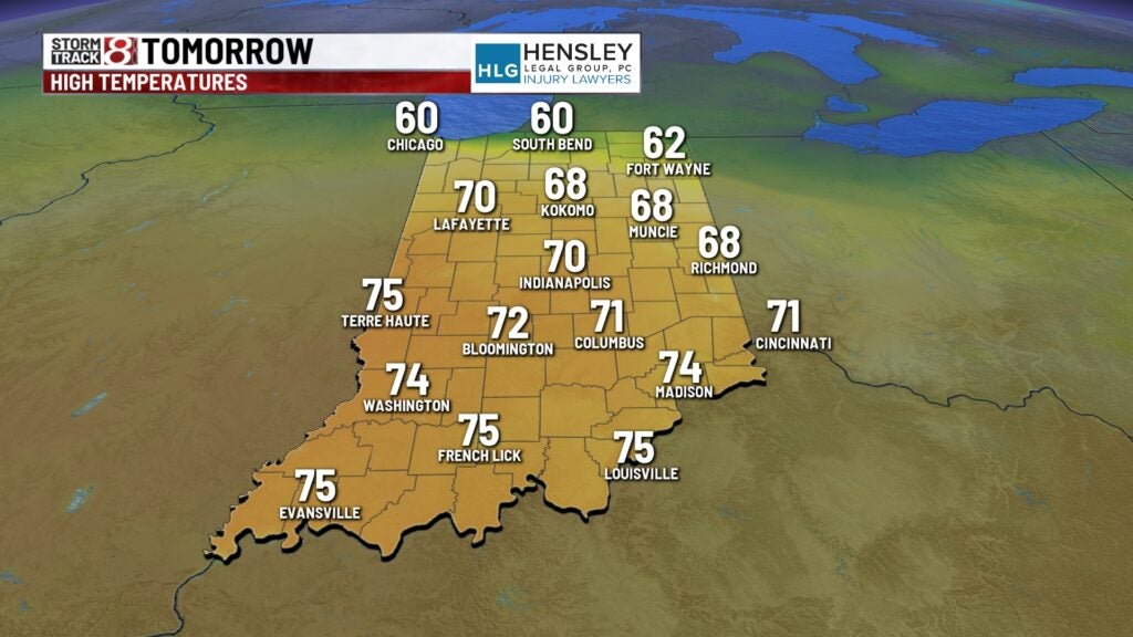
INDIANAPOLIS (WISH) — What a fantastic Friday that Indiana had statewide with highs in the mid to upper 60s.
The warmer air sat the stage for several chances of rain and storms through Easter weekend and into the beginning of April.
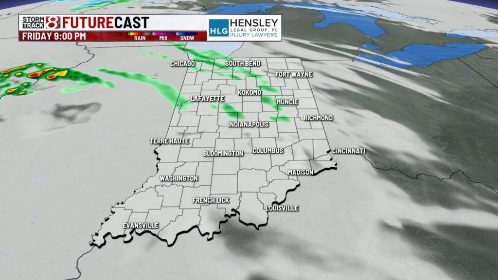
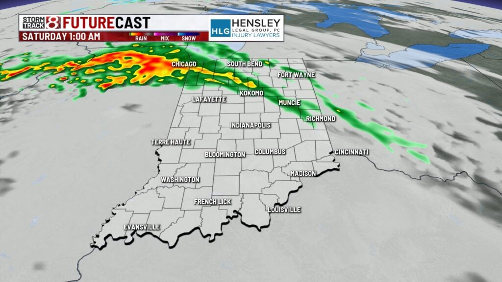
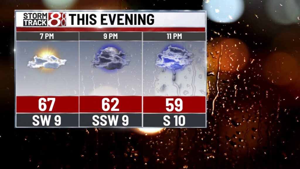
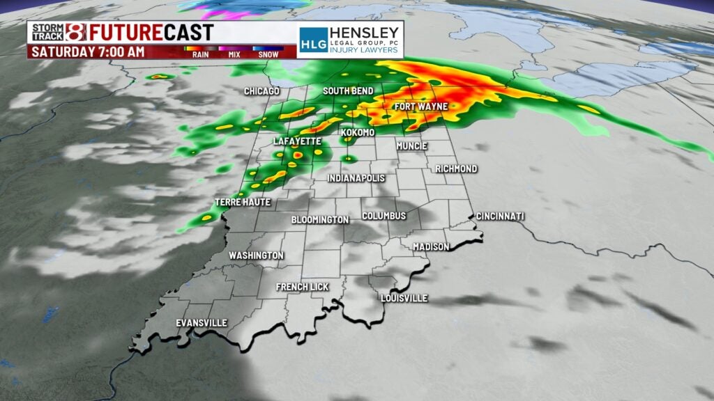
Friday night: We will see rain chances increase. Showers and storms will develop with the better chance for rain overall tonight being in northern Indiana.
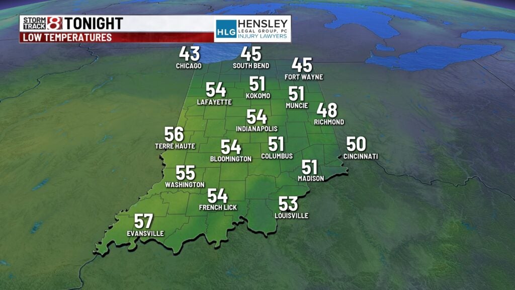
Lows will only dip into the mid 50s.
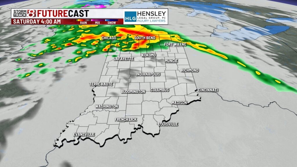
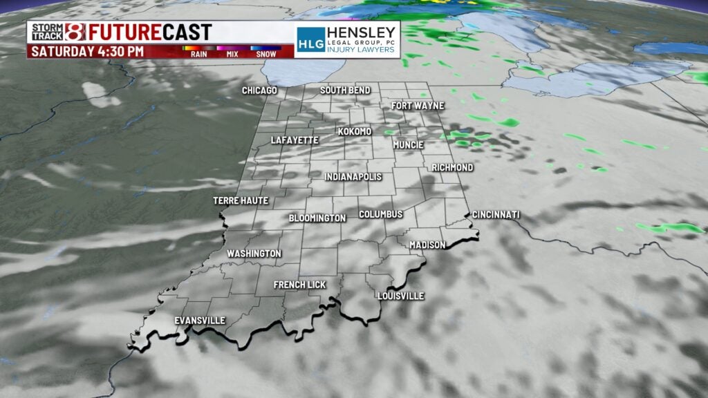
Saturday: Some showers and storms will be ongoing to start before we work in a break. There could be some isolated pop-ups during the afternoon and evening hours before another formidable wave of rain and storms slides in late Saturday night.
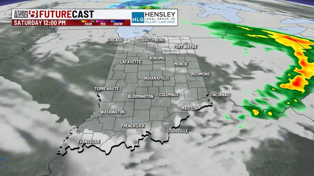
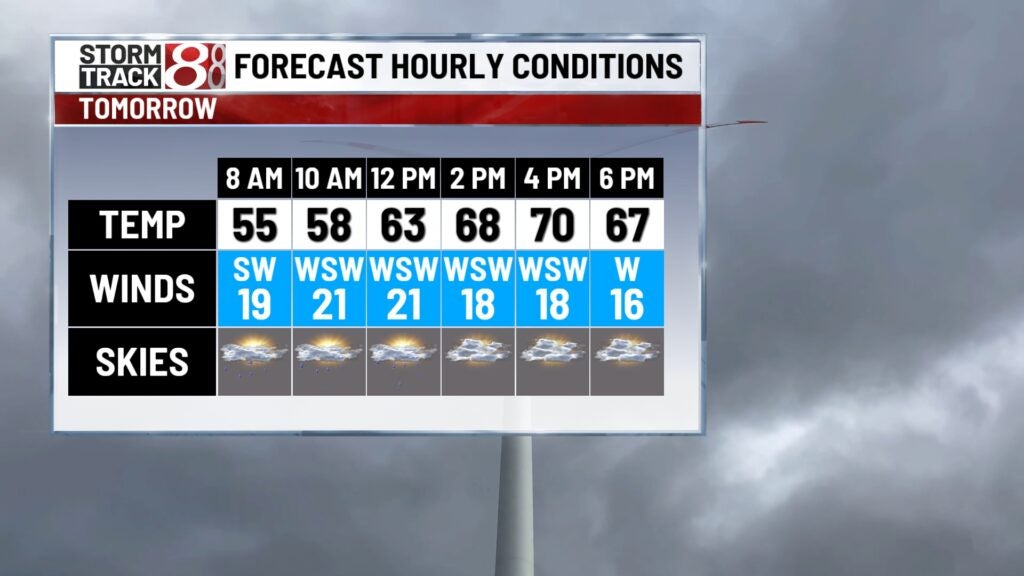
Highs will top out in the upper 60s to low 70s. It will also be a breezy day with gusts from 25-30 mph at times.
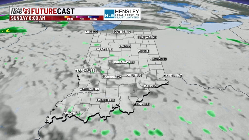
Sunday: There is potential for there to be scattered showers and storms in the morning, so be sure to keep an eye on radar ahead of and during church services or Easter activities. The scattered rain and storm train will keep rolling into the afternoon and nighttime hours.
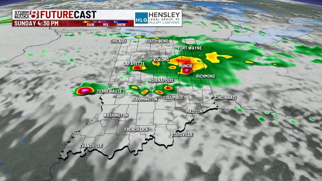
There is a low threat for strong to severe storms Sunday afternoon and night across much of the state. Hail and wind will be the primary concerns.
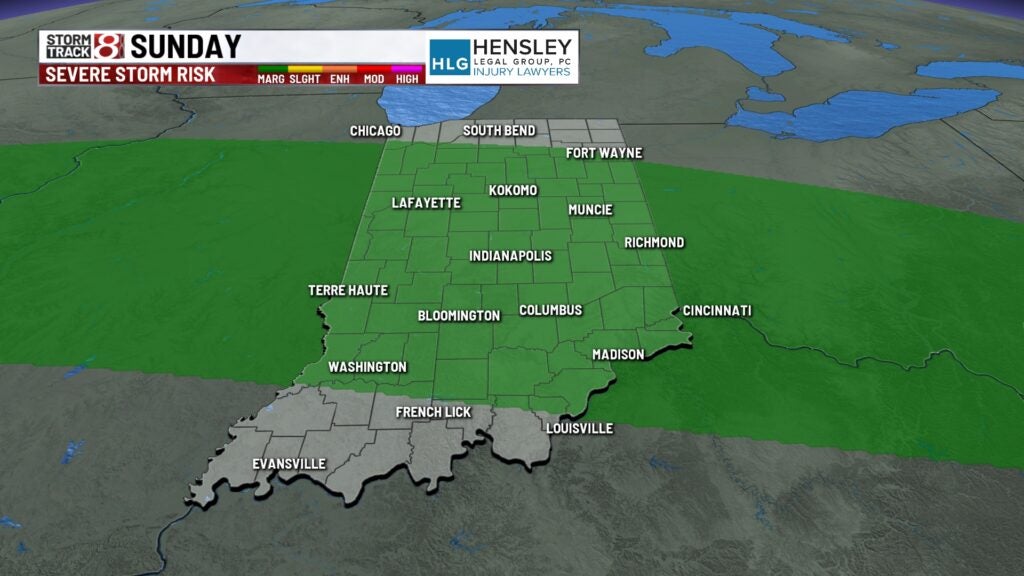
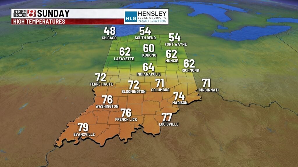
Highs will widely vary across the state with some spots only in the 50s while others get into the 70s.
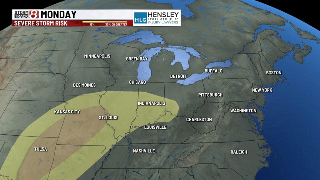
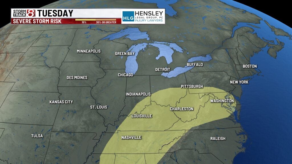
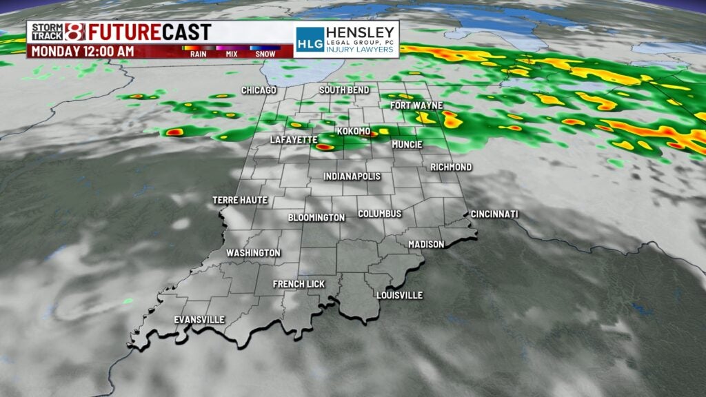
8-Day Forecast: Rain and storm chances will be maximized Monday and Tuesday as a stronger low-pressure system moves closer. There is also a slightly higher risk of strong to severe storms late Monday into Tuesday. Details on Friday remained uncertain, with the speed of the weather system and the positioning of the warm front to be determined, but, regardless, a possibility exists for some flooding. Temperatures will fall back into the 40s and 50s once again by midweek.