Summerlike pattern into midweek, big flip to chilly weather afterwards
INDIANAPOLIS (WISH) — We’re on a warm roll so far through the first two days of October thanks to a strengthened ridge of high pressure and sunshine.
This very warm pattern will stick around the next couple of days before we quickly find ourselves dealing with below normal fall-like temperatures in the second half of this week.
Monday night: Skies will stay mostly to mainly clear tonight. This and the combination of light winds plus higher moisture values will yield fog development overnight. Lows in the low 60s.


Tuesday: Warm and sunny weather will continue to be the norm through our Tuesday. We will not be too far out of reach of record high temperatures. The record high for Tuesday, Oct 3, in Indy is 90 from 1954. Highs will push into the mid to upper 80s, and this is up to 15-20 degrees above normal for us across central Indiana this time of the year.


Wednesday: One more very warm day will be on deck for Wednesday. Abundant sunshine and light winds out of the south will push our temperatures back into the mid to upper 80s. Wednesday’s record high here in Indy won’t be far out of reach either as it is 90 from 1951.

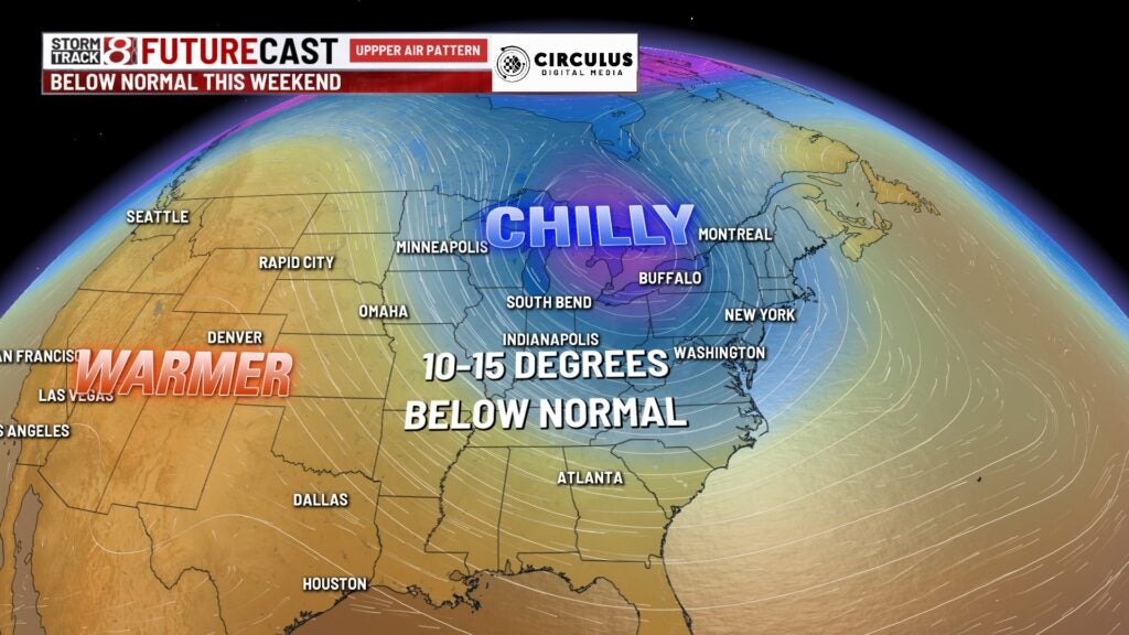
8-Day Forecast: The warm pattern comes to a screeching halt Thursday as we track the return of rain chances and cooler air. A front will pass through Thursday and bring showers and isolated thunderstorms in the afternoon and nighttime hours. Then, a second frontal passage will ultimately take us down into much more chilly fall-like territory by Friday. Highs on Friday will only be in the upper 60s, and this weekend could feature some areas struggling to get out of the 50s. Lows this weekend for some may be in the 30s, so we could be taking the first frost of the year as well for some locations.