


Tracking Thursday night’s storms, then hot for Friday
INDIANAPOLIS (WISH) — We are tracking rain and storms going into our Thursday evening and night, then, we will flip towards a hot Friday.
A Severe Thunderstorm Watch remains in effect until 2 AM EDT Friday morning.
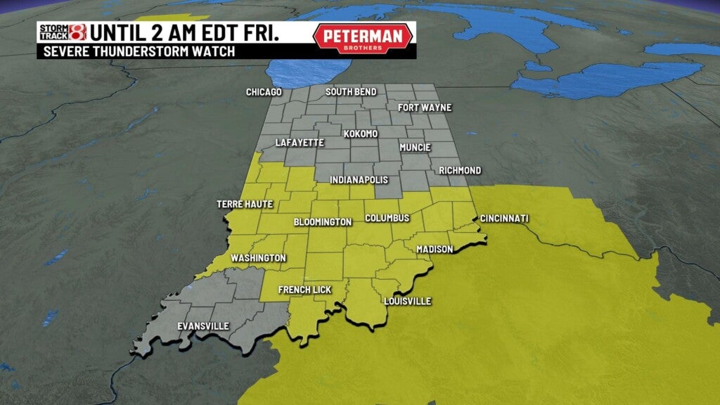
A Tornado Watch is also in effect for far southern Indiana until midnight EDT Friday.

Thursday night: Rain and storm chances stick with us through sunset. Some storms could turn strong to severe.


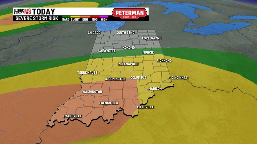
There is an Enhanced Risk (level 3/5) of severe weather for areas south of a Bloomington-Columbus line. A Slight Risk (level 2/5) sits south of a Indianapolis-Richmond line. The main threats are damaging winds and hail, but isolated tornadoes are also possible.
It will be a warm night with lows only dropping into the upper 60s to low 70s.

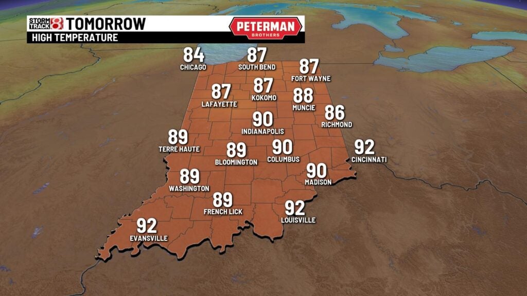
Friday: A few showers may linger into Friday morning before we really turn up the heat even further. We will not only challenge our warmest day of the year (89° so far for Indy), but we may also tie our record high of 90° set back in 1977. Winds are set to also become quite strong with gusts approaching 35-40 MPH at times, and the humidity levels will be in the uncomfortable range.


After a hot day, we will watch a system to our northwest that could cause some rain and storm chances going into the overnight hours.


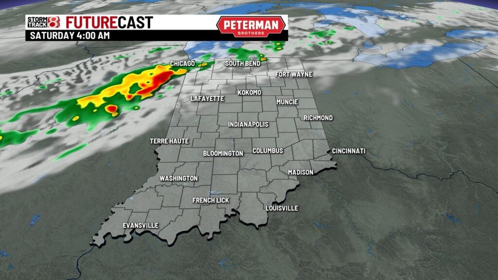
There is the chance for isolated strong to maybe even severe storms during the overnight hours into early Saturday morning. This threat is place for areas north of interstate 70. Damaging winds and hail are the primary threats.

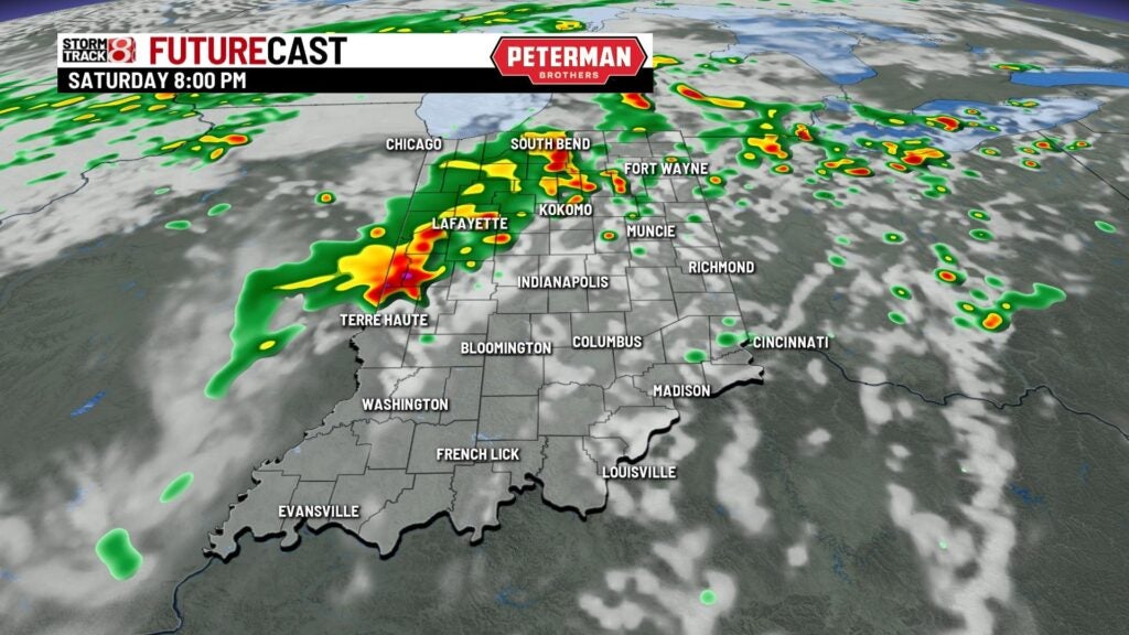
Weekend: Isolated to scattered showers and storms could be ongoing to start our Saturday. Then, we look to briefly dry out before re-development occurs later in the afternoon hours. Another chance for isolated strong to severe storms is in place for Saturday afternoon and evening with damaging winds and hail as the main threats.


Highs on Saturday will once again climb into the mid to upper 80s.

A few morning showers are possible for Sunday with temperatures turning much cooler. Highs look to only reach the upper 60s.

8-Day Forecast: As we go into next week, temperatures will quickly bounce back into the mid 70s. Rain and storm chances then look to return by Wednesday and linger into Thursday.
