Warming up with storm chances ahead
INDIANAPOLIS (WISH) — Today was a bit of a better day for us weather-wise as the sun returned with temperatures rising into the upper 30s to low 40s. The warming trend is set to continue for the remainder of the week as we track active weather up ahead for Friday.
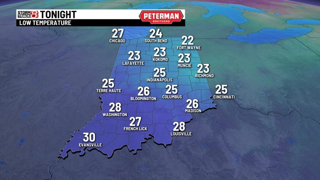
Wednesday night: After a mostly clear day, skies will become partly cloudy for tonight. Lows will bottom out in the mid 20s.

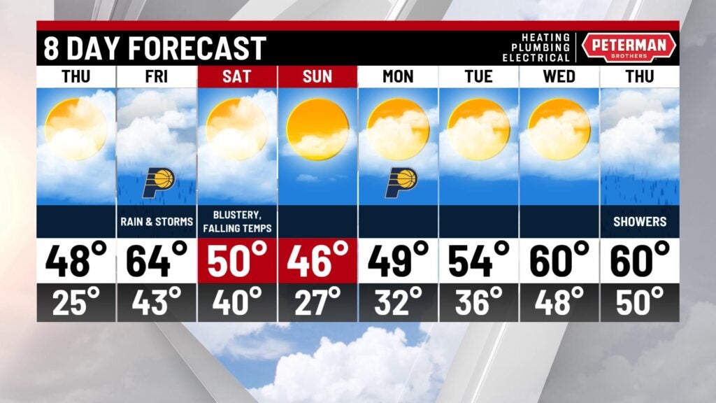
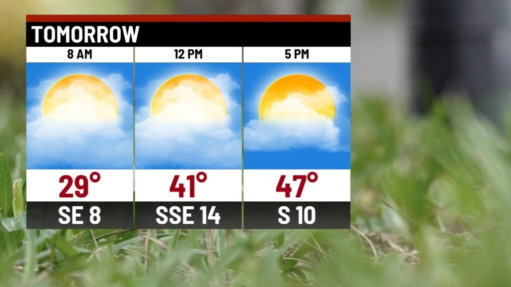
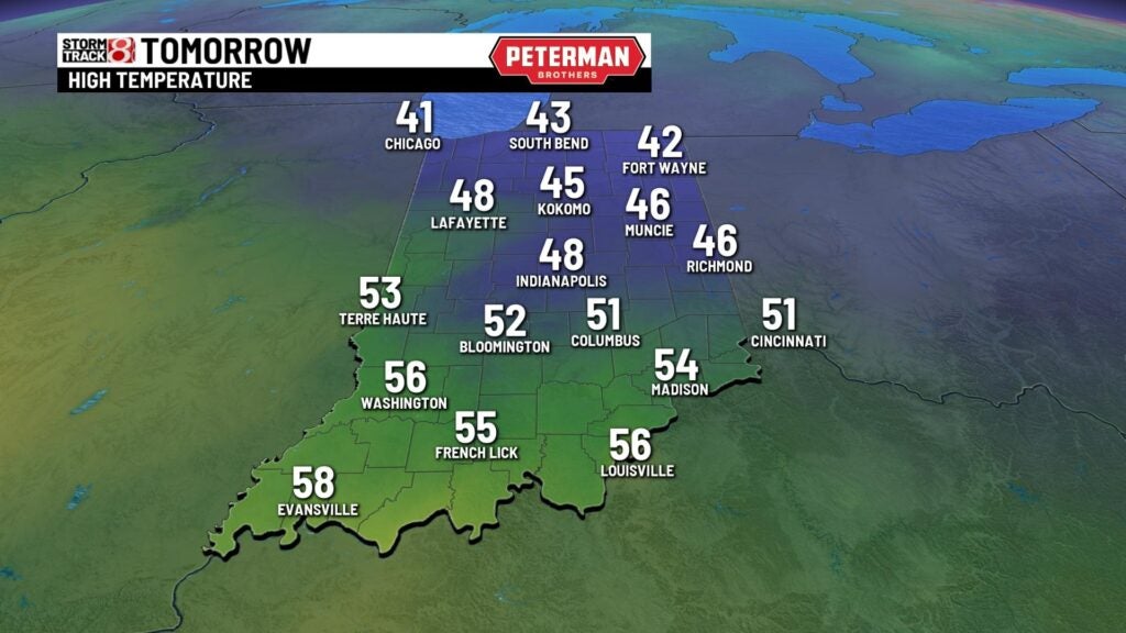
Thursday: Warmer air will continue to slide into the state as we increase cloud cover for our Thursday. Spotty showers cannot be ruled out Thursday night. We will make a return to the 40s with some areas even tapping into the 50s. Winds will become breezy by the afternoon hours.
Friday: A busy Friday is ahead for the entire state. It will be mainly cloudy as showers begin to move in by the afternoon hours. Coverage will quickly ramp up with numerous showers and several storms as we get towards Friday night. The activity will likely continue into the overnight hours.


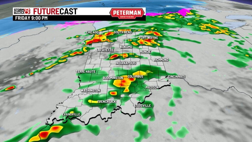
Be aware that there is also the chance for isolated strong to severe storms Friday night. Better chances for severe weather at this time is from a Bloomington-Columbus and south. All hazards are possible, which means that we will have the chance for damaging winds, large hail, and even isolated tornadoes. Flooding could become a concern as well. Severe weather is exceptionally rare in December for Indiana, but make sure to stay weather aware Friday night and have your safe plan prepared. Be sure to also download the Storm Track 8 weather app as you get up-to-date radar and timely warnings based on your location.

We are also going to have near record high temperatures for Friday. Highs will rise into the low to mid 60s. It will also be windy at times with gusts up to 30-35 MPH.

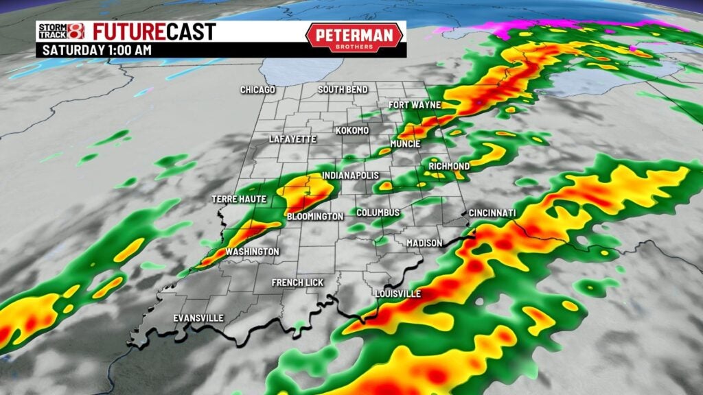
8-Day Forecast: Showers will likely be ongoing into the early morning hours of Saturday before activity moves out by sunrise. Cloud cover will decrease as well as the system quickly pushes towards the east coast. It will also be very windy Saturday with decreasing temperatures throughout the day. Highs look to briefly return to the 40s for Sunday and Monday. Then, another warmup will swing in with temperatures rebounding back towards the 60s by midweek next week.